River management in the anthropocene

“A lively debate, provocatively labeled ‘conservation in the Anthropocene,’,” my University of New Mexico colleague Ben Jones and collaborators wrote last year,  “has been taking place over what conservation, and related notions of naturalness and preservation, means where large natural systems are increasingly inter-connected or coupled to human systems.” In particular, Jones et al. were interested in the Colorado River and Glen Canyon Dam, and the proper incorporation of the range of communities and values that must be incorporated in decision making regarding the dam and its relationship to the larger “coupled human and natural system.”

Ben is (and I am) using the word “anthropocene” here not in the formal geological sense – a grand debate over where we’ve entered a new “-cene” defined by an identifiable geologic layer of human stuff. Rather we’re using it in the broader sense in which it has migrated into public discourse, the way David Biello was using it in a book review essay in today’s New York Times:

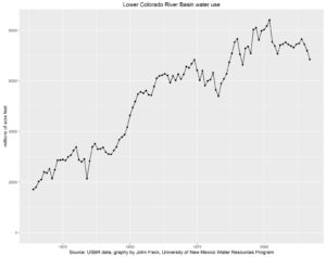
The waterways of the West now exist as monuments to an ambitious desert civilization. Across this vast region of America, few, if any, rivers flow without hosting one or more dams, concrete channels, diversions or other human-made “improvements” that allow people and farming to flourish in this dry country. And few, if any, rivers reveal this unnatural world more than the Colorado, which no longer reaches the sea or carries along its entire 1,450-mile length much of the reddish silt that inspired its name.

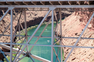
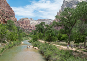
Downstream from Glen Canyon Dam, the Colorado River is green not the red of its name. Navajo Bridge, May 2017, photo by John Fleck

When I was deep into work on my book, a friend over beer was quizzing me about where I in was in the project, what I was writing about. The friend, a law professor, was doing what law professors do I guess, that sort of Socratic questioning that ultimately led me to the realization that while I said I was writing a book about the Colorado River, what I was really writing was a book about what happens with the water once we take it out of the Colorado River. It was a striking realization, with which I ultimately made peace, and it was an important insight both for the book and for how I think about the river and my work going forward.

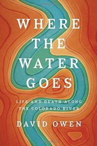
Biello’s NYT piece, a review of David Owens Where the Water Goes, goes full Anthropocene on this point:

The people of the Western states, in collusion with the federal government, have opted for irrigation, power and sprawling cities in the desert like Los Angeles and Phoenix. The glass of Colorado River water is either half-full or half-empty, depending on whether you think water woes bring out the cooperative side of people, or the litigious. As Owen discovers on his journey, both are true — lawyers and legislators make a good living adjudicating claims, but owners of water rights also often work it out among themselves without drying anybody out. This is a system that muddles through on a blend of threats and collaboration, with the underlying understanding that everybody must win or everyone will lose, as the longtime water reporter John Fleck explores in his illuminating recent book “Water Is for Fighting Over.” It remains to be seen what the likely shortfall of rain and snow brought by global warming will do to this already fraught series of arrangements.

The river here is defined now by our decisions to take water out of it, and by the “fraught series of arrangements” with which we try to manage the problems that are upon us now that the Colorado seems to be running short. It is simply impossible to think of the Colorado absent those fraught arrangements and the implications for the “irrigation, power and sprawling cities in the desert like Los Angeles and Phoenix”. It is in fact a coupled human and natural system, deeply coupled.

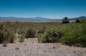
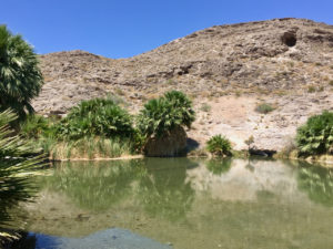
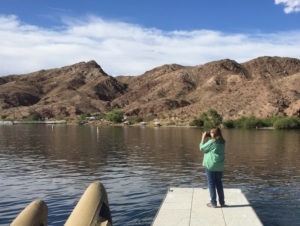
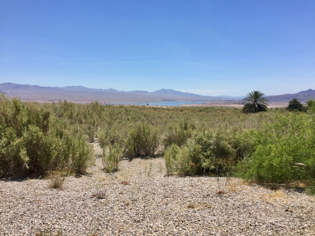
In the distance, Lake Mead, where we spread our water out to dry in the desert sun

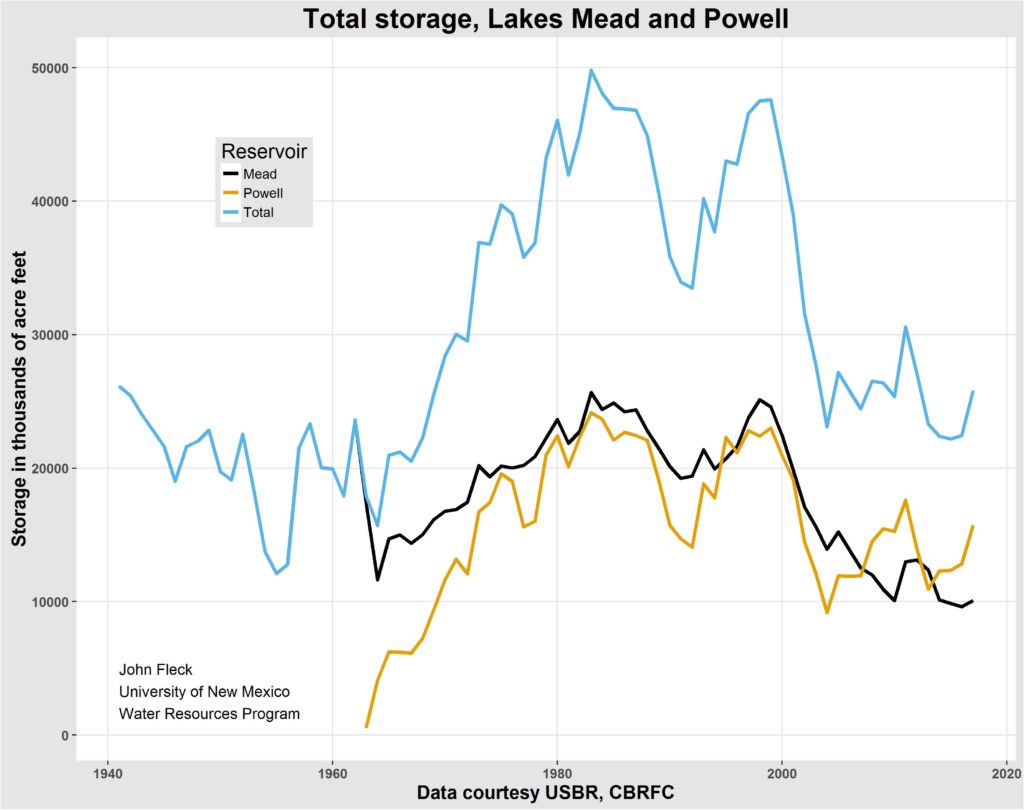
This is the painful realization at the heart of Frederick Reimers’ piece last week in Outside Magazine about the dreamers who would drain Lake Powell and free Glen Canyon. “Fill Mead First”, the dreamers’ scheme, would move Powell’s water downstream to Lake Mead, emptying Glen Canyon Dam. It’s premise is classically Anthropocene – that because of Powell’s seepage and evaporation losses, you could save water for human use and free up Glen Canyon as a happy side benefit. As I’ve written before, the best science suggests that those savings are not to be had. But there’s also something wonderfully Anthropocene about the whole argument, as Reimers writes:

Without Powell, more dams could be greenlighted upstream to replace that storage capacity, meaning free-flowing sections of rivers that feed the Colorado—including the Gunnison, Yampa, and Green—could be compromised. Water diversions could be built, too, pulling enough water from the river that it might not even flow in some stretches.

It’s a coupled system now. There’s no uncoupling.

In the end Biello’s NYT piece, and Owen’s book, and mine, all point to a narrow but hopeful path. All three of us point to Minute 319, the US-Mexico agreement that returned water, however briefly, to the Colorado River Delta, left dry by all of that water we take out to use elsewhere. Here’s Biello:

Part of the work of the next few decades is to imagine and build a better future rather than letting inertia reign.

Perhaps that better future allows the Colorado River to flow along its entire course, restoring a once lush wetland teeming with life while also allowing for all the human uses along its length. That delta has been dead for more years than I’ve been alive, killed by the filling of Lake Powell, which means everyone born after 1963 accepts this as the normal state of affairs. But there is no reason I or my children couldn’t see Lake Powell and the delta. Our hand is on the faucet of a formerly natural, unpredictable waterway; what will we do with that power and responsibility?

This is a fundamentally different narrative than the old stories of Cadillac Desert and A River No More, stories of humanity’s sins against nature and our coming punishment. It’s a narrative I’m happy to be a part of.

Lots and lots of people seem to be going to our National Parks

Virgin River, Zion National Park

Driving back this week the long way from Las Vegas, Lissa and I were stunned by Zion National Park. The river was high, the rocks were red, and the people were everywhere.

I’m guessing it’s been 50 years since my first Zion camping trip, with Mom and Dad and Lisa and one of those big canvas tents. I’ve been back many times since, but not for 15 or 20 years. Lissa and I stayed in St. George and drove up for the day. Mindful of the Park Service warnings, we parked outside the park, in the little town of Springdale, and rode the shuttle bus to the park entrance.

Zion is magnificent, beautiful narrow canyons carved by the Virgin River and its tributaries from the geologic layer cake of the Colorado Plateau. You can see why lots of people would want to come here, and I am not one to complain about the crowds. I go to cities for fun all the time, where there are lots of people. But when I turned to the visitation data on our return to St. George, I was frankly stunned.

Source: National Park Service, graphed by me

If you believe the data from the Park Service’s visitor use database, visitation to Zion has risen 52 percent in the last three years, topping 4 million people in 2016. That’s a huge step  function beginning in 2014, almost too big a jump to be believed.

Zion is not alone, according to the Park Service data. Joshua Tree, Canyonlands, Rocky Mountain National Park all saw increases of more than 50 percent. I only poked around randomly looking at parks that interested me, so my look at this data is in no way comprehensive, but here’s a graph of all the parks I pulled the data for. I apologize for the clutter, Prof. Fleck would grade his students off for posting a graph this busy, but look at all those hockey sticks!

Park Service visitation

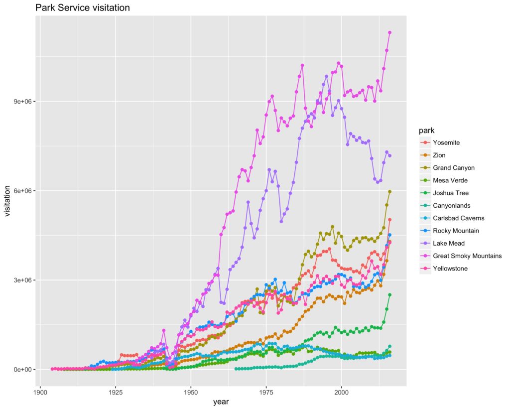
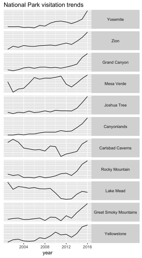
Here’s another attempt at a visualization, a tiny multiples graph showing each of the parks I looked at from 2000 to the present, without vertical scale and a non-zero baseline, just to get a feel for the shape of the curve for each park. You can see that every park save Lake Mead (a National Recreation Area, not a “park”) has a jump beginning in 2014.

I posted some of the graphs on Twitter and mused about what might explain it, and my friends pitched in with a host of hypotheses:

  • a change in data collection or reporting methodology – maybe they’re counting differently?
  • a surge in foreign visitors (lots of those cramming into the Zion shuttle buses with us were thus)
  • a boom in baby boomer retirement travel
  • publicity around the Park Service centennial (and maybe, related, the Ken Burns PBS documentary)
  • the drop in gas prices that began in 2014 (this matches up better date-wise than the centennial or Ken Burns hypotheses)
  • Instagram! This is my favorite, the idea that we’re seeing all our friends’ pictures on Instagram and Facebook and the like, stoking demand for that picture perfect vacation, so we wanna go too. We saw a lot of selfie action.

It’s interesting to think how one might test these hypotheses. The more I look at the graphs, with that sharp jump in 2014 in so many parks, the more I think we need to start with the first hypothesis – some sort of data methodology change. But it doesn’t take much googling to discover active conversation in the communities around the parks that suggests some amount of the increase is real.

By the time we hitched the shuttle back to our car after a day of hiking Zion’s crowded trails, Springdale looked like on long narrow parking lot that ran for miles. Not hard to see why people want to come, but it’s a bit of a mess as a result.

update: Shawn Regan linked to a post he wrote a couple of years ago that there has been a long steady decline in National Park visitation, dating back to the 1980s, when looked at in per capital terms. I updated the data here – long steady climb in visitation by this measure from the 1960s through the late 1980s, then a steady decline. That decline appears to have reversed in the last few years, but still has not come close to its 1980s’ peak:

per capita park visitation

desert rats

ROGERS SPRING – Rogers Spring is a strange apparition in the desert, 400 gallons per minute burbling out of the side of a mountain and down through an oasis of palm trees before the water peters out into the creosote of the Mojave Desert.

Rogers Spring, Lake Mead National Recreation Area

Driving up out of Kingman last Sunday, on our way to Las Vegas, I was moved as I always am by the return to the Mojave Desert of my childhood. The scraggly pacing of the creosote, a bush imbued with chemical magic that helps it drive away neighbors to hoard scarce water for itself and its offspring, always feels like home to me. I grew up in Los Angeles and the deserts to the east, beyond Banning Pass, were my childhood playground.

I live in a desert now, the 9.7 inches of rain a year at my Albuquerque home half that of my Southern California childhood and barely under the arbitrary ten inch definition of desert. And I love my New Mexico deserts. But the Mojave will always have the nostalgic tug of youth, of badly air conditioned cars and tents pitched at the base of Joshua Tree’s boulders.

I wrote well about this five years ago, best just to self-plagiarize for a moment:

We’d largely discarded this place, without meaning to, but realized we can’t. That much was clear as we drove yesterday up through the Pinto Basin in what is now Joshua Tree National Park. By “place” here I mean something big and a bit complicated, but we’ll start by defining it as the deserts of southeastern California. Lissa and I did some of our falling in love here – living in LA and wandering these deserts when we were young and poor and carefree. But that’s only a piece of it, and not the beginning, and certainly not the end. Mom and Dad brought me here from the beginning, camping in one of those big canvas tents. In Boy Scouts – ah, glorious Boy Scouts, where I learned all those unintended lessons – we hiked the desert canyons. When we were old enough to con adults out of car keys (how did we do this?), my friends and I would do the same on our own, freedom defined.

Lissa’s sister Ginnie lived here and died here, a refugee of the city settled into the strange culture that is desert living on society’s fringe. Returning to cope with her death 10 years ago was our last visit, and arguably the most important.

I never lived here, but I learned a lot by visiting.

And so we are back again. In my new career as a professional water nerd, I’ve made the drive from Albuquerque to Las Vegas six or eight times in the last few years (I’m a desert rat, why fly when you can spend a glorious day driving across the desert?). This trip Lissa tagged along, willing to put up with a few days in Las Vegas in trade for some bonus time together before and after in the desert, this desert.

Lissa at Willow Beach

As we approached Las Vegas late Sunday afternoon, we dropped down off the highway to Willow Beach, where the Colorado River shambles out of the bottom end of Black Canyon. Slowed by Hoover Dam upstream and Davis Dam downstream, the Colorado here is more like a narrow, slow-moving lake at Willow Beach, and we parked and walked down onto the marina’s docks to watch folks at play.

There are two things about the desert. Well, there are a lot of things about the desert, but here are two of them. The first is the way aridity makes it possible to begin to see what is going on. The geology is not obscured by things growing atop it, and you begin to see the pieces of an ecosystem in ways you can’t in a wet place. And you can always see the horizon. There are not trees in the way.

The second is the sharp contrast between wet and dry. I have written before about John Van Dyke’s “ribbon of green“, and while I now accept that Van Dyke probably made up much of what we read in his classic book The Desert, the sharp boundary between wet and the dry, between springs or rivers and the desert around them, remains the most interesting thing of all to me about the desert.

So of course Lissa and I turned when we saw the clump of palm trees up against the base of a hill and a short paved road that led up to Rogers Spring. Because water in the desert is an impossibly rare and wonderful thing.

Past the spring, the road bent north, following the Muddy River and then the Virgin, through the kind of desert river valley towns where the idle chitchat with the supermarket checker is about how hot it is and her scheme to have those tunnels like they make for gerbils to get to your car in the desert heat, where gleaming Mormon churches sit across the street from small alfalfa fields (this is the edge of LDS country, where Utah spills into Arizona and Nevada and the alfalfa fields are small).

We’ve got a couple more days of wandering before we have to get back to Albuquerque, and I couldn’t be happier.

Lake Mead’s Overton Arm, in the distance, in the desert


When a water supply problem becomes an air quality problem

Matt Weiser (Water Deeply) has a nice interview with Mike Cohen (Pacific Institute) about one of the most interesting policy conundrums in Colorado River Basin water governance – the question of the Salton Sea.

Here’s the sequence. California needs to figure out how to use less Colorado River water. Since the biggest chunk of the state’s Colorado River water goes to farms in the Imperial Valley, one obvious move is to improve ag water efficiency in Imperial. But when you do that, you reduce ag runoff, which is what fills the Salton Sea. Reduce that, the Sea shrinks in the hot desert sun, and…

It exposes lakebed, which creates dust, and that’s a major public health threat. The Imperial and Coachella valleys already fail to meet air-quality requirements, and asthma rates are already higher than the state average. So, your baseline is an already-bad air-quality situation, which is going to be exacerbated as the Salton Sea shrinks and more dust blows off that lakebed.

US drought migration patterns are not what I expected

We also note that migrants are very strongly attracted to areas experiencing drought. Drought are associated with low precipitation and higher-than-average temperatures, two amenities that attract residents (even if they may be detrimental for local agriculture).

That is from The Effect of Natural Disasters on Economic Activity in US Counties: A Century of Data, an NBER paper looking at 90 years of county data from the United States by Leah Platt Boustan, Matthew E. Kahn, Paul W. Rhode, Maria Lucia Yanguas.

In general hurricanes, forest fires, and landslides encourage people to leave. “On the other hand, and surprisingly,” they write, “tornados and earthquakes appear to have no effect on mobility flows.” Floods actually cause in-migration, perhaps because infrastructure improvements in response to flooding (dams, levees, and the like) create more buildable land.

But droughts?

Colorado River reservoirs rising

According to the latest Bureau of Reclamation runoff and reservoir storage forecast (the “24-month study”, pdf here), combined storage in the two largest Colorado River reservoirs, Mead and Powell, will end this water year up 3.4 million acre feet from last year.

Mead/Powell storage

Mead is forecast to end the year up more than five feet in elevation. Powell is forecast to rise 27 feet.

information control and the priesthood of water

The “nilometer” was the device used in ancient Egypt to measure water levels in the Nile:

Only priests and rulers, whether pharaohs or later, Roman or Arab leaders, were allowed to monitor the nilometers, and their ability to predict the behavior of the Nile was used to impress the common people. (And to determine how much money would be collected in taxes.) This is why so many nilometers were built in temples, where only priests would be able to access the mysterious instrument.

Via Atlas Obscura

Using less water on the Lower Colorado River

At the end of April, Lake Mead sat at 1,085 feet above sea level, more than eight feet higher than it was a year ago. That is in part thanks to a big winter upstream, which has ensured continued above-average releases from Lake Powell upstream.

But equally important is the fact that folks in the Lower Colorado Rive Basin are using less water.

Lower Colorado River Basin water use (2017 forecast)

According to the current Bureau of Reclamation Forecast, water agencies are expected to take 6.849 million acre feet of water out of Mead this year to supply farms and cities in Arizona, California, and Nevada. If the forecast holds, that would be the lowest Lower Basin use since 1992. As Tony Davis has pointed out, we need to be careful about putting too much stock in these forecasts this early in the year. There is a lot of water allotment juggling underway right now, including questions about how much Northern California’s wet winter will allow the Metropolitan Water District of Southern California to leave extra “intentionally created surplus” water in Lake Mead, and the ups and downs of Imperial Irrigation District’s use as it adjusts to changes in its water-saving fallowing program that kick in beginning July 1.

But the preliminary forecast can give us at least an inkling of where the water savings are coming from:

  • Metropolitan Water District (southern California municipal water) is currently forecast to take 522,000 acre feet of water, which would be its lowest year since as far as my records go back, which is to 1964. This could change – lots of discussion now about Met’s approach to storing surplus water, and there are indications elsewhere in the Bureau’s water forecasting system that Met’s take could be as high as 768,000 acre feet – but no matter how things end up, Met will likely have a very low water use year, well below its 937,000 acre foot per year 21st century average.
  • Central Arizona Project is forecast to take 1.506 million acre feet, roughly the same as the last couple of years, about 5 percent below its 21st-century average.
  • Imperial Irrigation District is forecast to take 2.5 million acre feet. This is 20 percent below its 2003 peak – Imperial’s a remarkable case study in agricultural prosperity in the face of reduced water availability.

Overall, under the current forecast Colorado River water use in Nevada, California, and Arizona would end the year 18 percent below its peak in 2002.

Where the Water Goes

There is much to like in Where the Water Goes, David Owen’s new book about “life and death along the Colorado River”, but the thing I liked most was the bemused charm with which Owen himself confronts western water’s absurdities, which must be embraced, but which are easily taken for granted.

Where the Water Goes

Here he is in Denver conference room a Continental Divide removed from the Colorado River Basin itself, introduced to (and introducing us to) the strange distinction between “paper water” and “wet water” that underpins much of western water discourse. Water lawyer Kent Holsinger is our guide, describing the cattle ranch near Walden, Colorado, on which he grew up:

A stream crosses the ranch, and the Holsingers draw water from it, but their right to do so isn’t based on the fact that their property is adjacent to its banks, as it would be in the East. “Water law in Colorado and most states in the West is based on the doctrine of ‘prior appropriation,'” he said. That doctrine holds that the first person to make “beneficial use” of water gains the right to use that quantity for that purpose forever.

I was amused to note that Amazon has categorized Owen’s book in “General Western US Travel Guides” (where it happily is the #1 New Release). But on reflection, the choice made sense. Structure in a narrative like this is always a great challenge, and some of our best books about rivers (think Fradkin’s River No More as one shining example) have used the “headwaters to sea” device. Here Owen deploys it effectively, taking us along on his travels as he follows the Colorado’s twisting path from the Rocky Mountains to the Sea of Cortez. I never would have called this a “travel guide”, but on reflection could see it serving solid road trip duty.

By itself, the travelogue is delightful – his side trip into the RV culture of Quartzite on the desert Colorado’s Arizona bank left me full of writerly admiration. Who has travelled the Lower Colorado in winter and not pondered the strange immensity of the human experience spread across the great snowbird RV parks? This is the charm of Owen’s writing, the slightly self-deprecating way he invites us along as he visits interesting people and places, learning new things along the way.

But within the geographical structure, Owen is doing something more subtle, leading us through the ways in which society and river interact as we go through the complex motions of moving water out of the river channel and doing with it what we do. By the book’s end, he’s easily and gently laid a foundation that allows a discussion of the hard stuff, as he leads us through the effect the global food market has on Larry Cox’s Imperial Valley farm, and therefore on the Colorado River’s water:

“Even on the citrus we grow – lemons for export have to be different sizes from lemons for domestic. Then we’ve got fancy grade, choice grade, standard grade. We put up thirty-two different packs, between lettuce and broccoli and mixed lettuce and sleeved romaine – and it’s okay, but you kind of feel like a poodle jumping through hoops.”

Ultimately the hard stuff includes the recognition that the Colorado River’s problems really are hard, not amenable to easy “rewrite the Law of the River” or “abandon prior appropriation/Imperial/Las Vegas” narratives, and it is to Owens’ credit that he ably sums up this no-easy-fixes reality.

Even water nerds who think they know everything about the Colorado River <cough>me</cough> will likely learn stuff they didn’t know, but you’re not the book’s primary audience. Y’all should pick it up. But really, Where the Water Goes is a water book for everyone else.