If trends continue, Phoenix is on a path to groundwater “safe yield”, according to new research

If past trends in greater Phoenix – agricultural land transitioning to urban – the area is on track to groundwater “safe yield”, according to new research by an Arizona State University team:

Under (business as usual) conditions where population is expected to increase and agricultural activities to gradually decrease, our results indicate a reduction in the use of groundwater of ~23% that, in turn, will likely allow achieving safe-yield. If the decrease in agricultural activities will be less drastic or remain constant in time (i.e., more food will be produced locally), additional water from more energy-intensive water sources (groundwater and CAP) will be needed.

A shift in the trend – less ag land decline – makes it less likely that Phoenix would meet the goal, the researchers found. A shift to more renewables means an even better prognosis for groundwater, given the significant use of water for power plant cooling. And it probably goes without saying that a multi-decadal drought would make things harder.

The paper is Guan, Xin, et al. “A metropolitan scale water management analysis of the food-energy-water nexus.” Science of The Total Environment 701 (2020): 134478. Found behind a paywall here.

Imperial Irrigation District’s line in the Salton Sea sand

The Imperial Irrigation District board will take up a resolution this afternoon drawing a sharp line. If action isn’t taken to deal with the Salton Sea, the historic early-2000s deal that attempted to untangle California’s Colorado River overallocation (the “Quantification Settlement Agreement” or QSA) “will have been breached”:

Imperial Irrigation District board resolution language

Imperial Irrigation District board resolution language

The full text of the resolution and accompanying memo is here.

New paper with Anne Castle on Risk of Colorado River curtailments in Colorado, Upper Basin

The framing questions I’ve used for my work on water over the last decade go something like this:

  • When the water runs short, who doesn’t get theirs? What does that look like?

Those are the motivating questions behind a new paper Anne Castle and I have written. We’ve also added an increasingly important third question:

  • Given the answers to the above, what should we do now to prepare?

The paper, The Risk of Curtailment Under the Colorado River Compact, is available for free download at SSRN. (I think you have to sign up for an account to actually download the paper, but it’s free.)

Here’s the nut:

Water supply in the Colorado River could drop so far in the next decade that the ability of the Upper Colorado River Basin states – Colorado, Utah, Wyoming, and New Mexico – to meet their legal obligations to downstream users in Nevada, Arizona, California, and Mexico would be in grave jeopardy.

Legal institutions designed nearly a century ago are inadequate to address the significant risk of shortfall combined with uncertainty about whose water supplies would be cut, and by how much.

This report indicates that declines in the Colorado River’s flow could force water curtailments in coming decades, posing a credible risk to Colorado communities and requiring serious consideration of insurance protection like demand management.

The risk is most easily understood in this graph, from new analysis done by the Bureau of Reclamation. It basically shows that a repeat of the most credible drought in the recent record, that of the early 2000s, could in a matter of a few years drop levels in Lake Powell to “power pool” – the level at which Glen Canyon Dam can’t generate electricity, and at which it begins to become difficult to get enough water through the dam to meet downstream delivery obligations under the Colorado River Compact:

Graph of Lake Powell risks. Source: USBR

Lake Powell risks. Source: USBR

The line screaming down toward the bottom, in sort of dark greeny color, is the one to look at. A repeat of the drought of the ’00s could, with just four dry years, drop Powell to “power pool” levels. This is not some scary future climate change scenario. This is something that has actually happened in the recent lifetimes of folks working on the river today.

Our contribution (and really all credit to Anne’s thinking here, she’s the one who did most of the heavy lifting) involves a detailed discussion bringing together well-understood climate science and hydrology risks with less well understood uncertainties in the legal system. We have a lot of people right now arguing essentially, “Well, the Law of the River shows those other people will have to have their water cut!” So lawyer up!

There be the dragons.

Anne and I believe it’s important to have a clear and public discussion about the significant unresolved Law of the River questions as well evaluate our hydrologic risk, so we head into the next phase of Colorado River management discussions with our eyes fully open.

We shouldn’t over-emphasize scary worst case scenarios, because the odds that we’ll be on that worst case line are low. But they are not zero (this is a drought that actually happened not that long ago!), and failing to have a plan seems like something worth trying to avoid.

Among the options Anne and I consider:

  • “Demand management” – essentially reducing water use now and banking the savings as a hedge. This has been done with great success in the Lower Basin, effectively avoiding the risk of curtailment there by banking water in Lake Mead.
  • Negotiating broad agreements with the Lower Basin, trading off some of our risk against some of theirs.
  • “Going bare” – deciding that the costs of insurance (by “insurance” we mean foregoing water use now as a hedge against future risk) are too high.

What does it take to win public acceptance of wastewater reuse?

Q: What does it take to win public acceptance of direct potable reuse of wastewater?

A: “a daily lived experience with the effects of drought or water scarcity”

That’s one of the key findings from a new paper I coauthored with a team led by the University of New Mexico’s Caroline Scruggs, working with Water Resources Program graduate student Claudia Pratesi: Direct potable water reuse in five arid inland communities: an analysis of factors influencing public acceptance.

We were interested in better understanding the connection between the technocratic answers to the reuse question (Science says it’s safe!) and the sometime cultural response (Yuck!). Dr. Scruggs has been working on reuse for years. I jumped in because of my interest in the science-policy interface, and in particular in the governance piece – how do decision making structures influence the kind of decisions that get made in a situation like this. As is the case with stuff like this, Claudia did a lot of the heavy lifting as part of her masters project.

I loved doing this project in part because of the way it embodied the interdisciplinary work we do in the University of New Mexico Water Resources Program – understanding the interface between the technical sciency parts of water management and the cultural and institutional pieces that are so important in getting stuff done.

How much might Utah’s Lake Powell pipeline cost?

My Colorado River policy attention time is a finite resource, and I admit I’ve not paid terribly close attention to Utah’s Lake Powell Pipeline proposal. My reasoning has been that it’s likely so expensive relative to the water it would provide that, with the end of big federal subsidies, Utah’s eventually going to wake up and say, “Wait, what? We’ll have to pay how much?” Simply using less water is likely to be a lot cheaper, and the folks in Washington County clearly have that option available. My public policy attention triage strategy is essentially “Don’t waste a lot of time on this one, it’s likely to go away soon.”

I’ve been thinking that for a while. It hasn’t gone away.

Emma Penrod has an excellent piece in the latest High Country News exploring what she calls the “funding quagmire”, including some really helpful public journalism exposing previously hidden efforts to government project backers to try to make the project look as cheap as possible:

But as state and local officials wrangle over the specifics of who might eventually foot the bill, there’s still a chance that Washington County residents could avoid paying it. Under Utah’s Lake Powell Pipeline Development Act, it’s the state — not the county — that will end up doing so, should Washington County’s efforts to pay fall short.

Is that unfair? Washington County Water District Manager Thompson doesn’t think so. Growth in Salt Lake City was once made possible by large, expensive water projects funded by a nationwide tax base. If Utah writ large has to raise taxes to pay off multimillion-dollar budget deficits, then so be it, he says. In his mind, it’s Washington County’s turn.

A book arrived at my house yesterday by post

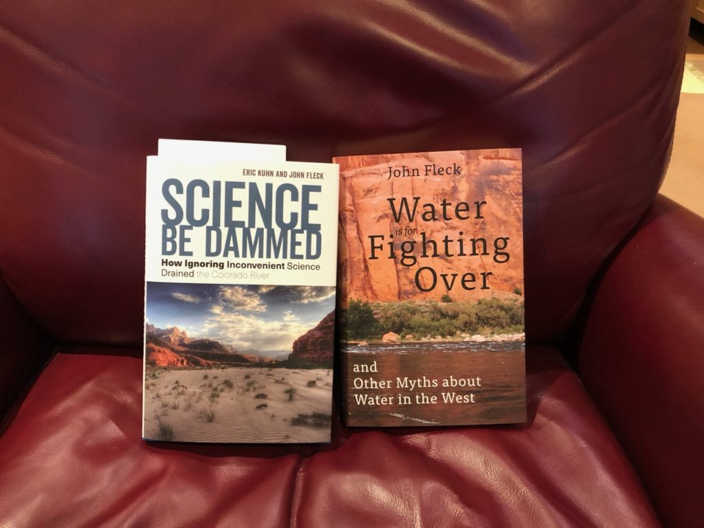
The new book Science Be Dammed, with my old book Water is For Fighting Over

the siblings’ first meeting

My early review copy arrived yesterday, ahead of the “official” Nov. 26 publication of the new Eric Kuhn-John Fleck book Science Be Dammed: How Ignoring Inconvenient Science Drained the Colorado. River. I’ve got but one – I talked to Eric this morning up in Glenwood Springs, Colorado, (in the Upper Basin) and he’s got a couple of boxes’ worth. Package tracking suggests my box with another 20 left Las Vegas, Nevada, last night (so currently beating their escape from the Lower Basin!).

So excited. Three years’ work with Eric, trying to tell a story that we think is so very important to understanding how we got to where we are in the Colorado River Basin, and how a better understanding can help us navigate the tough times to come. From the book’s closing chapter:

When E. C. LaRue wrote in 1916, before the Colorado River Compact, before Hoover Dam, before all the development that was to follow, that “the flow of the Colorado River and its tributaries is not sufficient to irrigate all the irrigable lands lying within the basin,” he prefaced his observation with a caveat. “More complete data,” he wrote, “would probably indicate a greater shortage in the water supply available” (emphasis added).

Each of those points has largely been lost to the history on which our modern operational understanding of the Colorado River Basin is based. The first, as we have seen in the stories of LaRue, Stabler, Sibert, Tipton, G. E. P. Smith, Stockton and Jacoby, and the modern climate change scientists is surely the most important. There is simply less water in the system than the edifice of laws and policies and infrastructure was premised upon. But LaRue’s second point may be the more important—the need for humility in the face of uncertainty, and the crucial need to design that humility and uncertainty into the institutions we build to use and manage the river.

We hope you enjoy it.

Metropolitan Southern California’s use of Colorado River water on track to be the lowest this year since the 1950s

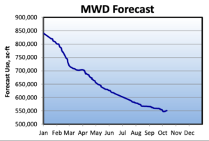
MWD 2019 water use forecast. Weird graph to read – it’s the forecast made at each point during the year. So back in January, the USBR was expecting MWD to take nearly 850kaf. That’s dropped to 551kaf.

The Metropolitan Water District of Southern California’s deliveries of Colorado River water this year are currently forecast at 550,518 acre feet, and depending on conditions over the two-and-a-half months of the year could drop as low as 506,000 acre feet, according to forecast data from the Bureau of Reclamation and what folks at MWD told me today.

That is the lowest draw on the river by coastal Southern California since the 1950s. Since 1964, MWD has taken, on average, more than a million acre feet of water per year from the Colorado River.

The reasons are twofold. First, a big Sierra snowpack (the fifth largest since 1950) meant a larger allocation via the California State Water Project – a 75 percent allocation (which is really bigger than it sounds – it’s a big allocation). Second, Met’s become much more nimble in conserving water and juggling the various supplies within its service territory.

I keep a dataset of the annual use by Met and other major Lower Colorado River Basin water users that goes back to 1964 (the year the Bureau began formally documenting use as part of the requirements of the Supreme Court’s decision in the case of Arizona v. California – the data’s here if you want to paw through it for yourself). 551kaf would be the lowest in that entire time period, so I wrote to a friend at Met asking them to dive into their older data. Previous low years:

  • 1958: 538kaf
  • 1956: 479kaf

So at the current official forecast of 550,518 acre feet, this would be Met’s lowest use since 1958. But with a current target within Met of 506kaf, this could be the lowest use of Colorado River water by metropolitan Southern California since 1956.

Either way, that’s before I was born.


From “The Great Mistake” to “Science Be Dammed”

William L. Sibert

William L. Sibert

When I was wrestling six years ago with a path through what became my book Water Is For Fighting Over, I collected material about what I came to call “the great mistake” – the overallocation of the Colorado River’s water. One of my favorite stories surrounded William Sibert:

It is quite probable that the compact attempts to apportion more water than the actual average undepleted flow of the river.

That’s circa 1928, before Congress ratified the Colorado River Compact and approved the construction of Hoover Dam, in a technical review of the project requested by Congress.

I set the topic aside back in 2013 in part because of the technical complexity of the early water math. I frankly had a hard time with the analytical framework (which period of record? which gauges? what upstream depletions? and on….), and the task of writing sensibly about something I couldn’t fully grasp myself was daunting.

Thanks to Eric Kuhn, who’d been thinking along the same lines and who had the analytical chops to make sense of what Sibert and others at the time were saying, we’ve had a chance to take another crack at “the great mistake”.

There in the pages of the Sibert board’s report was a clear message. The nineteenth-century droughts … meant the Colorado River had less water than the boosters had imagined when they crafted the 1922 Colorado River Compact and the federal legislation now before the Congress to ratify the compact and launch construction of what would become the Hoover Dam. The report’s math was inescapable. Once reservoir evaporation and water for Mexico were taken into consideration, any realistic effort to estimate the river’s flow left too little water to meet the allocations carved out in the 1922 compact and about to be ratified by Congress in federal statute.

That’s from “The Sibert Report: A Lost Opportunity”, Chapter 6 of our new book Science Be Dammed: How Ignoring Inconvenient Science Drained the Colorado River, out next month from the University of Arizona Press.

Sibert’s story is an important one that has been largely lost to history, relegated to footnotes or ignored entirely. A retired Army officer and engineer, he headed a panel chartered by Congress in 1928 to review the feasibility of the project about to be launched:

A board of engineers would be tasked with advising federal decision-makers on “matter affecting the safety, the economic and engineering feasibility, and adequacy of the proposed structure and incidental works” to be built on the Colorado River.

Critics of what would become Hoover Dam hoped to scuttle it on technical grounds – could they really build a dam that big? But Sibert, to his credit, took his charge of “economic feasibility” seriously. Would there be enough water to generate the electricity to pay for the project? That required him to take up the underlying question – does the Colorado River really have enough water to honor the allocations in the legislation Congress was about to approve?

His answer, quoted above, was “no”.

Water nerds in the audience will love Eric’s dissection of Sibert’s analysis of the river’s flows. (Buy our book!) More importantly, I hope water nerds in the audience will I hope appreciate Sibert’s probabilistic approach to water management:

Rather than picking one number, the board suggested the planning consider a range, with flows available for future depletion ranging from 10 million acre-feet during drought periods as long as 15–20 years, to high flows over similar time periods of 14.5 million acre-feet, with a long-term average somewhere in the middle.

As we explain in the book, there was too much momentum in Congress and the nation, and Sibert’s careful analysis was ignored. We live today with the consequences.