Kuhn and Fleck talk about “Science Be Dammed”. May 6, in the cloud.

Between trying to figure out how to work with graduate students I can’t see in person, and starting nervously at our pantry counting cans of beans, it’s been hard to do any of the work that has sustained me these last many years. Thinking, and writing.

As the fog settled in back in March, one of the first things to disappear was an appearance by Eric Kuhn and me at the Tucson Festival of Books to talk about Science Be Dammed. Ben Wilder from the Desert Laboratory on Tumamoc Hill in Tucson was going to host, and it was going to be fun!

As we emerge from the fog, our friends (and publisher!) at the University of Arizona Press have rented a hall, as it were, in the cloud. May 6, maybe 9 a.m. Arizona time, maybe 10 a.m. Albuquerque and Glenwood Springs time, I’m a little confused about exactly when this is happening, but I’m sure if you click through and sign up that’ll all be sorted out.

Please do join us.

Maybe the 1905 formation of the Salton Sea wasn’t the result of engineering incompetence?

Jenny Ross has a fascinating new paper suggesting we reconsider the story we all thought we knew about the formation of the Salton Sea:

It is widely thought that the Salton Sea was created accidentally in 1905-07 because of engineering negligence in the diversion of Colorado River water for agricultural use in California’s Imperial Valley. This is a misconception. Scientific data and historical records establish that formation of the Salton Sea was not accidental. The lake formed during 1905-07 in the same manner that numerous other large Salton Basin lakes did for at least tens of thousands of years from the Late Pleistocene through the late 19th century: as a result of the lower Colorado River’s natural hydrodynamic regime, floodplain morphodynamics, and established avulsion style in combination with changes in streamflow attributable to regional hydroclimate. A large body of scientific and historical evidence indicates the 1905-07 Colorado River flooding into the Salton Basin and the creation of a large lake there would have occurred regardless of man-made modifications to the river’s natural levee and distributary channels. In fact, the flooding would likely have been even worse in the absence of human intervention.

I love it when the stuff we thought we knew turns out to maybe be wrong!

Ten years ago today, a drive down a Yuma levee that changed my life

Morelos Dam, April 2010, by John Fleck

April 20, 2010, I took a drive that changed my life.

Around the back of the U.S. Bureau of Reclamation’s Yuma Area Office, helped by a map hand-drawn by Jennifer McCloskey, then the Yuma Area Office manager, I headed up a dirt road onto the levee that borders the eastern edge of the Colorado River as it makes its way south between the United States and Mexico.

Later that day, I headed north to Las Vegas. Always the storyteller in search of an angle, I walked after dark up to the strip to see the Bellagio Fountain. Here’s how I described it in a blog post time-stamped at 10:43 p.m. that evening:

LAS VEGAS, NEV – The distance between Morelos Dam on the lower Colorado and the Bellagio Fountain is profound. Morelos spans the U.S.-Mexico border, with the wheat fields and onions of the Yuma County Water Users Association behind me as I took this picture and Algodones on the far bank. Most years, Morelos is where the Colorado River effectively finishes its now futile run to the sea….

After some more stops to see the Lower Colorado’s plumbing, I made a beeline for Las Vegas. The contrast could not have been more stunning – up through the Sonoran and Mojave deserts, all mesquite and creosote, with occasional glimpses of the river strip in the distance, then through a ridge in the mountains, from quiet desert to this….

It is followed by the first of the umpty pictures I have taken in the years since of the Bellagio Hotel’s fountains as I returned again and again over the years to both places trying to make sense of the distance between the two.

Here is how I described that first levee drive in Water is For Fighting Over, the book that grew from the seeds planted on that April 20, 2010 drive:

Driving the Yuma County levee past Morelos Dam in 2010, I saw the last trickles of water from leaks in the dam and a shallow water table disappear within a few miles into a sandy, dry channel. This great river, the Colorado, around which I have spent much of my life, whose water I have showered with and drunk, which has grown the food I eat and floated my boats for hundreds of miles, simply disappears into the desert sand.

Storytelling as a vocation carries risk – the risk that a story often enough told becomes a substitute for the thing beneath it. Such is my story about Jennifer McCloskey’s map and my drive down the levee that spring morning. We hope that our bearing of witness is true to the thing, but it is always different than the thing. I wrote about this a year later in another context:

There’s an odd sort of detachment in the act of bearing witness for posterity instead of simply being in the moment. I know it professionally. I’m not a photographer, but I’ve been rethinking this because I’ve started taking pictures in my newspaper work recently. That fundamentally changes what has always been, for me, the act of bearing witness. Being at a “thing” when I’m working is different, the way I try to see more, remember and annotate and prepare for the retelling even as I’m experiencing. Instead of just being there and enjoying.

That trip to Yuma back in the spring of 2010 was my first attempt to learn the things I needed to bear witness to the Colorado River. I view this, still, as a work in progress.

Searching for The Birds

It’s been increasingly difficult to maintain a “social distance” at our neighborhood park, so the afternoon walks have begun to range. I guess, adapting my friend Maria Lane’s hashtag, we could call it #geographybyfoot.

Headed north across the freeway last week, I found this in the flood control channel:

The Bird, AMAFCA channel east of Carlisle, Albuquerque NM

It appears to be either an early or hasty version of a beautiful piece of street art we’ve seen repeated around this part of Albuquerque. I did a post over at Better Burque with a map of the four we’ve found, including a gorgeous one along the railroad tracks north of downtown Albuquerque that has since been painted over.

We’re asking for BB readers to share any more that they find.

Las Vegas abandons proposal to pump rural Nevada groundwater

When I was writing Water is For Fighting Over five years ago, I built a little analytical model of Las Vegas water – projections of per capita demand and population growth, current patterns of water use and banking, risk to Colorado River water supply. At the time, the Southern Nevada Water Authority was aggressively pursuing construction of a pipeline to rural Nevada, to pump groundwater to augment the rapidly growing metro area’s supplies.

My model suggested to me that they didn’t really need the water.

I was timid in the way I wrote about it in the book:

The great failure in Las Vegas water management is an odd one. Like many cities, it has repeatedly underestimated its customers’ zeal for conservation, which results in overestimating how much water Las Vegas will need.

These failures are understandable. Water managers’ incentives favor erring on the side of caution. The consequences of having too little water are far greater than the consequences of having too much. So Las Vegas has continued to pursue expensive and politically costly plans to import more water into the Valley from rural Nevada, water that the Valley’s conservation success suggests may never be needed. (emphasis added)

Daniel Rothberg reporter yesterday that the Southern Nevada Water Authority has abandoned its pursuit of the pipeline:

The Southern Nevada Water Authority is ending a decades-long effort to build a controversial 300-mile pipeline to pump rural groundwater from eastern Nevada to Las Vegas.

On Thursday afternoon, the water authority confirmed in a statement that it would not appeal a recent court ruling that denied the agency a portion of its water rights.

The decision means the water agency is shelving a development project that has long inflamed tensions between rural and urban Nevada, from the Legislature to the courts, and eclipsed nearly all other water issues in the state.

This is one of the most striking examples to date of the argument I’ve been making ever since I had the epiphanies that drove my work a half decade ago on Water is For Fighting Over – municipal water demand is declining as fast as, or faster than, population growth, opening up enormous opportunities in our pursuit of sustainable water management in the West.

Thinking about rural water

In the time of pandemic, I’ve been thinking a lot about small rural community water systems. This is in part because of work one of our University of New Mexico graduate students was doing in the Time Before, which seems super relevant now. Tucker Colvin just defended his thesis in UNM’s Geography and Environmental Studies program (I was on his committee, it was one of our university’s first Zoom defenses of the new era).

Tucker, working with UNM Water Resources Program student Amy Jones and Geography faculty member Ben Warner, spent oodles of time interviewing rural New Mexico water system managers to better understand the challenges they face. It was fascinating to me, as someone who’s spent most of his time talking to big municipal and ag system operators, a window into a world I’ve not thought enough about.

UNM’s Graduate Studies folks did a nice writeup on Tucker and his work:

By interviewing managers of drinking water systems, he discovered “that water systems face numerous issues including deteriorating infrastructure, limited funding, overly burdensome regulation, and perhaps most importantly, not having enough engaged people to manage their water systems.” Additionally, Tucker explains, “The state is also promoting regionalization as a blanket policy to promote sustainability of water systems. This research finds that this can be a useful tool in some cases, but for many communities it is perceived as taking away local control of a vital community resource and giving responsibility to a distant entity. This process can resurface historical political tensions and interactions between communities and government agencies. Many communities are in fact already organically and informally cooperating and sharing resources with their neighboring communities. Some policies and institutional structures created by the state seem to be innocuous and were likely created with good intent, but they are sometimes reinforcing power structures and keeping underserved communities marginalized.”

Once we come out the other side of our current predicament, I look forward to helping Tucker in his goal to share his findings with folks who can help move his insights into the policy world.


“hooligan” in the time of pandemic

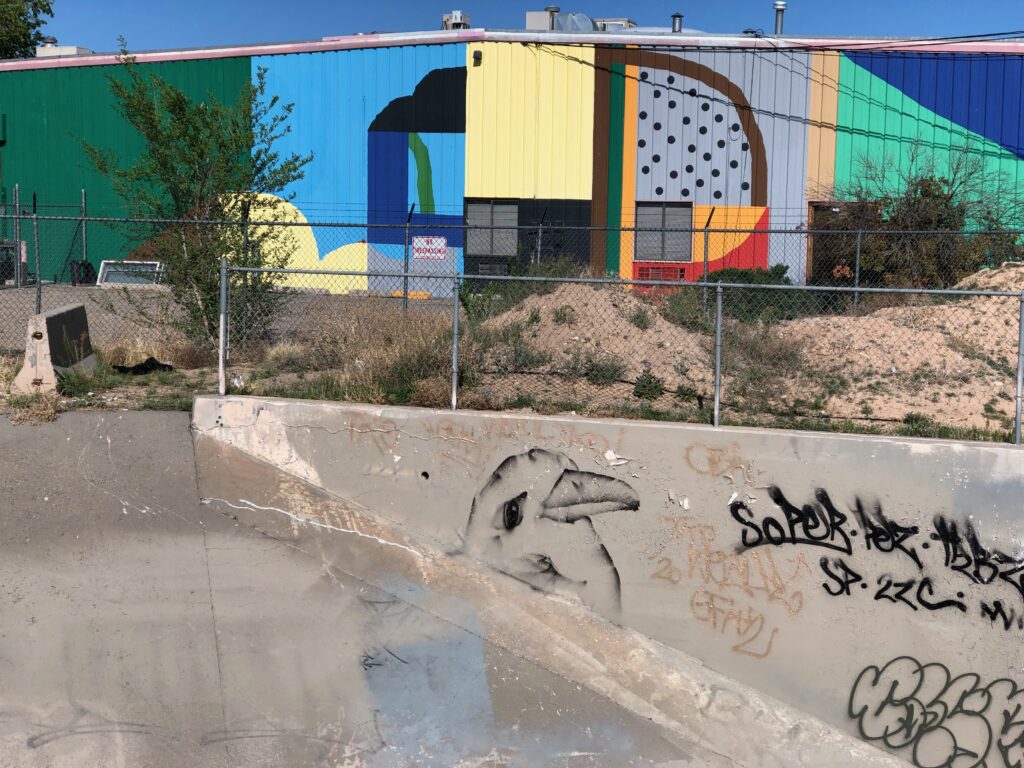
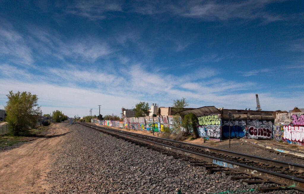
railroad track graffiti, Albuquerque’s North Valley off Vineyard

My current favorite word is “hooligan”.

It’s origins are murky, but the authors of the Oxford English Dictionary say it first appeared in newspaper stories in 1898, to whit:

1898   Daily News 8 Aug. 9/3   The constable said the prisoner belonged to a gang of young roughs, calling themselves ‘Hooligans’.

The story behind its emergence is unclear. Again, per OED:

The word first appears in print in daily newspaper police – court reports in the summer of 1898. Several accounts of the rise of the word, purporting to be based on first-hand evidence, attribute it to a misunderstanding or perversion of Hooley or Hooley’s gang, but no positive confirmation of this has been discovered. The name Hooligan figured in a music-hall song of the eighteen-nineties, which described the doings of a rowdy Irish family, and a comic Irish character of the name appeared in a series of adventures in Funny Folks.

And so, from the beginning, it has carried a combined sense of thuggishness and rowdy comedy.

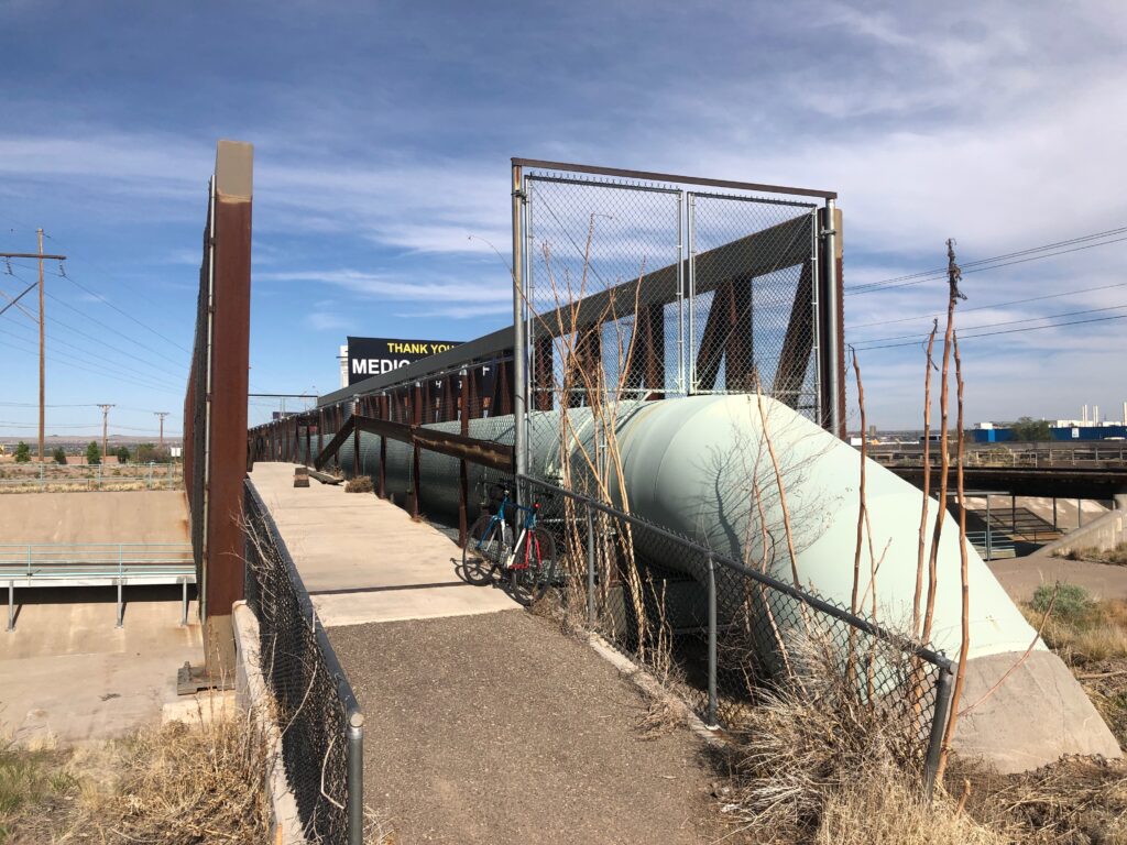
In the Time Before, my friend Scot and I had begun exploring combination train/bike expeditions for our weekly Sunday ride. Several involved meeting up at the Albuquerque depot and taking the train north, being deposited at various places up the Rio Grande Valley for a long ride home. As such, the train took us through the raggedy light industrialness of Albuquerque’s North Valley. The tracks are lined with the most remarkable graffiti, and every train trip through, I was reminded that I needed to find a way back in, to enjoy the space at leisure.

Train tracks are like alleys, corridors through a city largely forgotten except to their denizens. It’s where I find the best graffiti. But unless you’re on the train, they are largely impenetrable, fenced off save the intermittent street crossing. Impenetrable, that is, to all except the hooligans.

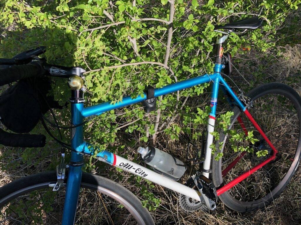
I was riding last week across the North Valley, trying find a new way to cross the tracks when I turned, not quite randomly, on a street called “Vineyard.” (I’ve been working with a couple of UNM Water Resources graduate students piecing together the history, nature, and structure of agriculture in the region, so Vineyard Road has been of interest for a while. In pieces, I’ve ridden the length of it. There are no vineyards remaining. This is what we mean by “#geographybybike”.)

Vineyard Road had the usual “No Outlet” sign. On the bike, I’ve learned to ignore them. Where cars cannot go, pedestrians often find their way. In this regard, Vineyard did not disappoint.

Where the street stubbed into the railroad tracks, the fence was cut, admitting me to the rich alleyworld of the railroad tracks. The hooligans, once again, did not disappoint.

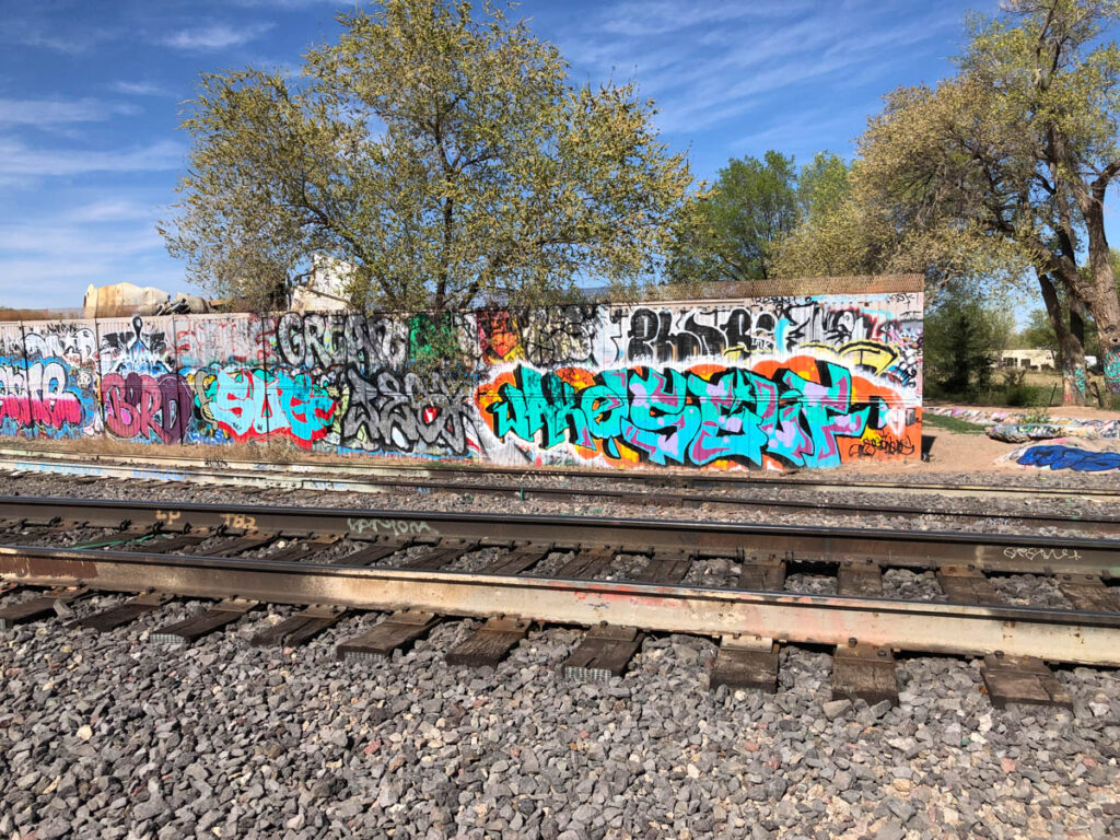
the hooligans did not disappoint