As Albuquerque’s Rio Grande dries, is the system simply functioning as we intended?

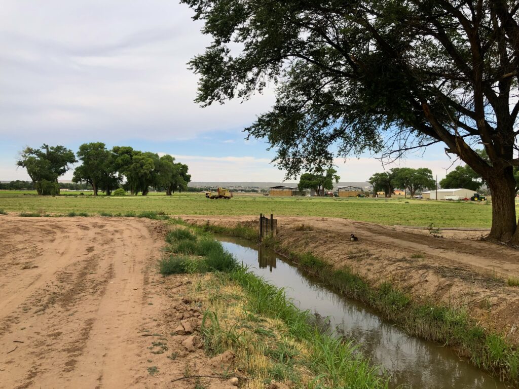
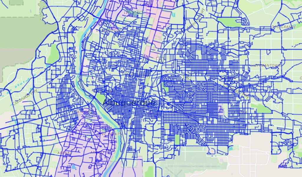
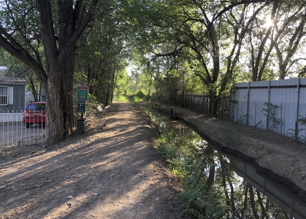
The Chamisal Lateral, a shady oasis in Los Ranchos de Albuquerque.

In a sad but important way, the disastrous 2022 water year has been a gift to the writer, and I’m spending as much time as I can in reporter mode, sussing out the stories of this remarkable year.

In the new book we’re writing, Bob Berrens and I are trying to make sense of the decisions Albuquerque has made over the last century to live on the Rio Grande Valley floor – we shape river, and  the river shapes us.

2022 is a test. There is less water, a lot less. What will we do? What will this place look like as climate change makes years like this less exception and more norm?

This morning’s bike ride took me through the middle of my hypothesis, a transect across the hydrogeography of Albuquerque – up the river valley through the community of Los Ranchos de Albuquerque, then out onto the riverside trails.

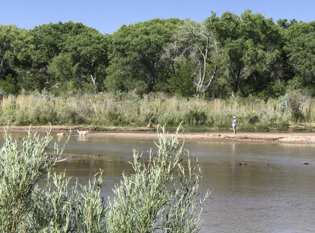
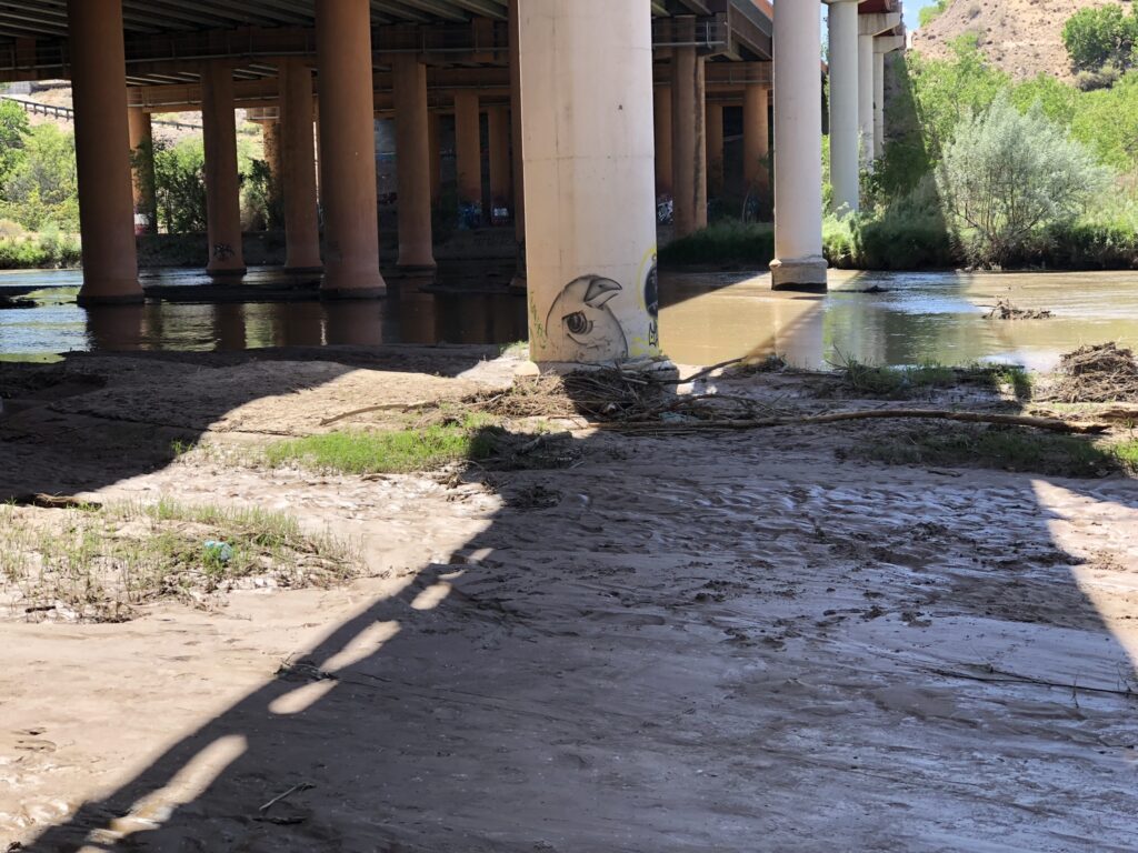
Los Ranchos was leafy and green. The riverside woods were parched, and the river itself, the part flowing between the levees, is at the lowest it’s been at this point in the year since 1989.

For those alarmed by the dropping river, and perhaps struck by the contrast with the buccolic, tree-lined Chamisal Lateral in the picture above, it’s worth considering why things are this way. Because it occurred to me as I enjoyed the shady lanes of Los Ranchos and then looked on at the dull agony of a drying river that this system is, in fact, working as designed.

We have a set of rules, encoded in state legislation and state and county implementation policy and therefore (I guess?) reflective of our collective values as a community that are designed to keep Los Ranchos green while allowing the river to go dry.

Rules as Water Management Design Principles Case 1: Domestic Wells

In 1953, the New Mexico legislature passed its first domestic well statute:

By reason of the varying amounts and time such water is used and the relatively small amounts of water consumed in the watering of livestock, in irrigation of not to exceed one [1] acre of noncommercial trees, lawn or garden; in household or other domestic use, …  the state engineer shall issue a permit to the applicant to so use the waters applied for.

The statute has changed over the years a bit, but its basic principle still applies. If you want to drill a domestic well at your house, you get to.

The New Mexico Office of the State Engineer does have the authority to declare something called a Domestic Well Management Area “when hydrologic conditions require added protections to prevent impairment to valid, existing surface water rights”, but that has not been done here. (Source, p. 33)

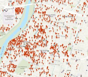
The result is a valley floor pockmarked with domestic well permits, allowing people to use water from the Albuquerque Bernalillo County Water Utility Authority for indoor use, and water their lovely yards from a shallow  domestic well. But remember, those shallow aquifers are in direct connection with the river. This is basically water coming straight out of the river.

If our rules are a codification of our values and intentions, it seems here that our intention is to keep the valley floor green in times of drought. If it isn’t, we need to change the rules.

Rules as Water Management Design Principles Case 2: The Agricultural Tax Break

Our crazy smart UNM Water Resources Program student Annalise Porter recently finished a relevant piece of work on the agricultural property tax break irrigators get on the valley floor here in the greater Albuquerque  metro area. Annalise defended in the spring, and is writing an expanded version of the project for a paper for publication. Soon! I think it’s really important stuff.

I rode down street after street today of affluent Los Ranchos homes colored pink on my version of Annalise’s maps – horse pastures, hayfields, one in sunflowers, all getting the tax break. This is not commercial agriculture, or “subsistence farming”, as one court ruling suggested was the intention of the 1967 state statute. These are hobby farms.

We have a set of rules – a state statute, implemented by our local county government, that is providing a financial incentive for this use of water, which Annalise estimates at ~10,000 acre feet per year in Bernalillo County.

Ribbons of Green

The title of the proto-book is Ribbons of Green, after a line in John Van Dyke’s oddly dishonest masterpiece The Desert. In our work, Bob and I are playing with a theme – that we make progress by thinking of “the river” as more than the narrow strip that flows between the levees. Our notion of the river includes the water we move out across the valley floor – the ditches, the shallow aquifers from which we pump to water valley yards, a culturally and biologically rich and complex system lain across a valley floor where an unencumbered river once spread spring floodwaters on its own.

It is interesting to think about what the ribbons will look like five years from now, or ten. Between the levees, in the river’s main channel, the die seems cast – we’ve apparently decided as a community that we’re fine with letting it dry. Maybe Texas will have a say in what comes next – sooner or later our Rio Grande Compact obligation to get water downstream to Texas will require us to put more water into the river channel, perhaps reducing the Los Ranchos blanket of green in the process. Or reducing the green somewhere. Riverside bosque? Farms?

Perhaps the struggle to help the dwindling Rio Grande silvery minnow, our Endangered Species icon, will lead to more water in the river and less in Los Ranchos (or less somewhere).

On my book research bike rides (such a racket!), I have come to stop random ditch walkers and yard waterers and engage them in idle conversation. In general, they love the green, have little idea where the water is coming from, and are delighted with the current situation.

The Compact or the Endangered Species Act as drivers may ultimately change things, but they are something different from our community values. As seen in the Water Management Design Principles above, we seem fine with spreading the green outside across the valley floor while letting the part of the river between the levees, its main channel, go dry.

If it were otherwise, we’d have different rules.

Ditch Lobster in a Drying Griegos Lateral

Ditch lobster in a drying Griegos Lateral, Albuquerque, June 9, 2022

Sorry I didn’t have the presence of mind to give you something for scale. This little critter was a a bit smaller than my hand, crawling along the bottom of the drying Griegos Lateral, one of the 1700s-era irrigation ditches on the Albuquerque Rio Grande Valley floor.

Drying kind early this year, because climate change.

The PhD’s at the Inkstain Science Laboratory can’t agree on the spelling – “crayfish” or “crawfish”. I’m going with “ditch lobster”.

2022’s gonna be a tough year for the ditch lobsters.

A few notes on the Rio Grande in 2022

Rio Grande Monday, 6/6/22, under the I-40 bridge in Albuquerque. Not dry yet!

A few notes on New Mexico’s Rio Grande in 2022, as I collect my thoughts for a TV interview later today:

Snowpack and runoff

  • Snowpack peaked at ~80 percent of the median
  • Runoff into NM’s middle valley looks to be less than 50 percent (maybe quite a bit less?)

Dry spell

As I write this a bit before sunup on June 8, 2022, the NWS offers me a 20 percent chance of precipitation this afternoon. Through yesterday, we’ve gone 69 straight days without measurable rain or snow at the Albuquerque NWS complex. That’s the 19th longest streak on record, going back more than a century.

Put another and perhaps more meaningful way – 1.19 inches of precip at the airport since Oct. 1 is the fourth driest start to a water year in the aforementioned century-plus of records.

Current flow

Current Rio Grande flow at the San Felipe gage north of Albuquerque (my best measure of river flow entering this part of the valley) is the lowest it’s been on this date since 1989.

Current not flow

The river began drying south of Albuquerque over the weekend like that (sound effect of sharp finger snap). We had more than 20 miles go dry by Monday morning, I don’t have the latest data, but I talked to one of the folks working down there who said things are drying so fast that they’re not seeing the usual number of stranded pools as flows drop. This seems to suggest a fading shallow aquifer after our third dry year in a row.

Whither the riverside forests, our beloved bosque, which depend on that shallow aquifer? Further research needed.

Future not flow

Last year Cassandras such as myself warned of river drying in the Albuquerque reach for the first time since the 1980s. It did not dry. It rained.

Cue Cassandra, who enters stage left.

If it does not rain again, we could see drying in the Albuquerque reach this year for the first time since 1983.

Irrigation

Not. Upstream storage, on which we normally depend for irrigation water in the middle valley, is zip, nada, etc., except for some loose change in the couch cushions. USBR data web site is down this morning, but I think it’s fair to guess that zip, nada, etc., is similar to the lowest it’s ever been at this time of year? How could it be otherwise?

Ditches are already starting to go dry, and it’s still early June.

Municipal supplies

Albuquerque’s plan was to shut down its river diversions ~June 15 because flows would be too low. That could well happen sooner. We’ve got groundwater to fall back on, an “emergency reserve” we’ll have to tap into for the third consecutive year. (Disclosure: I serve on the Albuquerque Bernalillo County Water Utility Authority’s Technical Customer Advisory Committee, where we gather monthly over Zoom to talk about things like this.)

Fond memories

I went on a bike ride Monday morning down one of the riverside trails. There’s a point just north of Central Avenue where the trail drops to a low spot that filled in late spring 2019 and stayed impassable for months.

I did not mind that my favorite trail was impassable.

I rode up to it, to the water slipping quietly back into the bosque, many many times, turned around and went another way.

Made me smile every time.

It’s quite dry there this year.


Tobacco farming and swamps in early 20th century Albuquerque

For a brief moment, this was Albuquerque’s “Tobacco Farms”. Before that, a swamp.

Albuquerque’s nod to its agricultural past, like much of the style we have adopted for ourselves, is in significant measure artifice. This is not to say that it is not in some vague sense rooted in a truth, an actual past. But we engage in the 21st century in significant embellishment, a story we spin out on the land.

One of the last large farms in the urban part of this stretch of the Rio Grande, “greater Albuquerque”, is in what we call the “South Valley”. It’s ~350 acres of alfalfa, broken in two, separated by a Walmart and an uncrossably, dangerously busy highway. (This is your bike riding author’s humble assessment, having tried on more than one occasion to cross from one part of the farm to the other without aid of automobile. Do not try this without the aid of a skilled South Valley guide.)

Some of the land is in private hands, a proto-development with alfalfa parked on the land (the owner gets a good tax break) until the market hits that point of equilibrium where building stuff on it makes sense. The rest is in public ownership, an enthusiastic but perhaps historically misguided civic sense of self, directed toward preservation of an agrarian past that, while real, looked very different than the picture above.

The early 20th century property records bear an odd name: “Consumers Tobacco Co.” The old maps also show something very different than what we see today – swamps, and lakes. “Water surface variable, very high this date. Aug. 29, 1927”, one of the old maps reads.

The tobacco name lingers in “Tobacco Farms LLC”, the legal owner of a good fraction of the land.

The swamps and lakes are long gone, drained away by deep ditches dug nearly a century ago to turn swamp into a tobacco-farming empire.

Like so many of this valley’s attempts at landing on a successful commercial crop – large scale wheat farming, tomatoes, pinto beans, orchards, sugar beets – this did not go well.

Tobacco Farms

Albuquerque Journal, March 11, 1928

The advertisement in the March 11, 1928 Albuquerque Journal seems profoundly out of place.

The signatories, the members of a consortium that in in the 1920s had formed the Consumers Tobacco Company, were an odd assortment for an agricultural enterprise – an insurance agency owner, a lawyer, four developers of subdivisions in the burgeoning area around downtown Albuquerque, a warehousing and shipping firm, the Albuquerque Gas and Electric Co., and the First National Bank.

The ad was one of many run by this group of civic boosters. Why were they – no farmers themselves – so enamored with a crop that seemed so out of place in the arid West? The answer can be found in the advertisement’s words attributed to the First National Bank: “Any crop that can increase the per acre yield of the acreage we have under cultivation will react to the benefit of the farmer and the community alike.”

That “benefit … to the community” was the key. That’s why a bunch of housing developers thought tobacco was the answer to Albuquerque’s future.

These people were pursuing Albuquerque’s destiny as a great city. The citizens of this growing metropolis needed jobs, and a contemporary understanding of the economic structure of the day – remember this was the 1920s – saw those jobs in a “Von Thunen Ring” of farming around the city. Never mind that by the 1920s Albuquerque’s food was arriving by rail, and local agriculture even then could not compete. The economic structure of the nation was shifting beneath their feet, and it was hard for the Kelehers and Clinton P. Andersons of the day to see beyond the confines of their paradigm.

Draining the swamps

Circa 1927, a plan to drain the swamps around “Hubbell Lake”

To build that city, these civic entrepreneurs needed to drain the swamps that made up the bulk of the land on the valley floor.

“It’s pretty hard to develop economically in a marsh,” New Mexico State Engineer Steve Reynolds said years later.

The most successful crop in the Middle Rio Grande – mortgages

This is the heart of the book Bob Berrens and I are writing (credit here to Bob for the work we’ve been doing on the Tobacco Farms story – Bob’s the smart guy, I’m the literary muscle, a bouncer standing at the door of the Ribbons of Green nightclub deciding which stories to let in). To understand Albuquerque’s pivot in the 1920s from swampy valley to booming city, Bob and I have been spending an inordinate amount of time staring at three sets of old maps. (Huge thanks to the staff at the Middle Rio Grande Conservancy District for helping us with the complete map sets.)

If you look at the Tobacco Farms maps, you see swamps, and lakes, and a bold straight line drawn through the middle of the page – “Isleta Interior Drain”. It’s deceptively simple – dig a big ditch through the marshland to lower the water table, and voila – swamp becomes farmable land!

But the deception is perhaps in the goal? If you compare the list of names on the newspaper ad above, the founders of Consumers Tobacco Company, you see not farmers but developers. You also see, crucially, a who’s who of the backers of the creation of the Middle Rio Grande Conservancy District.

And if you head east across the 1927 maps, you see something striking. Before the drains were even built, while they were still dreams in the eyes of the Kelehers and Clinton P. Andersons, a carefully platted tract of homes: “Tobacco Farm Subdivision”. Immediately to the east is another ditch – “Atrisco Riverside Drain”.

We see this up and down the valley – even as the rhetoric (and some of our modern mythology?) suggests an attempt salvage and boost agriculture on the valley floor, a network of drains, and subdivision after subdivision being platted on the resulting newly reclaimed swampland.

In the 1929 census, tobacco peaked at 15 acres in Bernalillo County, never to be seen again.

Tobacco Farm Subdivision remains.


Central New Mexico’s Rio Grande is beginning to dry

The Duranes ditch, dry this morning (June 6, 2022)

Sometime last weekend (June 4-5, 2022), the Rio Grande south of Socorro, New Mexico, began drying. By this morning (Monday June 6) river managers reported 20+ miles of drying. The gage north of the 380 bridge at San Antonio dropped to zero today.

The Albuquerque Bernalillo County Water Utility Authority, which normally gets the largest share of our drinking water from the Rio Grande (supplemented with imported Colorado River water via the San Juan-Chama Project), will likely be shutting down its river diversions within the next week to ten days, switching entirely to groundwater through late summer or fall. Which means my tap will still run, and I’ll still be able to water my lush suburban oasis cactus.

Flows on the Rio Grande through Albuquerque right now are the lowest since 1977, which was a crazy bad water year here. Absent a good summer monsoon (which bailed us out last year), we’re expecting the Rio Grande to dry in the Albuquerque stretch this year. As I understand it, this would be the first time we have seen that since 1983, though historically it has happened with some frequency in the past.

But it’s never happened since I’ve been here. (I hope readers will forgive a post now and then as I bear witness to my river going dry.)

Folks who depend on surface water for irrigating their yards, horse pastures, and the like are likely to see dry ditches like the one you see above – the Duranes, which was dry today when I rode through the neighborhood on my morning bike ride.

Domestic wells on the valley floor

Folks with domestic wells to water their yards on the valley floor – and there are a lot of them, especially in the more affluent neighborhoods – should be OK. (Forgive my modest cartographic skills, the red push pins are locations with a domestic well permit, allowing them to pump from the shallow aquifer to water their yards.)

The endangered Rio Grande silvery minnow isn’t doing well at all this year. Surveys have found almost no eggs, suggesting spawning barely happened this spring.

One of the things I’ll be watching this year is the health of our bosque, the cottonwood gallery forest that lines the river. The trees are phreatophytes, which means they stick their roots down into the water table to drink directly. Even as the river dries, they’re still able to tap into the shallow aquifer, and we’ve seen them do well in recent years even as the surface manifestation of the river dries. It’s almost like under a nature-drive doctrine of prior appropriation, the trees are the senior users on the system. They’ll continue to take their cut.

This morning, out on the river just south of Albuquerque’s Central Avenue Bridge (Route 66), I saw this guy with two very old dogs slowly but happily splashing. When the flows get low like this, you see that a lot. So I guess there’s that.

Happy dogs, splashing in a river


A hundred years ago in Colorado River Compact negotiations: the Supreme Court Breaks the logjam

By Eric Kuhn and John Fleck

With a single statement, the United States Supreme Court changed the direction and tone of the compact negotiations:

[T]he waters of an innavigable stream rising in one state and flowing into a state adjoining may not be disposed of by the upper state as she may choose, regardless of the harm that may ensue to the lower state and her citizens.

In a unanimous ruling, on June 5, 1922, the court issued its decision in Wyoming v. Colorado, ruling that Colorado could not develop waters of the Laramie River in a manner that ignored and injured downstream senior appropriators in Wyoming.

Salt Lake Tribune, June 8, 1922

The decision, and its clear implications for the development of the Colorado River, echoed around the West. “State Lines on Colorado River Are Wiped Out”, blared a front page headline in the Salt Lake Tribune, adding “Federal Officials Say California is Already Owner of Stream’s Summer Use.”

This was the risk that states in the river’s upper basin had long feared – that the doctrine of prior appropriation, used by the states within their own borders, might be determined to apply across state lines. Nervously, they all eyed California.

The Laramie, the river at the center of the court’s ruling, has its headwaters in the Northern Front Range Mountains about 40 miles west of Ft. Collins. From there it flows 280 miles north into Wyoming, reaching  the North Platte River near Ft. Laramie, WY. Wyoming farmers and ranchers began using the river for irrigation purpose in the 1880s and 1890s. Within Colorado there is little irrigable land along the river’s path, but its elevation just happens to be about 225 feet higher than the Cache La Poudre River where the two rivers are a little more than two miles apart. Thus, in 1909 two Colorado water companies, including the North Poudre Irrigation District, a client of Colorado’s Delph Carpenter, began construction of an 11,500 foot tunnel that would divert 800 cfs (essentially the entire river in low flow years) from the Laramie River into the already fully developed Poudre. In 1911 the State of Wyoming filed suit against Colorado to protect its existing irrigators.

Over the course of the eleven-year case, the Supreme Court held three oral hearings, the last in January 1921, only weeks before the Colorado River Commission first met. Wyoming’s basic argument was that Colorado’s proposed project would cause great damage and injury to its citizens who were already using the river for irrigation. Colorado’s basic argument was that it had a sovereign right to take and use any water within its boundaries without regard to the rights of states or individuals outside of Colorado. Both states used prior appropriation, but details of how the doctrine was administered were quite different. In Colorado water rights were adjudicated by the local district court. In Wyoming they were granted by a state Board of Control.

The opinion, written by Justice William Van Devanter, determined that since both states used prior appropriation, this doctrine would set the rule for the equitable interstate division of water on the Laramie River. The effect of the opinion was that to protect downstream senior appropriators in Wyoming, the Colorado project would be limited to an annual diversion of 15,500 acre-feet per year, about 20% of the original plan. The opinion was not a complete loss for Colorado. Wyoming had challenged the legality of the Colorado’s project because it was a transbasin diversion. The court found that there was nothing illegal with projects that move water.

As soon as the opinion was released, Colorado River Compact Commission Secretary Clarence Stetson sent copies of the opinion to the commissioners along with a six-point summary. For Colorado’s Carpenter, the loss was probably not a great surprise, but it was nonetheless a bitter defeat. He told his upper river colleagues that the decision left them badly exposed.

For the compact negotiations, the court decision required Carpenter to change his basic strategy. Up to this point, he and Utah’s Caldwell had held firm for a compact based on the concept that water projects in the Lower Basin would never interfere with water uses in the Upper Basin. The decision coupled with building public pressure for Congressional approval of a large storage reservoir to control floods, regulate the river, and produce much needed hydroelectric power meant that it was now time for Carpenter to propose a more practical alternative.  He turned his attention to a concept proposed by Reclamation Service Director Arthur Powell Davis at the Los Angeles field hearing – a compact based on dividing the use of the river’s waters between two basins.

Stetson’s goal was to get the Commission back together in August. Hoover had asked New Mexico Governor Merritt Mechem for a recommendation on where they might meet in relative seclusion. Mechem found such a place, but finding a date that would work for Hoover and the other commissioners would push the meeting date out to November – stay tune.

The Bird Watches Over a Drying Rio Grande

The Bird (by the artist Irot) watches over a drying Rio Grande

The only thing better than a tailwind on the bike ride home up the hill from the Rio Grande is an air conditioned bus on a hot afternoon.

Tailwinds are great, but stories happen on buses.

Riding my bike to a meeting with folks trying to figure out how to cope with climate change seemed appropriate signaling, but mainly bikes are fun, as my friend Charlie likes to say, and I pretty much ride mine everywhere I can.

After the meeting, I took the long way home, which involved a dirt trail through the riverside woods along Albuquerque’s reach of the Rio Grande. It was shady and cool on a hot afternoon, but the glimpses of the river were painful. Sometime around midday flow dropped below 300 cubic feet per second, which probably means nothing to most everyone, so I’ll put it this way – it’s just a hair above one tenth of the normal flow for this time of year.

We are having a very bad year.

The Bird, painted by the artist Irot on a bridge piling beneath the interstate, was looking out on muddy sandbars where a river used to be not that long ago. I’ve written about Irot’s work before – his Silver Surfer on a plywood panel downtown became an icon of pandemic survival for me, when all I could do to keep my head about me was ride my bike. I always stop to say “hi” to his Bird when I’m on this stretch of the riverside trails.

I wore a mask all day at the meeting, so I guess the pandemic fog is still hovering, but it was good to see friends caring deeply about working on a problem. So there’s that.

But lordy the gut punch of climate change as I looked at that river today.

Off the river trail and on to a bus, because, as I said, the only thing better than a tailwind on a hot afternoon like this is an air conditioned bus. The crosstown blue buses have become a staple. Did I mention climate change?

On the ride home, a story: a person sitting on the seat across from me, head in hands. Their cell phone ringing. Pulled it out, looked at it, put it down. Rang again. Stopped. Again. Stopped. Again. Head in hands.

I got off the bus at the university and swung through the Student Union Building to refill my water bottle before the last leg home, took a big long drink.

We’ll be OK. We’ve got no choice but to use less water. But this won’t be easy.

Sure, dead bodies in Lake Mead, whatever. I remain optimistic.

Boulder Harbor, Lake Mead, Oct. 18, 2010

Cracked mud at Boulder Harbor, Lake Mead, Oct. 18, 2010

It has become a Frequently Asked Question of late here at Inkstain World Headquarters:

John, you’ve frequently been quoted in the past expressing optimism about the future of the Colorado River Basin.

Dude, Lake Mead is so low they’re finding dead bodies.

Are you still optimistic?

My answer, of course, is “yes”.

It’s in my contract.

Some history

“the harbinger of doom”

Some years ago, I wrote a book called Water is For Fighting Over (and Other Myths About Water in the West). It hasn’t made me a whole lot of money, but it was generally well received. The New York Times called it “illuminating“, and radio talk show host Ross Kaminsky called it “fascinating”.

In it, I laid out a novel argument: Despite the water management and development mistakes of the past – overbuilding our cities and farms in the desert, in the process growing increasingly dependent on an increasingly unreliable water supply – we aren’t screwed.

Why?

I laid out what I and most of my family members agreed was a fairly compelling case about successful water use reductions and collaborative governance that, I argued, have created a framework for sharing rather than fighting over water.

It was a defense of the adaptive capacity of human communities. “When people have less water,” I wrote, “they use less water.”

When WIFFO came out in 2016, it was a bit of a novelty. “Hey, there’s this guy Fleck who doesn’t think we’re screwed! Let’s invite him to come speak at our conference!”

There I would be, in some hotel conference room in Las Vegas (it always seemed to be Las Vegas) offering up my charts and graphs of water conservation success, and stories about people coming together like happy kids on the elementary school playground whose moms had packed yummy treats in their lunchboxes. Treat shortage? No problem, we’ll share what we’ve got before we head out to play Foursquare.

I’d make self-deprecating jokes about my old newspaper self hunting up pictures of cracked mud for my drought stories, grabbing the front page by ominously hinting at our impending doom. (True story: One of my editors used to delight in calling me “the harbinger of doom”, a golden ticket to the front page.)

And then one of those annoying climate scientists would get up (it always seemed to be Brad Udall) with their charts and their graphs about long tail risks of rapidly declining river flows. It was an exercise in uncertainty – climate change my be this bad or it might be that bad. And I would bury my head in my hands. Some climate change, some reduction in river flows, I would think to myself. We can handle that with the tools I had just described. But out toward the scary edge of Brad’s graphs?

I could see how climate change could outpace the tools I had described. Out there, we’d be screwed.

Bodies in Lake Mead

In 2016, when WIFFO came out, the combined storage of Lake Mead and Lake Powell, the two primary water supply reservoirs on the Colorado River, was about 22.4 million acre feet. At the end of this water year, it’s projected to be down to about 13.1 million acre feet.

That’s a decline, on average, of 1.5 million acre feet per year.

For the six years I’ve been out on the hustings hawking my book and its optimistic message, we’ve been using, on average, 1.5 million acre feet more per year than the river has provided.

1.5 million acre feet per year is six Las Vegases. It’s 30 Albuquerques. It’s more than half the farming in the entire Imperial Valley, year after year after year.

If I was my critic, I’d have to point out that dude, Lake Mead is so low they’re finding dead bodies.

It’s a fair cop.

On Getting Started

One of my favorite lines in Water is For Fighting Over isn’t mine. It came from my beloved editor Emily Turner, to whom I owe so much, and landed in the last paragraph of the book.

I was talking about the risk of headlines of doom. Emily was the one who, riffing off of the “not really something Mark Twain said” theme of the book’s title, found the bolded bit below:

[I]f you are able to sidestep the crisis narrative and recognize that your community can thrive with less water, then the fight with your neighbors seems less necessary and the risks of water wars and a crash diminish. It’s time to stop fighting over water and turn our attention to another adage Mark Twain likely never said: “The secret of getting ahead is getting started.” When we start talking, we can learn to share our beloved but dwindling Colorado River in a changing world.

This is the heart of the thing I didn’t understand when I wrote that book. “Getting started” is harder than I thought.

“Getting started” is a weird way of thinking about this, because the body of that book, all 250 pages of it, is a whole bunch of very successful work done in the two previous decades to conserve and share water. But next steps are always harder than the last, and they’re hardest when the reservoirs still have water in them.

That’s the thing about the six years since Water is For Fighting Over came out. For the first four of those six years, the reservoirs were relatively stable – two up years, two down years, leaving them basically where they were when I  first sat in those Brad Udall talks with my head in my hands. The reservoirs weren’t inexorably dropping.

Basically the entire drop in the system that is now revealing Lake Mead’s dead bodies has happened in just two years.

We could wish that it wasn’t so hard for water managers to tell their users, “Y’all need to fallow those fields and tear out those lawns now because things might be bad in future years.” We all wish now that we had done stuff like that five years ago and built a buffer so that when the bottom dropped out of the system in 2021 we had a bit more of a cushion.

But we also could wish that carbon emissions didn’t warm the atmosphere. Both seem to be boundary conditions here, and wishing human politics and human nature were different than they are seems no more helpful as a policy recommendation than wishing that greenhouse gases weren’t fucking everything up so badly. That’s the reality we need to start from.

Wait, this was supposed to be about why you’re optimistic, wasn’t it?

Sorry, dear readers, this post is already far too long. But it’s my blog.

I’m trying to think through a talk I’ve been asked to give next week to a bunch of Colorado River people at the Law of the River CLE in Santa Fe – looking forward, where do we go from here, what does the next hundred years of the Compact hold for us, etc. The reality of my forty years as a writer of newspapers and other things (eek I am old!) is that I a) don’t know what I think about something, really, until I try to write it, and b) the writing doesn’t really work unless it’s done in public.

I’ve never been one for journaling. So thanks for hanging in, dear readers.

The wisecracking schtick at the top, before I shifted to my ominous Rod Serling voice, included my joke about how it’s my job to be optimistic, that it’s in my contract.

I have no contract. I made that up.

But despite all the Sturm und Drang, I am optimistic. Because the tools are all there. All the things I wrote about in Water is For Fighting Over can be scaled up when they have to be. It would be nice if we’d scaled them up sooner, but now that we’re pretty much out of water, we’ll have to, and we will.

The most important and useful thing I’ve helped write recently was this paper with Anne Castle, where we drew on the academic literature of what I might call How Stuff Actually Gets Done, rather than the literature of How We Wish Stuff Got Done. We argued that the river’s current plight has opened a window of opportunity for strong actions that might not otherwise be possible.

The current state of dramatically decreased overall flows has opened a window of opportunity for the adoption of water management actions that move the river system toward sustainability.

In working on that paper with Anne, we tried to mindful of Bob Lalasz’s admonition to folks like us that “the times call for as much solution specificity as you can muster”. We did that – Colorado River water managers should check out the supplemental tables.

The solutions point in two directions – from the top down, and from the bottom up.

From the top down, rejiggering the river’s rules so that there is clarity about how much less we all need to use to bring the system to sustainability is the key. I’m not sure of the answer – do we need to cut 15 percent out of the system? 20? Do we need a system that’s more flexible and robust so we’re have a plan for whatever climate change throws at us. (My answer: yes.)

I’m confident that my friends at the Albuquerque Bernalillo County Water Utility Authority, who so capably bring Colorado River water to my shower head each morning, would prefer not to have to cut a whole bunch more than we already have, and I’m also sure they have a pretty good legal argument about why the cuts shouldn’t fall on us.

But as I’ve written more than once, pretty much everyone is lawyered up with arguments about why the cuts should fall on those other people and not them. And there’s not enough water for all of the lawyers to be right.

And I also am confident that every single water user on the system, if forced to, could find a way to have a rich, vibrant community with less water than they’re using now.

Including me.

When people have less water, they use less water.

That’s why I’m optimistic. Somebody has to be. We have to model what success might look like.

Thanks for sticking with me, see y’all in Santa Fe next week.


“seeking out the #SlowWays”

“numbers go up”, Squadrats version

I’m feeling old and tired, so Squadrats, a new (to me) GPS mappy bike game, arrived at a good time.

There’s a video game culture catch phrase, “numbers go up”, which describes the incentives designers have to give you ways to make some number go up, to lure/hook you into playing ever more. (Think “streaks” in Duolingo.)

For years, I’ve played such a game with my age, celebrating my birthday by riding said age in miles on a bike to celebrate. But this year, 63 became a beast.

The ride was epic. I did it early, feeling good on a random Sunday a few weeks before the big day, I showed up to the morning meetup for the weekly Sunday ride with my friend Scot and said, “I wanna do the birthday ride today.” We already had planned out a long ride, and Scot’s always up for long bike riding fun, so off we went. It had everything – dirt, levee roads, water management chaos, and tacos.

It was full of things going wrong – the least of which was a GPS bike computer crash, the greatest of which was an actual bike crash.

The bike crash happened at low speed, a wheel caught in a pavement crack on a little climb, and felt minor at the time. I got up, brushed off, rode a bit to see how I felt, which seemed OK. Scot and I went back and forth about options to get me to a nearby bus to get home, but I was having fun, dammit, and it was my birthday! So I rode on, another 25 miles to finish the 63. A little stitching together of a borrowed GPS track from Scot’s ride to overcome the GPS malfunction confirmed the 63-ness, and the numbers had gone up!

But nearly three weeks later, my rib cage still aches from landing hard.

I am old.

The “numbers go up thing” has always been part of the cycling game for me – miles, GPS tracks. It’s fun! I’ve never been particularly fast – during the years I raced bicycles I was arguable the slowest bike racer in Albuquerque. (I am neither particularly physically gifted, nor have I ever “trained” particularly hard.) The map games are a great alternative, incentivizing time on the bike and geographical exploration.

In blue, streets I have ridden in the central part of Albuquerque, courtesy Wandrer

I play Wandrer, which tracks unique streets, trails, etc., that I’ve ridden (I’ve ridden 1,821.5 miles of the 5,446 miles in Bernalillo County, where I live). But “tiling” is the most fun.

The game originated with a guy named Ben Lowe, a cyclist and software developer in the UK who runs the Veloviewer web site. As he explained in a 2016 post:

The VeloViewer Explorer Score and more specifically the Explorer Max Square has acquired a bit of a cult following since its introduction to the site back in March 2015 despite me not having fully explaining what it is all about until now!  The Explorer Score rewards those people who explore new roads/trails rather doing the same old loops. Providing non-performance based motivations has always been one of the main goals of VeloViewer and this one really looks to tick that box.

That – “non-performance based motivations”, i.e., slow old person stuff – has John Fleck written all over it.

tiling Albuquerque – my 2020 pandemic riding map

I got hooked on tiling back in 2020, when pandemic riding became (?was it always?) a mental health anchor. That year, as you can see by the map, I basically covered all of Albuquerque, absent a single pesky square in the middle of Petroglyph National Monument, where cycling is prohibited. (I eventually hiked in this year to get it – any “activity” with a GPS track counts.)

The tiles are ~2/3 of a mile on a side, and you color one in by riding (or walking, hiking, running, whatever) through any bit of it with a GPS on.

Tiling has became a niche but epic game, especially popular among crazy long distance cyclists in Europe, where the density of the road network makes it possible to color in massive areas of one’s map if one has the time and legs.

But for aging me, the game was losing its luster because it was becoming increasingly difficult to get new squares on my lifetime map. You can see the way I worked up and down the Rio Grande back in 2020, and my current map covers the river all the way from near Cochiti in the north to well past Belen in the south. So getting more river squares has been a big part of the game. My “new bike” was basically set up for tiling, with tires that can run on dirt and a rack and bags to carry food for longer rides. But I’m old and slow and lazy, and each new square is increasingly difficult, requiring either very long rides, catching a bus or train to the start point, or throwing the bike in the car.

I hate throwing the bike in the car, much preferring “out the door” adventures.

Enter Squadrats.

bagging the Aztec Village mini-tile

With GPS units for riding super cheap these days, and the Strava platform’s API making it easy to upload and move your ride tracks about, the technology side makes it increasingly tractable both for riders and developers. Squadrats takes the game and breaks up each big Veloviewer tile into 8 mini-tiles. Suddenly I’m afforded with tons of opportunities to make my numbers go up on short rides by going back to little tiny chunks of Albuquerque I’ve missed. This morning I was feeling punky after getting my Covid booster shot, but still had the oomph for a short ride up to the Aztec Village mobile home park, where I’d determined that if I rode up to their security gate, I’d be barely inside one of the mini-tiles I’d missed.

The hook for me was this ride shared by Jonathan France, one of the crazy-wonderfulest European tilers, describing the work needed to get the mini-tile encompassed by Westfield Mall in London:

The Westfield mini-tile is easy to get into, but almost impossible to get a GPS signal in. The service roads and entrances on all sides let you get near but not in with a signal. I fudged it eventually by entering the car park and standing near a sky light long enough to get a signal.

France’s lifetime map is amazing. Here’s London, his home base. The dark orange bits are a densely connected network of mini-tiles (basically the largest collection of tiles that he’s ridden that are surrounded on all four sides by tiles that he’s also ridden – “clusters” in the Veloviewer lingo, or “Yardinhos” in Squadrats). Light orange are areas where he’s ridden some, but the network isn’t quite so dense, with holes scattered through it.

Jonathan France’s London tiling map

France is a bit of a role model for me – a guy in his 60s who likes to ride his bike, for a long time, slowly. The photo essays that accompany his rides are lovely (there’s a social media aspect of this). I’ve adopted his Strava tagline:

“seeking out the #SlowWays”

On my birthday ride, I got 25 new mini-tiles.