Stuff I Wrote Elsewhere: Measuring the Weather

Eleven years ago next week, I stuck up a rain gauge in the backyard and starting dutifully writing down daily data on NOAA WS FORM B-91, “Record of River and Climatological Observations.”

Today, my employer kindly indulged my little hobby, affording me space on the front page of the newspaper for a riff on the problem of determining how much it rained in a geographically diverse place like Albuquerque (sub/ad req):

I’m a weather nerd, and my trip to the city’s official rain gauge was something of a pilgrimage. I’ve been keeping rainfall data at my house for more than a decade, and I’m always comparing it to the official airport total. But I had never actually visited the official weather station.

So on a bright summer morning a couple of weeks back, Journal photographer Marla Brose and I joined Camacho and a group of his colleagues, piling into a pair of National Weather Service trucks. Through a guarded gate, with Camacho in regular contact with the airport tower to make sure we didn’t get run over by a jetliner, we drove down the taxiways and onto the dirt next to a line of instruments that collect Albuquerque’s weather data 24 hours a day, 7 days a week.

There are thermometers, a device that looks up to measure cloud cover and an ultrasonic wind sensor. But it was the rain gauge that interested me, the AWPAG — All Weather Precipitation Accumulation Gauge.

It looks like a big shiny bucket, with a funnel on the top and a very precise scale inside to measure the water that falls. Fiber optics connect it to a nearby rack of communication gear and, via a network of weather websites, to the world.

If you look up “the weather in Albuquerque,” this is most often what you get.

As if the weather gods somehow knew I was working on the column, we had a lovely rainstorm last night in Albuquerque. I got 0.14 inch at my house. They got 0.13 at the airport. For once, we almost match. (updated with embarrassing typo on rainfall amount fixed)

Rutledge on Climate Change and Peak Stuff

Caltech prof David Rutledge’s “peak coal” argument is getting a lot of traction of late, and came up in a discussion on twitter this morning. The question was posed: if Rutledge is right, does this mean greenhouse gas regulation is not needed? Rutledge, in a talk two years ago here in Albuquerque, said the answer is “no.”. Here’s how I summarized (adwalled):

Most energy experts argue that Earth’s vast reserves of coal could last for centuries, which is one reason advocates of action on climate change have focused on policies aimed at reducing coal use. But Rutledge, who makes his prediction based on historical decreases in coal production, argues that coal supplies may simply run out, solving the problem through shortage.

That does not diminish the importance of searching for alternative energy sources like large solar plants, Rutledge said. Whether they are needed to reduce climate change or to replace fossil fuels when we run out, they will still be needed, he said.

He also argued that simply burning up all the fossils fuels we have might cause unacceptable climate change, and there could be benefits to setting aside areas of land as nonminable reserves. One example, he said, is the Grand Staircase-Escalante National Monument in Utah, which has significant coal reserves that are now off-limits to development as a result of action taken in 1996 by the Clinton administration.

To stabilize Earth’s climate at reasonable levels, he said, “you really need to leave it in the ground.”

Moving Water, Moving Silt

Imperial Dam

Imperial Dam siltation basins, Farm Security Administration via Library of Congress

One of the central struggles in moving water out of the Colorado River a century ago was the silt. Moving water moves a lot of it, and when you slow the water down, the silt drops out. It was siltation that kept clogging Charles Rockwood’s Imperial Valley diversions, where he was taking water from the Colorado . Or maybe George Chaffey’s diversions? The assignment of blame here is fickle. The need to keep cutting new diversions is what eventually led to the Colorado River jumping out of its channel in 1905 and flowing into the Salton Sink, turning it into the Salton Sea. The fingerpointing that ensued….

That is why the Imperial Dam, built in the 1930s, has these huge siltation basins, located between the diversion gates and the All American Canal, built in the 1930s.

Moving Water, Pakistan Edition

Scrawled on the whiteboard in my home office is the phrase “moving water”. The phrase is Lissa’s. It seemed to capture the set of problems I’m trying to write about.

Pakistan Floods

Pakistan floods, courtesy NASA

As the hydrologists among my readership can attest, water is an enormously powerful force that tends to want to do what it wants to do, mostly flow downhill and spread out. It is only diverted from that behavior by a significant investment of human energy. Our problems are often associated with the unintended consequences of moving water from where it wants to be to where we think we need it.

Such is the message of this story by Mason Inman about the current flooding in Pakistan, done for National Geographic’s water project:

Pakistan’s extreme floods, which have displaced 20 million people and swamped a fifth of the country, have been made far worse by decades of river mismanagement, experts say.

In Pakistan’s wide plains where the bulk of the population lives, the rivers swelled by monsoons have been confined by levees, dams, and canals, in much the same way the Mississippi River has in the United States.

On Pakistan’s glacial-fed Indus River, the British started to build a system of canals and small dams for diverting water onto fields, when Pakistan was part of their Indian colony.

Since Pakistani independence in 1947, river managers have expanded the canal system. Now, instead of the natural flow from the Himalaya in the north to the Arabian Sea in the south, the Indus is diverted, piecemeal, east or west, wherever it is needed to support farming. Such river diversion is a common sight around the world as populations and food production boom.

These contrived river boundaries and tributaries in essence prevent the Indus River Basin from holding as much water as it once did during heavy and prolonged rains.

This is not to argue that the Indus should not have been managed for agriculture. As Inman points out, the irrigation system “has turned this arid country into an agricultural powerhouse,” and it’s hard to argue against the perfectly understandable motivations of the Pakistanis who made the choices that led to the current situation. But we do have to figure out how to manage these systems going forward, understanding the problems we’ve created for ourselves.

When I was interviewing Terry Fulp at the Bureau of Reclamation in April for my book, he asked me what the title was. I blurted out “Moving Water.” It may stick. It captures a lot.

Save it for next year?

Water law in the western U.S. doesn’t generally allow a user to save water from one year to the next. You use it, or you lose it. That, for example, is the situation faced by the Imperial Irrigation District this year, which faces the prospect of (horrors!) having Los Angeles get the extra water if the farmers don’t find something to do with it.

A new paper in Water Resources Research by Donna Brennan touts the benefits of creating a property right in stored water, allowing farmers to store and trade water across years, rather than only within a single year:

[C]ompared to the historically used, centrally determined storage policy, a market-based storage policy would store more water, on average, and would also allocate more water in periods of low rainfall.

It’s hard to think about the legal and policy approach that might be used here to implement such a thing. Suggestions?

Elephant Butte

This week’s bit of western water history comes from the archives of the Library of Congress.

Elephant Butte Dam

Elephant Butte Dam, circa 1916 or '17, courtesy U.S. Library of Congress

Elephant Butte Dam (originally Engle Dam) is on the Rio Grande upstream from El Paso. Completed in 1915, it is currently the subject of a fascinating New Mexico water rights adjudication battle, nicely detailed by Sig Silber.

The Largest Tributary in the Middle Rio Grande?

It’s been called the largest tributary in New Mexico’s middle Rio Grande – the outfall from Albuquerque’s sewage treatment plant.

A friend loaned me his mountain bike for the weekend (I’m in the market for a new bike that I can ride off the pavement), so I took it for a test ride down in Albuquerque’s south valley, where the sewage treatment plant discharges our cleaned up water into the Rio Grande.

Albuquerque sewage treatment plant outfall

Albuquerque sewage treatment plant outfall, August 2010

I’ve never run the numbers, so I can’t say this with publication-quality authority, but it’s frequently said that it discharges more water annually into the Rio Grande than any natural stream between Otowi and Elephant Butte Reservoir – the stretch we call the “middle Rio Grande.” In round numbers, Albuquerque withdraws about 100,000 acre feet of water per year, consuming about half of it and discharging the rest into the Rio Grande here. Given that the major drainages between Otowi and the Butte are largely ephemeral, flowing primarily during flash floods, I’ve got no reason to doubt the “biggest tributary in the middle Rio Grande” thing.

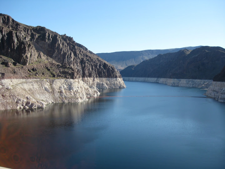
The water has a bit of a musty smell, and comes out crystal clear, poking out into the Rio Grande before it quickly mixes in with the river’s muddy main stem.

Albuquerque sewage outfall mixes with the Rio Grande

Albuquerque sewage outfall mixes with the Rio Grande, August 2010

By my back-of-the-envelop calculation, the treatment plant’s contribution this time of year is upwards of 10 percent of the river’s flow downstream from this point.

This has been on my mind because I’ve been following George Janczyn’s discussion of San Diego’s Indirect Potable Reuse project. It’s a test of cleaning up some of San Diego’s sewage and returning it to the water system. In arid lands, this seems to me like a no-brainer. Clean the water up and find a way to put it back into the system so it can be used again. In our case, the water is used by irrigators downstream of Albuquerque, ultimately ending up in Elephant Butte Reservoir and on to water users to the south.

Until recently, Albuquerque’s water came from pumped groundwater. In the long run, that has the effect of depleting the river, gallon for gallon, as water leaks out of the riparian system to fill the holes being created by our pumps’ great sucking. But in the shorter term, it has had the effect of a sort of water subsidy for the Rio Grande.

Here, the return flow issue makes for some complicated water policy discussions because of a common misunderstanding of what our net water supply really is. For every 100 gallons we withdraw from the system (from groundwater or the river), we’re putting 50 gallons back into the system where others can use it, so our net consumptive use is just 50 gallons. There are two types of efficiencies we can implement. One type would involve, for example, reducing outdoor watering. A gallon of outdoor watering is entirely consumptive, so saving that gallon by tearing up a piece of lawn saves a gallon of net consumptive use. That gallon never had a chance to get back to the river.

Saving a gallon by installing a low-water toilet is different. If it uses a gallon less per flush, that means one less gallon withdrawn from the system in the first place, as well as one less gallon returned to the river. The effect on our net consumptive use is effectively zero. There are good reasons to do the low-flow toilet anyway – energy consumption in pumping and treating the water, line losses, etc. But things like low-flow toilets and other indoor water efficiencies don’t save as much water, in terms of our overall water budget, as people often think.

If, on the other hand, you’re discharging the effluent from your sewage treatment plant into the ocean, as I understand San Diego does it (So I have this right, George?), then both indoor conservation and things like IPR are, as I said, no-brainers.

In addition to the water math, there were some positive externalities today as a result of our sewage plant return flow, in the form of a trio of lesser yellowlegs poking around in the mud.

River Beat: “We know that it’s being drained.”

My on-again, off-again infatuation with 1083.57, the elevation Lake Mead reached in March 1956, is back on. As Shaun McKinnon reports in this morning’s Arizona Republic, Mead’s at the lowest it’s been since then. The latest “24-month study” from the Bureau of Reclamation (pdf), out this week, is back to forecasting that we’ll drop below those 1956 levels this year, perhaps in October, meaning the Colorado River will be at it’s lowest since it was filled in the 1930s.

1083.57 is arbitrary, a nice bit of history that’s useful for storytelling purposes. But, as Shaun explained, there’s another marker just a bit lower, at 1075 feet above seal level, that is of real deal importance:

Lake Mead

Drought-stricken Lake Mead has dropped an additional 10 feet since last summer, and now, Arizona and other Colorado River users are scrambling to keep the reservoir full enough to avoid water rationing.

Before year’s end, the lake will likely sink to within 9 feet of the level that would trigger the first round of restrictions – and the first such restrictions ever on the river. They begin with a reduction in water deliveries to Nevada and Arizona, where farmers would be affected first. (emphasis added)

I still think it’s remarkable that we’ve just had the 11 driest consecutive years on the Colorado and no one has had their deliveries reduced. That suggests, as CAP’s David Modeer suggests in Shaun’s story, that the system is pretty robust.

Mead’s dropping numbers come as no surprise. Another dry year on the Colorado meant minimum releases from Lake Powell while users in the Lower Basin got their full allotments again this year. That means less water in Lake Mead. “We know that it’s being drained,” one of the region’s water managers told me recently.

The Most Water Efficient Way to Wash Your Car

Professional Car Washing and Detailing magazine recently excitedly reported the results of an investigation by News 8 in Austin, Texas, into water consumption associated with various ways of washing your car:

A self-serve carwash uses about 17 gallons of water (depending on the nozzle; an IBA wash, found at a gas station can use between 20 and 40 gallons; a full-serve wash can use up to 60 gallons; and a driveway washing can use over 100.

My staff conducted its own independent investigation, and concluded that not washing the Inkstain Honda Civic at all uses zero gallons.

River Beat: LaRue and the Question of How Much Water There Really Was

Between the USGS, the Bureau of Reclamation, the Library of Congress, Calisphere and others, there are so many great old Colorado River photos around that it’s easy to think the early history of the river’s development happened in black and white. I get lost in them.

Three guys working on a boat, Birdseye expedition, Colorado River, 1923. Courtesy USGS.

Three guys working on a boat, Birdseye expedition, Colorado River, 1923. Courtesy USGS.

Today’s treasure is a photo from the 1923 Birdseye expedition, a 1923 survey of the river between Lee’s Ferry and Diamond Creek, through the Grand Canyon. This came just after the completion of the Colorado River Compact, as they were trying to decide where to build the big dam. Most everyone thought the Boulder Canyon/Black Canyon reach was the best spot. But E.C. LaRue, one of the river’s great early hydrologists, thought Glen Canyon was a better place. A little biographical discussion I recently found (pdf) says LaRue thought the Boulder site would be a waste of money and water:

He considered the controversial Boulder Dam a waste of taxpayers money and a waste of river water primarily due to the expected evaporation from the large surface area of the resulting reservoir.

According to the USBR, about 600,000 acre feet per year of water evaporates from Lake Mead on average. That’s about 7 percent of the total average annual inflow.

LaRue also was one of the technical voices back then arguing that there was insufficient water in the Colorado River for all the uses eager developers were planning. Given our current situation, that shows some foresight on his part, though the discussion back then was primarily focused on the acreage of agriculture that could be irrigated. They weren’t really thinking Phoenix or Las Vegas as we now know them.

The USGS photo archive doesn’t identify the three men in the picture, but the metadata suggests it was taken by LaRue, who was reported to have done the photography on the Birdseye expedition.