River Beat: Another Place There Used To Be A Lake

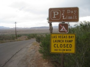
One of the guys at the Las Vegas Marina yesterday was sounding optimistic. Sure, the lake level’s low, he said, but they expect it to start rising soon. Plus, he said he heard they expect it to eventually come up another 60 feet. He shrugged as if to say, “Dunno, but that’s what I heard,” as if he didn’t quite believe it himself.

Colorado River: Supply and Demand

Colorado River: Supply and Demand

For the record, the latest Bureau of Reclamation projection has Mead dropping another 6 feet in the next year. We haven’t even started the winter snow season, so it’s too early to do anything other than shrug at the projection, but that’s what it says.

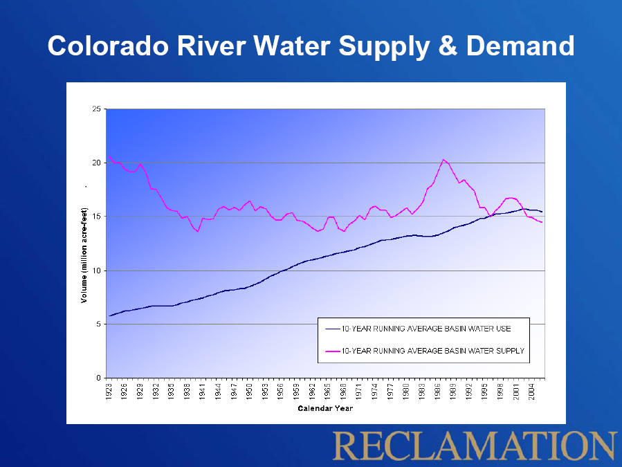
The reason, of course, is that for the last decade, demand for water on the Colorado River has exceeded supply. This is a telling graphic that’s been making the rounds this year as we all watched Lake Mead slip toward its current historic low. (Click the image for a bigger version.)

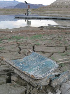
Another way of looking at the situation is out at the end of what used to be the boat ramp at Boulder Harbor, another of the former boating sites on the western edge of Lake Mead. I stopped by this afternoon on my continuing tour of places the lake used to be.

Boulder Harbor, Lake Mead, Oct. 18, 2010

Boulder Harbor, Lake Mead, Oct. 18, 2010

The boat ramp’s closed. What’s left of the harbor can’t be more than a few feet deep at this point. There were literally hundreds of coots poking around in the muck, and I watched an osprey fish (successfully). The strangest bird was a white domestic goose, who squawked loudly when I got too close, but couldn’t be bothered to actually flee. The coots did flee, but in a lackadaisical way that suggested they were not all that concerned that I would eat them.

The narrow inlet to the harbor is nearly dried up, and with a few more feet of lake level drop, Boulder Harbor will dry up completely.

If the guy I talked to yesterday at the marina is right, of course, Boulder Harbor will rise again, and the power boats will return. Sixty feet would be sweet indeed.

The Stilling Well

Down a long, dank corridor inside Hoover Dam that seems to be known as the “1211 tunnel” (things in the dam tend to be named after their elevation above sea level) and up a flight of stairs sits the top of the dam’s “stilling well”.

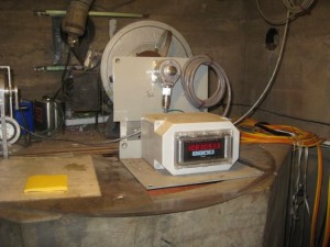
Hoover Dam stilling well, Oct 18, 2010

Hoover Dam stilling well, Oct 18, 2010

It’s essentially a long tube that runs to the bottom of the dam, a little less than three feet wide, with an inlet pipe near the bottom that allows lake water to enter and equalize the height of the water in the well with the lake height outside. It’s the place where Bureau of Reclamation workers measure the surface elevation of Lake Mead. You can see from the picture that it was at 1083.05 and change when I was there this morning (Mon. 10/18). This is the place where the dwindling of Lake Mead is turned into a crisp number.

It is a measurement freighted with meaning. The complex interlocking set of water management rules that govern the allocation of Colorado River water increasingly invoke the number spewed out by the device in the picture. If it gets too low, which it could within the next year (1075 is the magic number), a shortage will be declared and for the first time Colorado River users (Nevada and Arizona in particular) will have their allotments reduced.

If you’ve driven across Hoover Dam, you drove right over the top of it. It sits just beneath the roadway surface, right about the middle of the dam. At Lake Mead’s high point, on July 24, 1983, the water was just three feet below the top of the well. When I was there this morning, the water was 146 feet below the top of the well. As I think I have mentioned previously, that is the lowest the lake has been since they filled it in the 1930s.

Felicity Barringer had a great quote this morning from Barry Nelson at the NRDC:

This strikes me as such an amazing moment. It’s three-quarters of a century since they filled it. And at the three-quarter-century mark, the world has changed.

Teofilo is right when he points out that the milestone is “more symbolic than practical”. The lake looked pretty much the same to me today as it did yesterday, and not all that different from my last visit to Hoover Dam back in April.

But symbols are storytelling tools, and records (“the lowest in history”) are things people can relate to as we undertake the next steps in our conversation about western water.

(For more on the record, Bryan Walsh has a nice summary of the state of the lake and climate change implications.)

Drought, American Style

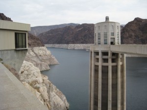
Hoover Dam, Oct. 17, 2010

Hoover Dam, Oct. 17, 2010

If you blow this picture up enough, you can probably see pixels of rock that have not been exposed since the 1930s. Or maybe not.

The surface elevation of Lake Mead hit 1083.18 feet above sea level today between 11 a.m. and noon Pacific time today, when this picture was taken. That is below the previous low – 1083.19 – on April 26, 1956. We can now unequivocally say that the drought of the ’00s and continued water consumption by downstream users has lowered the mighty reservoir to the lowest level it has seen since it was filled in the 1930s.

I tried this morning to explain to one of the tourists visiting Lake Mead the historic significance of the bathtub ring. He had jumped out of his car on an overlook on the Arizona side of Hoover Dam, and he was doing that thing where you hold your digital camera out at arms length to get yourself in the picture.

I told him it was a historic picture – that today Lake Mead had dropped to its lowest level since they built Hoover Dam in the 1930s. He looked puzzled.

Him: “Why’s it so low?”

Me: “Drought upstream. Water use downstream.”

Him: “It’ll fill up some day.”

And he jumped back in his car, headed for Vegas. This is how we do drought, American style.

Lake Mead, Oct. 17, 2010

Lake Mead, Oct. 17, 2010

I tried various explanations of what was going on this morning, from the quick to the complex, sort of testing my message as I wandered among the tourists visiting the dam, oblivious to the history I was trying to document.

It was hard to get across the drama. So far, the people suffering the most from Lake Mead’s decline seem to be the recreational boaters, who keep having to move their floating docks to chase the dropping water. I guess we can count that as a good thing. I mean, no one dies here in a drought, right?

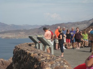
We are sufficiently buffered by affluence that almost no one I talked to today had any inkling of what was going on. Just another tourist Sunday on Hoover Dam. The best I got was from one the folks in this picture, who were on a Sunday drive at one of the Lake Mead overlooks. One of them, a Las Vegas resident, knew the lake was way low, and said the solution was simple – somebody needs to have the political courage to make them release more water from Lake Powell, upstream.

I decided against explaining the Colorado River Compact, and the complex reservoir equalization rules in the 2007 shortage sharing agreement, that upper basin states are using less than their share of the river anyway, that Powell is low too, that it’s not that easy. But ultimately, I guess that’s what I have to figure out how to explain.

Water in the desert, Kingman, Ariz., edition

KINGMAN, ARIZ. – I made a beeline across two states today, heading for Lake Mead to watch history happen.

It looks as though sometime tomorrow (Sun. 10/17) or Monday, depending on the weather and releases from Hoover Dam for power generation and downstream water users, the surface level of Lake Mead will drop below 1083.19 feet, its low point during drought of the 1950s. As I write this Saturday evening, it’s less than an inch away.

Kingman, Ariz., October 2010

Kingman, Ariz., October 2010

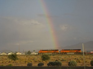
I made it as far as Kingman by sunset, and after checking into my motel grabbed some fast food and headed to a city park. By the time I got there it was pouring, so I hunkered down in the shelter of a utility building and watched. It had the feel of a summer thunderstorm even though it’s mid-October, with thrashing winds, thunder and lightning. It’s fall enough that the wind was blowing leaves off the trees, and my feet got wet and cold (I was wearing sandals.) But it was lovely nonetheless. There is a joy to being in the desert in a downpour. As I drove back to the motel, gutters were running full, and kids were splashing.

On the drive over, across northern Arizona, you could still see big patches of piñon pine that died in the drought of 2002-2003.

Tom Yulsman has an excellent post today on the what’s and why’s of  Lake Mead’s situation, to which I don’t have a lot to add. Well, OK, I have a lot to add, enough to write a book, but there will be time enough for that. For now, head over to Tom’s place for an explanation of our big dry, with the money quote from Brad Udall:

. . . what you’re really seeing here is a combination of drought and an overuse problem amongst the three three lower basin states of California, Nevada and Arizona. And that overuse problem historically has been covered up by a little extra water that flows down from Colorado and the upper basin states. But over the last 11 years, with the most serious drought on record, that water hasn’t been there, and so the overuse problem has become readily apparent.

It’s worth noting that the variables that will determine when we drop below that 1950s low are weather and downstream use – how much water nature provides and how we decide to use it. Drought in this sense is very much a human phenomenon.

The response to the convergence of those problems is the 2007 shortage sharing agreement among the lower basin states. It’s a remarkable thing, a set of guidelines to do something that has never been needed before in a century of industrialized development of the Colorado River – to use less water.

One of the reasons I’m heading to Hoover Dam, Lake Mead and Las Vegas is to learn more about how the shortage sharing agreement was developed, and how it will work in practice.  I’m increasingly dissatisfied with the “OMG we’re screwed” narrative. I’m trying to understand the institutional frameworks that have allowed us to go through the 11 driest years on record without anyone’s water being cut off, and to further understand what happens during year 12, which seems to have a good chance of happening in 2011.

In the time I’ve been writing this, Lake Mead dropped another 1/8th of an inch.

G.K. Gilbert Got It

I’m about to head off for a few days to watch Lake Mead drop, and for some reason thoughts turned this evening to G.K. Gilbert.

Tomorrow is “blog action day“, and the subject is “water”, a topic about which I’ve had a few things to say of late. I’m frankly not all that excited about blog action, having that peculiarly annoying “view from nowhere” mind set of a journalist. But really, that’s a copout. The whole point of “action” for me is to encourage better understanding of things I think are important, so here’s one.

Sometimes it’s wet. Sometimes it’s dry. Sometimes the “sometimes” in those sentences involves days or weeks or months, but sometimes it involves decades.

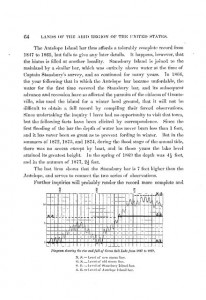
That’s the great insight of G.K. Gilbert, about whom I’ve written before. In the 1870s, he gathered records about when Mormons could get their sheep out the peninsula to Antelope Island in the Great Salt Lake (when the lake was low) and when they couldn’t (when the lake was high). The result was a record of decadal-scale climate variability – the droughts and pluvials that are a defining characteristic of life in the arid western United States. This is the best image I could find, sorry for the poor image quality, of Gilbert’s graph:

Climate Variability

Bill deBuys and the dilemma of water conservation

A friend just pointed me (thanks E!) to a provocative column by Bill deBuys last month published via High Country News last month on the loss of societal resiliency that accompanies water conservation efforts. DeBuys (author/editor of two of my favorite western water books – Salt Dreams and Seeing Things Whole: The Essential John Wesley Powell) calls water conservation “a hoax, or at best a waste of time.”

Part of his argument is a familiar one: Why should I conserve water at my just to enable all that sprawl development to continue on the fringe of my city? But he’s also making an argument more nuanced:

[W]ater conservation is good for the short-term economy because the water it frees up keeps the real estate industry, the building trades and much else going. But it doesn’t work out well for the resilience of our communities because it leads to “hardened demand.” That means that the water is needed all the time, no matter what.

This is the big irony of water management: In dry times, the practice of wasting water becomes our best friend. When water has been used wastefully, it is easy to deal with drought. Once everybody stops watering the lawn or washing the car, current demand drops like a stone.

But when everybody conserves all the time — putting in low-flow toilets, xeriscaping the yard and all that other good stuff in both the public and private sectors — the demand for water “hardens.” The uses that remain are essential; you can’t turn them off, and sometimes you can barely pare them back.

Conservation enables a community with fixed water resources to continue growing. But the more it grows on the strength of conservation, the more vulnerable it becomes to drought. Then when dry times inevitably come, there’s no flex in the system.

If you agree with deBuys’ argument, what’s the appropriate response?

It’s Albuquerque. We do balloons.

The Dark Lord

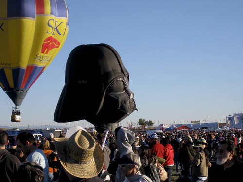
The Dark Lord, kinda laying on his side, Albuquerque NM, October 2010

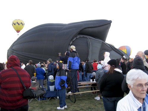
There’s something endearingly goofy about hot air balloons. Which is what makes the Dark Lord, sort of puffed up and laying on his side in at dawn in an Albuquerque park, so charmingly counter-intuitive.

It is the season of our city’s annual hot air ballon fiesta, nine days of a gobzillions (OK, hundreds, but literally many hundreds) of hot air balloons taking to the sky each morning at sunup. We don’t normally go out to the balloon fiesta field, what with the substantial crowd of people descending on it each morning to enjoy the spectacle. But our people in town, so we dragged ourselves out at alarm clock-thirty this morning and took the bus to see the show.

It’s really a hoot, and was worth the effort.

Dark Lord Takes Flight, L. Heineman, October 2010

Most of the balloons have the familiar teardrop shape, but a number of years ago, a tradition of increasingly elaborate “special shapes” balloons began making their appearance. Legend has it that the Carmen Miranda balloon was the first such special shape, complete with extravagant fruity headgear. Oh, it was so very fruity. Which is silly, which makes sense. Darth Vader? I’m sorry, but he’s just not silly. And yet seeing him inflate and soar off over the field this morning, a blast of propane filling his throat and a roar of approval from the crowd was, perhaps, meta-silly?

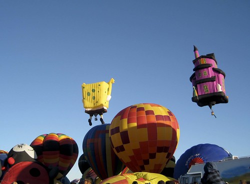
For silly, it really needs to be SpongeBob. He seemed right at home:

SpongeBob

SpongeBob, by L. Heineman, October 2010

River Beat: Will Utah Project be Scuttled?

Major water project development in the western US has always depended on federal subsidies. One can view those subsidies in a number of different ways – a boondoggle propping up rich ag interests, a foolish lack of clarity about what it really means to build a society in the arid lands, or a reasonable federal interest in supporting societal development that would otherwise not be possible west of the 100th meridian.

Whichever version of history one prefers, it seems increasingly clear that we are seeing the end of the era of federal subsidies. Yesterday’s story by Judy Fahys and Thomas Burr in the Salt Lake Tribune is a case in point:

The Wasatch Front has labored for decades to channel water from Utah’s eastern mountains to its thirsty and growing population, and Washington, D.C., has pumped more than $2 billion into building the Central Utah Project to support that goal.

Last week, project supporters said, word came that the Obama administration’s budget makers will not let a drop flow from next year’s funding spigot.

Budgets are where governments reify their goals and values. So this bears watching.

The Australian Model

I’ve written before about the possibility that we could view Australia’s struggles with long term drought, especially in the Murray-Darling Basin, as a model for how to deal with things here in the arid southwest. This version of the model is perhaps not quite so hopeful. From Australian Broadcasting:

A guide for water allocations in Australia’s beleaguered Murray-Darling Basin is due to be released tomorrow, and already irrigators are up in arms over reports that it might recommend cuts of up to 37 per cent.

Irrigators warn that cuts of this size could send whole communities to the wall in Australia’s most productive agricultural land.

But at the same time, environmentalists insist that despite the recent rain, the Murray-Darling is a still river in crisis and substantial reforms are necessary to ensure its long-term viability.

Is this, also, a preview of some of the issues we can expect in the Colorado River and Rio Grande basins in coming decades? It already sounds a bit like the wrangling in California’s Central Valley.