The problems in agriculture aren’t related to particular technology. They are related to what we, as a society, have valued. What we value (either in making law or making purchases) drives what farmers grow and thus why Monsanto is so successful.
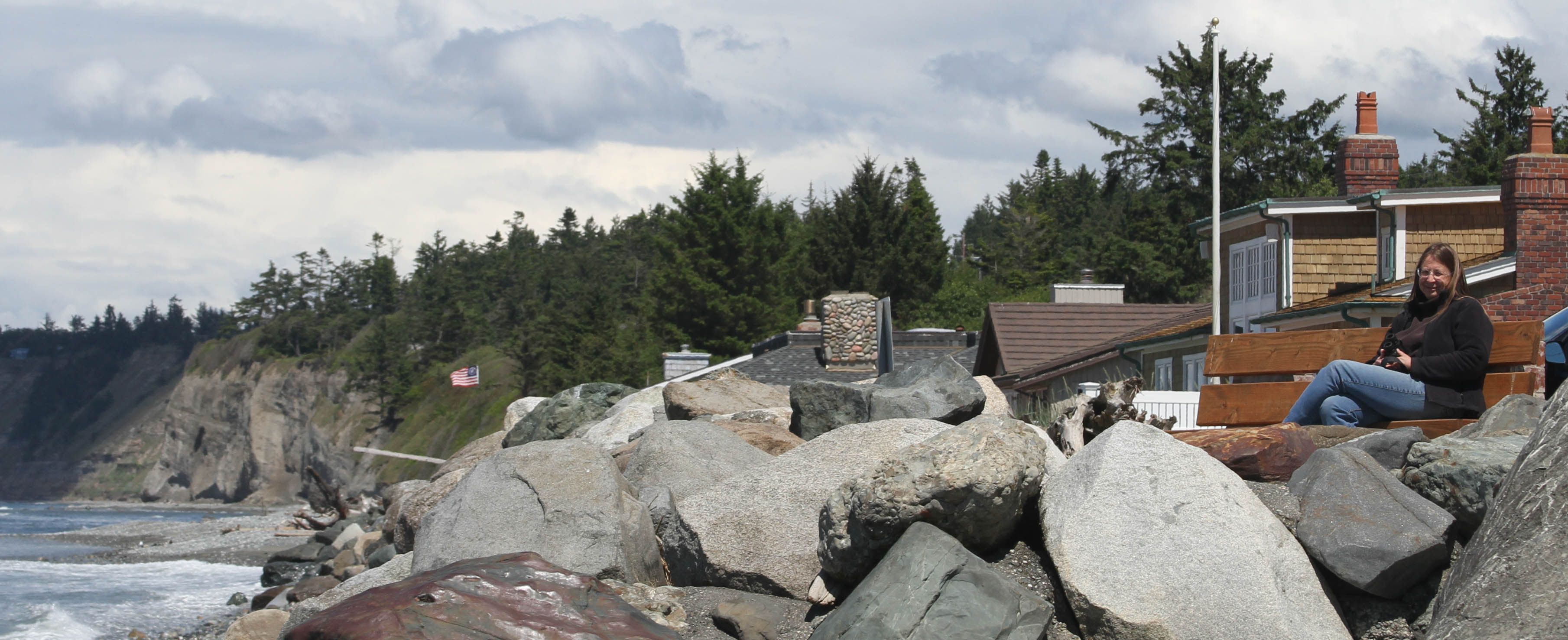
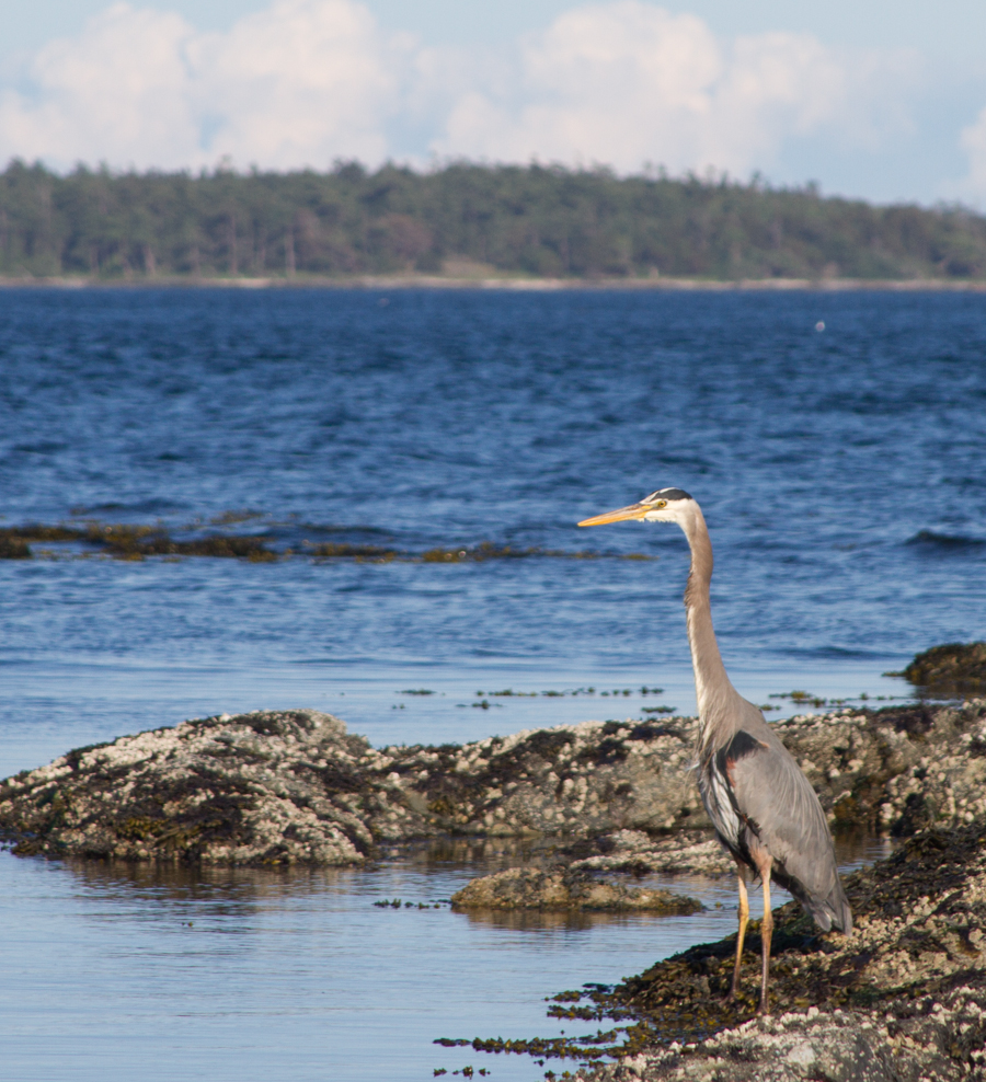
On vacation, we found and then refound this little pullout on the west side of Whidbey Island facing out to the Strait of Juan Fuca and the Pacific Ocean. It’s a little public parking area wedged between beach houses. When Lissa and I revisited Thursday, there were a couple of surfers desperate to try to catch the little swells blowing in from the strait. They weren’t having much luck, but I admired their persistance. You surf with the waves you’ve got.
Lissa at the beach, Whidbey Island, May 2013
Lissa grumbles about having her picture taken, but I keep trying, and I’m posting this one with her permission. She looks happy, which she is, and which is the point. On rambles like this I most write about the things I’m seeing, which is the way my mind works. I conceptualize my world by writing about it, experiencing through the telling of stories. I don’t much write about the personal stuff, which is OK. But hanging around with Lissa, a craft we’ve honed through nearly 30 years together, is really the best part. We have fun, which is why this picture looks right to me.
PORT ANGELES – The Elwha River is, as U.S. rivers go, a dinky thing. It rises in the Olympic Mountains, draining a basin of a bit more than 300 square miles and flowing north some 45 miles before dumping its cargo into Strait of Juan de Fuca just west of Port Angeles, Wash. By my standards, it’s a wet place. The Elwha Ranger Station, in Olympic National Park, averages 56 inches of rain a year.
The scale of the thing is completely different than the rivers I’m used to. The annual flow on the Elwha at McDonald Bridge, just upstream from Port Angeles, is greater than at Otowi on the Rio Grande in New Mexico.
Here’s a few seconds of video I shot yesterday afternoon of the Elwha’s outfall into the Strait of Juan de Fuca. At somewhere around 1,500 cubic feet per second, it was bigger than the current flow on the Rio Grande. But the weird thing was the color, a sort of ashen gray.
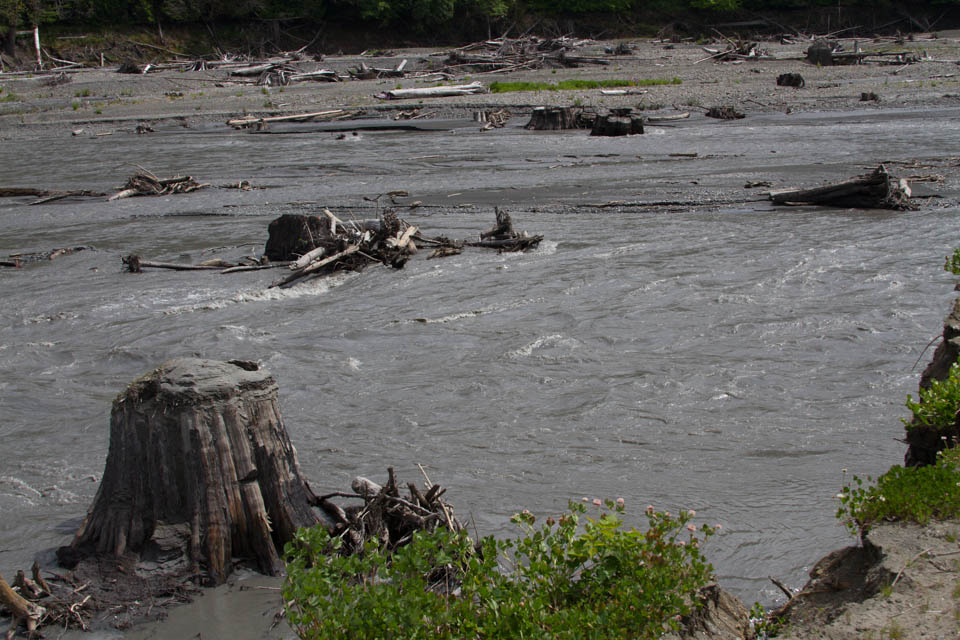
the former Lake Aldwell, Elwha River, by L. Heineman, May 2013
Over the last couple of years, an effort led by the National Park Service has been underway to remove a pair of dams on the Elwha built in the first part of the 20th century to generate hydro power for the region. The goal is to restore a salmon run in what folks seem to unequivocally describe as “the largest dam removal in the United States.” The first of the two dams is gone, and work is now underway on the second. But they’re running into hiccups.
Lynda Mapes, the Seattle Times reporter who has been documenting the process, explained in a piece last month the current difficulties. The problem, in a nutshell – downstream communities, especially Port Angeles and Nippon Paper Industries, a major employer, depend on Elwha water. With huge sediment loads expected following the removal of the dams, building a treatment plan to ensure continued flow of clean water was crucial to the project:
More than $162 million was spent on the Elwha water facilities, far more than on ecosystem restoration, at $27 million — including revegetating the former lake beds, fish rearing, restoration and monitoring combined. Dam removal, including taking down both dams, removing the power lines and decommissioning the lower plant, cost $35 million.
The water facilities seemed promising at the start, with the designer, URS Corporation of Denver, winning a prestigious national award from a national professional association. But somewhere between the lump crab and avocado salad at the black-tie awards gala last spring and the first slug of sediment served up by the Elwha as the rains began in the fall, something went wrong.
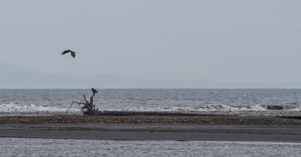
Eagles, Elwha delta, May 2013, by John Fleck
Nearly a century of sediment trapped behind the dam simply overwhelmed the best efforts of human engineering. And that’s primarily with just the first of the two dams gone. Removal of the second dam is underway, but according to Mapes only 18 percent of the anticipated sediment flow has come down the river so far. The rest is still trapped behind the second dam upstream.
What’s intriguing here is the difficulty in unwinding a complex human-nature system built up over the course of a century. Best laid plans, and all.
Upstream, Lissa and I walked down an old boat ramp into what would have been Lake Aldwell, past stumps that have been underwater for nearly a century, through a tangle of riparian growth that had in places already grown as tall as us. None of the formal revegetation work has begun yet. This stuff is happening on its own. As a friend once told me, “The life force is strong.”
Downstream, we watched bald eagles on a snag out on a newly formed sandbar, where the rush of sediment is building a rapidly expanding delta. It will be worth returning in a year, and two, and five, and ten, to see how this goes.
This post has been updated to correct the body of water into which the Elwha flows
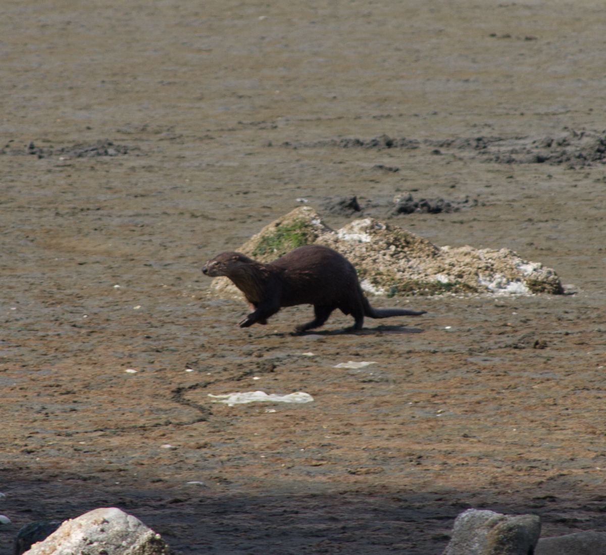
I was walking on the beach this afternoon when this critter poked his/her head out of the surf just offshore, looked around, then made a dash for the nearby woods. Need some lazyweb help – is it a sea otter?
update: Via Miriam Bobkoff, via Twitter – “More likely a river otter. His back feet similar in size to front, and he looks graceful on land…. We see them off Port Angeles shore, swimming in the Strait.” She links to this:
Sea otters rarely venture on land, where their movements are awkward and clumsy. In contrast, the agile river otter is frequently ashore. River otters maintain at least one permanent den on land, near the water, as well as several temporary shelters. While all otters consume fish and other aquatic animals, river otters also forage for food along the shore, and they prefer to eat on land rather than in the water.
What’s this critter? Victoria, BC, May 2013, by John Fleck
Three of the five restaurants in which we have eaten during our brief visit have had hockey on the television. This includes breakfast this morning at Denny’s.
The Kwik-E-Mart where we stopped to procure snacks had Hershey’s chocolate Stanley Cups for sale. Also, hockey on the television.
The tendrils of empire extended to the park on Saturday, where a cricket match was underway.
An urban seashore (Victoria and suburbs) strung out with public parks between the homes of the rich. Nearly all the public parks had clean toilet facilities, and on a sunny Sunday afternoon we never had difficulty finding a parking place.
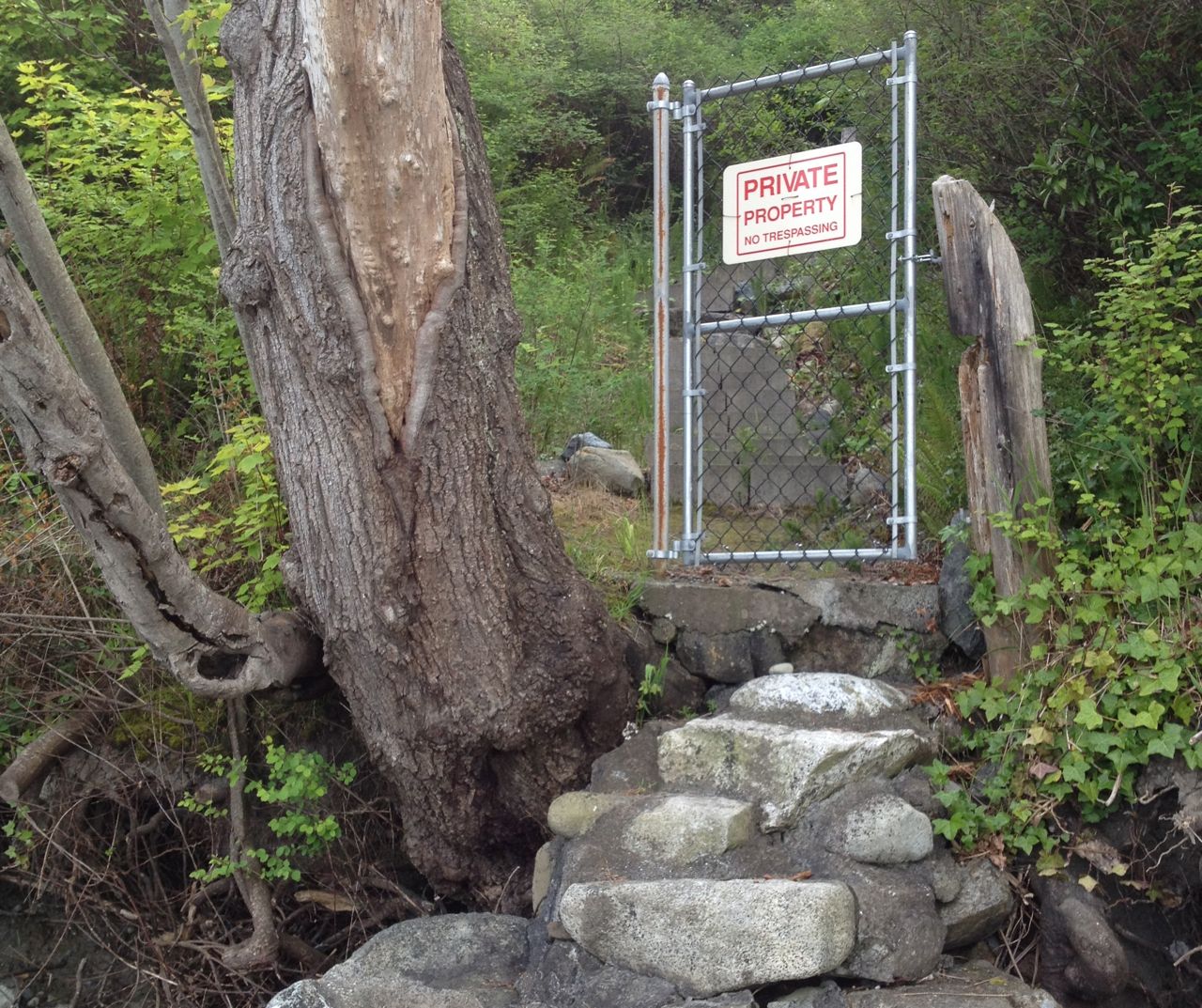
I realize it is a cliché (and a risk of nationalistic stereotyping) to comment on Canadian politeness, but it is a reasonable explanation for this, which I thought of as a “conceptual gate”:
conceptual gate guarding steps from a Vancouver Island beach to a private home. by John Fleck, May 2013
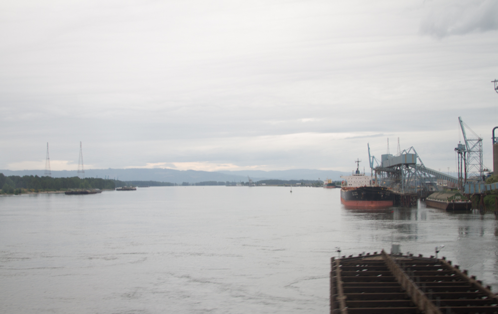
My particular view of the water world is constrained by scarcity. We don’t move a lot of cargo on the Rio Grande or the Colorado, the two rivers in my immediate field of view.
I forget, and our current trip to the Pacific Northwest has reminded me, of the magic of water in service of the movement of people and goods. Rivers and oceans provide smooth, low-friction roadways to move large quantities of stuff. (Steve Solomon’s Water: The Epic Struggle for Wealth, Power, and Civilization does a nice job of laying out the big picture here.)
This photograph is either the Willamette or the Columbia, taken by Lissa from the Amtrak as we crossed both in quick succession. In 2012, the Port of Portland shipped 4 million tons of wheat. (source: pdf) That’s enough for more than a pound of wheat for every human on the planet. In some small ways, as a young man I helped farmers out in eastern Washington to grow wheat. It most likely was shipped down the Columbia River, ending up at terminals at the Port of Portland, where the Willamette and Columbia meet upstream of the Pacific Ocean.