A century ago in Colorado River compact negotiations: Where to draw the line?

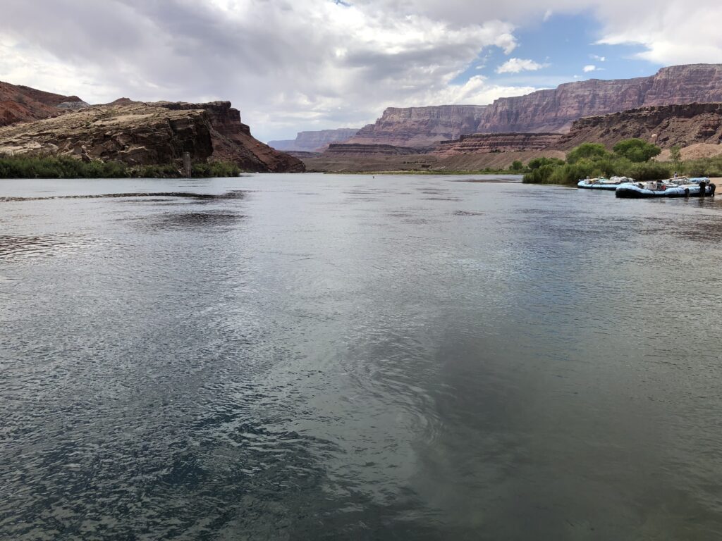
Lee’s Ferry. Photo by John Fleck

By Eric Kuhn and John Fleck

As the Colorado River Compact Commission’s negotiators returned to their task on the morning of Nov. 13, 1922, the shape of the compact was beginning to emerge into view.

Colorado Compact Commission Chairman Herbert Hoover opened the meeting by returning to the unresolved question from the previous evening –  “whether we could accept a general principle of a division between the upper and lower states of the primary basis of compact?”

Arizona’s Winfield Norviel responded in the affirmative: “We in Arizona are perfectly willing to accept in principle the division of the basin into two divisions.” He went on to make it very clear that in accepting a two-basin compact, Arizona was not accepting a “fifty-fifty partition of the waters,”  adding that “I think the fifty-fifty proposition is infeasible and impossible as a matter of exactitude.”

Where to draw the line between an “upper” and “lower” basin

The discussion then turned to the point of division and the status of the Paria River. Carpenter explained that in his compact proposal, he had assumed the division would be the “old Lee’s Ferry.” Norviel the pointed out that Lee’s Ferry is just upstream of the confluence with the Paria and because of the steep canyon terrain, there were no practical gaging locations below the confluence. After a bit more discussion about gaging, Utah’s Caldwell concluded that from his perspective, the Paria River was an upper division tributary and that there was no problem with using two gages, one on the main Colorado River and a separate gage on the Paria (the situation we still have today). Hoover summarized the consensus as follows; the dividing point between the basins would be the proximate location of Lee’s Ferry, but include the Paria River, and the details would be left to a drafting committee.

But how much water should pass the chosen point?

Hoover then turned the Commission’s attention to the question of the upper river’s delivery at Lee’s Ferry. (Note that, at this point in the negotiations, the terms “Upper Basin” and “Lower Basin” were not being routinely used.  They used several similar terms interchangeably – upper and lower divisions, upper and lower territories, and upper and lower river or states.)

Hoover put it this way – “the question is whether there be a positive delivery every year, or whether there should be only a delivery of a total over ten years or over three years or over five years or any other period.”

The discussion that followed was largely a two-way dialogue between Norviel and Carpenter, interrupted occasionally by Hoover to summarize or refocus the discussion, and by Arthur Powell Davis and R.E. Caldwell to add or clarify technical points. Carpenter detailed why he picked ten years.  He thought it was the “sweet spot” – neither too short to be a problem for the upper river nor too long to be a problem for the lower river.

Carpenter explained that Norviel’s concern that a ten-year average would allow the upper river to deliver nothing for a year or more was not realistic and that development in the upper river would naturally flatten the hydrograph, a point the engineers in the room generally agreed with. Arizona’s Norviel remained skeptical, never agreeing to any period greater than three years The combination of a ten-year flow plus an annual minimum remained an attractive option for the others, especially Nevada’s James Scrugham and Wyoming’s Frank C. Emerson. Carpenter agreed in concept but opposed a suggestion the minimum be set at five million acre-feet per year.

Hoover recessed the meeting, suggesting they take a long lunch, noting it was hard to sit for two-and one-half hours. The Commission adjourned until 3 PM.

That “crackpot” Maxwell

The Commission reconvened at 3 PM. The meeting began with Secretary Stetson submitting a long letter to the record from George H. Maxwell, Executive Director of the National Reclamation Association (now the National Water Resources Association). Maxwell demanded that they delay negotiating a compact and instead turn their attention to the construction of flood control storage facilities to protect the Yuma and Imperial Valley projects. Maxwell, whom Hoover considered a “crackpot,” was one of the people he wanted to keep out of the negotiations. The Commission had adopted a policy of voting on who could join their meetings as advisors. After accepting the Maxwell letter for the record, they voted to admit L. Ward Bannister, a water attorney from Denver, as an advisor to Carpenter.

During the remainder of the afternoon, the Commission exchanged views on several topics, including the term of the compact, the status of the Gila River, and the concept of a minimum annual flow at Lee’s Ferry. Carpenter stressed his view that any minimum flow should be tied to drought in the upper river and “should result in the penalty of drought being equally distributed over the entire river system.” The meeting adjourned at 6 PM to be resumed on Tuesday morning at 10 AM.

A century ago in Colorado River Compact Negotiations: Turning to Murky Details

Delphus Carpenter. Picture courtesy Colorado State University library

By Eric Kuhn and John Fleck

As the Colorado River Compact Commission negotiators returned to their discussions for a short 8 p.m. Sunday evening meeting Nov. 12, 1922, they began trying to dive into the details of how to divide up the great river.

In trying to make the broad concept of dividing the river between a newly proposed “Upper Basin” and “Lower Basin”, they found devils in the details:

  • Where should the measurement be taken that formed the basis for the split?
  • How would a division cope with the inherent variability in the river’s annual flow?
  • Would an “Upper Basin” reservoir be needed in addition to the one being contemplated in Boulder Canyon?

Carving the Colorado River Basin in two

After Saturday’s long meeting where they heard various proposals for a compact, Sunday’s gathering was short.  The focus immediately turned to the Delph Carpenter’s two-basin proposal and most of the questions came from Arizona’s Winfield Norviel. Norviel first asked the basis for Carpenter’s proposed 50/50 split based on the river’s flow at Yuma. Carpenter, while acknowledging that it was somewhat arbitrary, said he chose Yuma to make sure the tributaries below Lee’s Ferry were included in the division and that that an equal division of the use of the river was an “equitable” division. He noted that he used the Yuma gage flows to determine how much water the upper river would have to deliver at Lee’s Ferry to achieve a 50/50 division.

How much water must pass from “upper” to “lower”?

Norviel then turned his attention to Carpenter’s proposed 62.64 million acre-feet every ten years delivery at Lee’s Ferry. He voiced concerns that the ten-year provision would not provide the lower river enough certainty – noting that the upper division would have complete control over how much water was delivered in any one year. Carpenter responded that if Norviel was concerned that they could deliver no water for seven straight years then delivering it all in three straight years, such a delivery was ‘not in the range of my thought.” Carpenter went on to note that a reservoir at (or just above) Lee’s Ferry would naturally be a “stabilizing influence for the lower territory,” but such a reservoir “would essentially be a lower division reservoir.”  At this point Nevada’s James Scrugham suggested “wouldn’t the possible objection be solved by including with the amount, a minimum flow in second feet?” Carpenter responded that he would have no objection “if you made it low enough.”

A future obligation to Mexico?

Concerning the proposal that each division deliver an equal 50% share of any future treaty delivery to Mexico, Norviel asks “is any estimate to be made of the loss by evaporation or percolation between Lee’s Ferry and the point of diversion to Mexico?”  Carpenter responded no – “it was thought that the power benefits and other benefits that would run to the lower country would offset the loss.”

The discussion of losses prompted Herbert Hoover, the Commerce Secretary and Commission chairman, to ask Carpenter if his plan “conceives a sort of fifty-fifty division of the river as it was before white man began to divert it?”  Carpenter, perhaps confused by the question, responded “it would probably result in that conclusion.”

Sorting out the numbers

Reclamation’s Arthur Powell Davis then took the opportunity to provide the commissioners with his Reclamation Service’s data on existing irrigation above Lee’s Ferry and in the Gila River drainage. According to Davis, about 1.53 million acres were being irrigated in the upper river and over 400,000 acres in the Gila, including the Salt River Project. Davis went on to conclude that at an average of 1.54 acre-feet of consumptive use, the total use above Lee’s Ferry was about 2.35 million acre-feet annually. He had no similar total for the Gila but noted that the average consumptive use per acre on the Gila was much higher than in the upper river.

Davis went on to point out that Carpenter’s estimate of 14% for the lower tributaries was too high because it included rivers that Davis thought would be in Carpenter’s upper division such as the Escalante, the Dirty Devil, and the Paria Rivers. He suggested Carpenter use 11%. Perhaps Davis was hoping that Carpenter would adjust then adjust his proposed ten-year delivery (the adjusted number would have been 67.86 million), but Carpenter remained silent.

Two-basin approach left unsettled

At the end of the meeting, Hoover asked for a vote on the concept of apportioning water between two basins. Six of the seven, all but Norviel, agreed to proceed with that approach.  Norviel said that he wanted to take more time to think about it. They adjourned until tomorrow morning at 10 AM.

A century ago in Colorado River Compact negotiations: seeds of a deal planted, but which will grow?

By Eric Kuhn and John Fleck

In the leadup to the final compact negotiations, the weather in Santa Fe had been dry. Santa Fe New Mexican, Nov. 11, 1922

With the arrival of all of the commissioners and their key advisors, the Commission got back together on Saturday morning. The purpose of this meeting had been agreed to back in early April. Each commissioner would be given the opportunity to suggest the form of a compact. Nevada’s James Scrugham suggested they go by state alphabetical order.

What followed represents a remarkable turning point in the history of the Colorado River Basin, with echoes still reverberating today.

How should the water be divided?

How should the basin be governed going forward?

How much water did they actually have to work with?

The seven states, in alphabetical order

Arizona’s Winfield Norviel went first. Norviel suggested a compact based on the application of prior appropriation on a basin-wide basis – for a limited, but unspecified period. He suggested existing rights would not be impacted, shortages should be shared on an equitable basis, and that exports out of the basin would be prohibited except for a specified amount for Colorado and Utah. Importantly Norviel suggested a three-member commission appointed by the president that would investigate disputes and determine if water was being wasted for non-economic purposes. This echoed a proposal Norviel had made at the commission’s first meeting back in January.

California’s McClure passed but suggested one of his associates might make a proposal later. It was then the turn of Delph Carpenter, Colorado’s representative.

The two-basin solution

Carpenter proposed that the beneficial consumptive use of the river be split between two basins – the moment when this monumental foundation of the river’s management, which had been first proposed by Reclamation’s Arthur Powell Davis, began to move from vague idea to concrete plan.

Carpenter referred to them as the Upper and Lower Regions, with the dividing line at Lee’s Ferry, Arizona. He proposed the split be based on the average annual flow of 17.4 million acre-feet per year from gage record at Yuma, Arizona, which is below the confluence of the Gila and Colorado Rivers. Using this gage record would give each basin 8.7 million acre-feet per year. Carpenter believed that 14% of the river’s total flow, or 2.436 million, came from tributaries below Lee’s Ferry, therefore the upper states would have to provide 62.64 million acre-feet every ten years at Lee Ferry (8.7- 2.436=6.264). Under Carpenter’s compact, each division (basin) would be responsible for 50% of a future treaty delivery obligation to Mexico. He proposed that power generation uses would be subservient to domestic and irrigation uses. Fundamental to his approach was that after a compact dividing the water between two regions was signed, the individual states in each region would get together and divide each region’s water among themselves.

Utah’s R.E Caldwell then presented his proposed compact. It was like Carpenter’s. It would divide the river into two basins at Lee’s Ferry. Prior Appropriation would generally control the river, except the Lower’ Basin’s “senior” rights at Lee’s Ferry would be limited to six million acre-feet per year (the ten-year obligation would be 60 million acre-feet, almost the same as Carpenter). Caldwell also suggested that the Upper Basin would need a reservoir of six million acre-feet above Lee’s Ferry to make his compact work.

After Caldwell presented his suggestion, Wyoming’s Emerson, Nevada’s Scrugham, and New Mexico’s Steven Davis weighed in. Scrugham indicated that he would be OK with a compact between two basins. Emerson was on the fence; he could live with either option. Davis, however, still preferred the Commission apportion water among the seven states.

California’s McClure then asked the Commission to listen to a suggestion made by advisor George Hoodenpyl, a water attorney from Long Beach, California. He suggested a compact based on dividing the use of the waters 50/50 at Lee’s Ferry, all present uses would be protected, and each basin would cede control of future development to the federal government. After clarifying that his suggestion was his and not California’s, he went on to explain that he believed the federal government was the one entity that could make decisions for the good of the region as a whole.

The commissioners then had a general discussion of what they had heard. Norviel and Carpenter dominated the discussion. Norviel believed that a 50/50 split at Lee’s Ferry would not provide enough water for the lower river. Carpenter indicated that he was now totally convinced a compact dividing water among seven states would be unworkable. He also indicated his strong opposition to the formation of a “super-agency.”

Locking in a fateful mistake – Reclamation’s overestimate of the river’s flow

Toward the end of the meeting, Reclamation’s Davis reviewed his agency’s data on water flows and water use in the basin. His main source was the Fall-Davis Report, which had been published in February. Davis told the commission that his estimate of the water available at Lee’s Ferry was 16.5 million acre-feet per year – crucially ignoring the work of the US Geological Survey’s E.C. LaRue, who (as we wrote in our book Science Be Dammed) since 1916 had been trying to warn the West’s leaders that the gage record was insufficient, ignoring known droughts in the 1800s.

LaRue had offered his services to Hoover, to attend and contribute to the Compact’s development. In a fateful decision that echoes through Colorado River history, LaRue’s offer was ignored.

Davis indicated that the losses between Lee’s Ferry and Laguna Dam were a little bit more than the inflows. The estimated flow at Laguna Dam was 16.4 million acre-feet per year, based on the Fall-Davis report. He estimated that present and future uses in the Upper Basin would total about 6.5 million acre-feet annually. In the Lower Basin, it was about 7.2-7.4 million acre-feet.

As the Commissioners ended their marathon meeting, they were still split over whether they should proceed with a two-basin or seven-state split. They decided to adjourn until 8 PM on Sunday evening.


.


A century ago in the Colorado River Compact: Converging on Santa Fe

By Eric Kuhn and John Fleck


Santa Fe New Mexican

Santa Fe, New Mexico, was off the beaten path in November 1922. That was the point.

After a logjam and a seven-month break, the Colorado River Commission finally reconvened in Santa Fe, New Mexico at the Bishops Lodge on Nov. 9, 1922, to try to find common ground for a seven-state compact to divide the waters of the Colorado River.

The Commission’s chairman, Commerce Secretary Herbert Hoover, chose to meet there because he wanted a secluded location where the commissioners and their advisors could roll up their sleeves and hammer out a compact.

The enthusiasm for a deal, and the optimism for what might follow, was palpable as leaders across the West descended on New Mexico. The obstacles were great, both technical and institutional, New Mexico’s Alamogordo Daily News reported in the days leading up to the gathering.

That all of the obstacles will be surmounted goes without saying, and doubtless in an incredible short time and during the lives of the most of the people now living a net work  (sic) of lines and irrigation ditches will run out from the Colorado river that will give rise to new industries and create thousands of acres of new areas that will support large populations.

The lodge is a few miles north of the city over what was then a very rough road. Time was short. The 1921 law authorizing the negotiations only gave the Compact Commission a year to finish its task. Only 53 days remained and as far as Hoover could tell, the commission was nowhere near an agreement.

The 10th meeting did not get off to a smooth start. First, the commissioners from California, Nevada, and Wyoming had travel problems. All seven state commissioners would not get to Santa Fe until late on Friday. Next, Hoover had a second goal in picking the smallish Bishops Lodge. He wanted to limit the size and attendance at the meeting.  In his view, the negotiations had too many camp followers, especially from California. Hearing that the lodge had booked as many as four to a room, he ordered Clarence Stetson, his aid and commission secretary, to direct the manager to reduce the guest list, limiting those staying at the lodge to two to a room. Although it upset those that were kicked out of the lodge, only a few departed Santa Fe. Instead, most decided to make the daily trek over the rough road and to Hoover’s annoyance, the state commissioners, especially California’s McClure, were reluctant to tell their state colleagues they were not welcome.

Hoover’s scheme to sequester the negotiations kept the press at bay. “The Associated Press dispatches from the conference have been meagre,” the Nevada State Journal reported as the proceedings rolled forward.

Without all the commissioners present, there was little of substance that could be accomplished pm the first day. The five commissioners decided to limit the attendance at executive sessions to the commissioners plus one legal and engineering advisor for each and any governor that might be in attendance. They then adjourned.

While the commission may not have met in seven months, they had kept in communications with each other and Stetson. Colorado’s Delph Carpenter, in many ways the Compact’s most important parent, had been especially active. He was still reeling from his state’s Supreme Court loss in the Laramie River case where the court decision applied the Doctrine of Prior Appropriation on an interstate basin. That loss in his view left the upper river states fully exposed to the big projects California already had in place or was actively planning. He and Utah’s Caldwell both had already decided they would give up on their insistence that Lower Basin projects never interfere with future water use on the upper river. Both had a new idea to share with their fellow commissioners based on dividing the use of the river’s waters between two basins and leave the dividing the water among the states to each basin.

Now they just needed to wait until everyone arrived.

a Colorado River hypothetical and an attention-getting cuss word

Lake Mead, October 2022. Photo by John Fleck

Colorado River political and policy discourse is tangled right now around an increasingly unhelpful set of questions. They involve process: Should the federal government step in and impose cuts? Should the Lower Basin states, especially Arizona and California, do more to save themselves? Should we pay farmers to fallow? How much? Should the Upper Basin contribute more cuts? What about environmental flows – will the cuts we need to make endanger our ESA coverage under the MSCP?

What about my water?

These are all worthy questions, but our entanglement with them avoids the largest and most important question: In a future with less water, what will this engineered hydraulic landscape of irrigated farms and cities look like? What do we want it to look like?

That was the point of my attention-getting quote to Grist’s Jake Bittle:

“Whether those cuts are imposed by a federal government action, or voluntary action by the states, or the fact that the reservoirs are fucking empty, they will happen,” (Fleck) told Grist.

If you’re in Las Vegas or Phoenix or Los Angeles or San Diego (or Albuquerque!), the details of which path we’re on matter, but the larger question is unchanged. You’ll have to learn to live with less Colorado River water, and you’ll succeed at that. Your city will be less green, but you’ll have enough for cooking and cleaning and brewing your morning coffee.

If you’re in Yuma or Imperial or Palo Verde, the details of which path we’re on matter, but the larger question is unchanged. We’ll still get all the yummy melons and lettuce we love (and are willing to pay for), and there will be a lot less alfalfa grown in the deserts of the Lower Colorado River.

I’ve got a far longer blog post brewing on the hard drive, as I begin to work through the details of what a “Colorado River system crash” might look like, which is the seed for the project occupying my thinking right now. We need some sense of what the alternative is to the process the Department of the Interior has launched, the process that triggered Jake Bittle’s call and my flamboyant quote, the attempt to get things back on the rails and create an orderly approach to envisioning our desired future and acting on it.

I may never post it.

“Reservoirs fucking empty” is bait to folks’ limbic systems. It wasn’t a slip. I chose my words with care. But “fight or flight” may not be what we need right now. We need to understand that we can do this – that the key to our future is not winning a fight with Arizona/California/the Feds/the Upper Basin/the farmers/the cities over who gets what’s left, but rather envisioning a future in which we all figure out how to survive and even thrive with less water.

Dr. Swamp Cooler

Being a professional writer carried with it, for me, a bundle of contradictions – the arrogance of the act (I have something to say that’s so worthwhile that you should spend your time and your money to read it!) crossed with the insecurity, the fear (Do I really have something to say that’s worth their time and money?).

Doing it at a daily newspaper, as I did for most of my adult life, involved living those contradictions day in and day out. Today’s paper, written yesterday, was already on their driveways and I had to embrace the tension all over again – do I have something new to say today?

Absent the swagger, it was impossible to enter the arena. Absent the insecurity, the fear of looking stupid, it was impossible to do it well once I got there.

When I arrived at the Albuquerque Journal in 1990, the columnist Jim Belshaw – then Jim Arnholz – was already a community institution. I was a scared shitless young beat reporter, but also cocky. I wrote my news stories and privately fantasized about someday having his columnist job – write about anything you want today! – while being simultaneously terrified at the prospect of finding something to say.

Working adjacent to him for two decades, the steady transition from awe to a complicated friendship rooted in the shared craft, was a thing. Jim, a respected elder (gawd he would have hated me saying that! and also laughed) modeled for me, the contradiction – talented, revered in the community, and always deeply insecure.

Here is Liz Staley, once copy editor, then Belshaw’s wife:

“Once his columns were in the paper, he refused to be in the same room while I read them,” she said. “But, if he heard me laugh, he’d have to know what I was enjoying.”

A mentor as I looked on? I suppose, yes, that word might work.

When Belshaw retired in 2009, I slipped into one corner of the Journal columnist world that had been his. In that role, I fantasized about reprising Jim’s “Dr. Swamp Cooler” persona, a self-deprecating schtick about the Albuquerque ritual of climbing on the roof each spring to set up the swamp cooler, and each fall to shut it down.

I never had the guts to do the column.

If I had it to do today, it would be a self-deprecating column about how, in my senescence, I now hire someone to do the swamp cooler for me. And I only wander into the writing arena now and then – still arrogant (though now I just ask for your time, not your money) and still terrified.

You can probably see where this is heading. Jim died over the weekend.

Sorry, Jim, for burying the lede.

Accounting for Colorado River evaporation

Helpful piece by Luke Runyon on steps toward accounting for Lower Colorado River evaporation and riparian system losses.

During a September Colorado River symposium held in Santa Fe, both Interior Department Secretary Deb Haaland and Bureau of Reclamation Commissioner Camille Calimlim Touton told attendees that the issue of evaporation and transit loss in the Lower Colorado River Basin were short-term priorities for their respective agencies.

Key bit – timing:

They are giving states until the end of 2024 to prepare for what would amount to a significant cut in annual water allocations to users in Nevada, California and Arizona.

I have my talking points:

“It would be a huge change in how water is administered in the lower Colorado River,” Fleck said. “The states, especially California and Arizona, had come to depend on really big allotments that were only possible because we ignored the laws of physics and didn’t account for evaporation and system losses….”

“The underlying problem is that the water users in the Lower Basin have refused to step forward and save themselves by coming up with a plan to reduce their own use,” he said. “So we look for some tool that the federal government could use to force them to save themselves. And accounting for evaporation and system losses has always been hanging out there because it’s just nuts that we don’t do this.”

The Colorado River at the end of water year 2022: a status report

I don’t see how this ends well.

Most of the major players – the ones that matter, anyway, by which I mean Arizona, California, and the federal government – appear boxed in by constraints they can’t seem to overcome, while the water in the Colorado River’s big reservoirs is circling the drains.

Arizona’s giving up a lot of water right now, and it’s hard to see how they solve their in-state politics and give up more without California coming up with substantial cuts of its own. Meanwhile California’s internal politics have so far constrained it from coming up with meaningful contributions. This may change soon, but the numbers being discussed may not be enough to move the needle as far as it needs to move. And the federal government seems torn between tough immediate actions and placing responsibility on the states to come up with a plan to save themselves.

Last week’s Water Education Foundation Colorado River symposium in Santa Fe was striking.

It’s an invitation-only event, and I’m not sure what the ground rules are, so I’ll treat it as a sort of “Chatham House Rules” thing.

I will say this. I moderated a panel. Harsh words were exchanged. I was kind of an asshole as I tried to get people to say the quiet parts out loud. But right now, we need to be saying the quiet parts out loud, because the water is circling the drains.

the status of the reservoirs

Boulder Harbor, Lake Mead, Oct. 18, 2010

obligatory cracked mud photo (Mead is, like, 40 feet lower right now than when I took this)

Lake Mead will end water year 2022 next Friday with a surface elevation ~1,044 feet above sea level, down 1.8 million acre feet from a year ago.

Lake Powell will end the year at somewhere around elevation ~3,529, down 1.5 million acre feet from a year ago.

Flaming Gorge Reservoir, which must now be in the end-of-water-year mix because of the way Reclamation and the states have begun moving water around like pawns on the Upper Basin chess board, will end the year at elevation 6,013, down 300,000 acre feet from last year.

Absent action by water users to use less, next year’s not-all-that-farfetched possibilities (by which I mean the Bureau of Reclamation’s latest “minimum probable” forecast) has Powell dropping below minimum power by the end of 2023 – and staying there. Absent downstream action by water users to use less water, Mead drops to 1,016 by the of water year 2023.

If the federal government holds water back in Powell to prevent the need to use the dam’s bypass tubes, that drops Mead even farther.

For those not steeped in the numbers, this is cracked-mud, five-alarm fire bad.

2022 Water Use

Use Allocation percent
California 4.445 4.4 101%
Arizona 2.056 2.8 73%
Nevada 0.236 0.3 79%
Mexico 1.45 1.5 97%

Source: USBR, Lower Colorado River Basin water use forecast, retrieved 9/25/2022

Californians are touchy about these numbers, specifically the observation that they’re taking more than their full allocation this year, even as the reservoirs are tanking. They point out that in recent years they have used significantly less than their allocated 4.4 million acre feet, banking unused water in Lake Mead as a hedge against drought. Which they’re suffering now, massively. Which is true, and fair to point out.

So, for completeness sake, here are the three Lower Basin states’ annual take on Lake Mead going back a decade.

Arizona California Nevada
2013 2,778,867 4,475,789 223,563
2014 2,774,661 4,620,756 224,616
2015 2,604,732 4,493,918 222,729
2016 2,612,833 4,381,101 238,326
2017 2,509,503 4,026,515 243,425
2018 2,632,260 4,265,525 244,103
2019 2,491,707 3,840,686 233,996
2020 2,470,776 4,059,911 255,568
2021 2,425,736 4,404,727 242,168
2022 2,056,118 4,445,255 235,851
average 2,535,719 4,301,418 236,435
percent of total allocation 90.6% 97.8% 78.8%

Source: USBR decree accounting reports

I point this out as a native Californian, and with love for my California friends. The laws and policies we have developed allow – even encourage! – this. The doctrine of prior appropriation was designed to remove water from our rivers for “beneficial use”, emptying them in the process. California played a masterful game over the 20th century to ensure the priority of its water rights and the federal largesse needed to put the water to use.

But understand, please, why everyone else in the basin is glaring at you: you have a larger allocation than everyone else, and you’ve been reducing your use less than everyone else. The law gives your water use priority over others in the basin, but that doesn’t make it feel any fairer to the rest of us as everyone is being asked to cut back to save the shrinking river on which we all depend.

Boxed in

So where do we go now?

Despite the failure of the basin states to come up with a plan to reduce water use in 2023, and the unwillingness or inability of the federal government to impose one, the mass balance problem has not changed. The “protection volumes” – the amount of cutbacks needed next year and every year thereafter for the foreseeable future – are still huge. If the 2023 water year is similar to the last three, water users need to cut 2 million acre feet just to hold the reservoirs where they are and protect Lake Mead and Lake Powell from dropping to critically low elevations, according to the Bureau of Reclamation’s modeling.

Never mind about refilling.

According to a piece by Jake Bittle at Grist, California is working on a deal among the water users that would cut something – it’s not entirely clear what, Bittle references a range of 350,000 to 500,000 acre feet. This is super interesting in part because of the context – this is California going it alone. Yay for voluntary cuts! But it’s hard to see how the largest user on the system agreeing to cuts of that size gets us anywhere close to 2 million acre feet. But given the water politics within California, it’s also hard to see how California cuts more, at least voluntarily. Imperial Irrigation District is rightly demanding action on the Salton Sea, which has been shrinking as a result of past Imperial cutbacks. (Less irrigation means less percolation and runoff into the Sea. Bad air quality, bad mojo, as the Sea shrinks.) Getting Imperial farmers (and others, but Imperial’s the big player) to accept cutbacks voluntarily will have a big price tag. Forcing the cuts will almost certainly lead to litigation.

That leaves Arizona in a box. They’ve already cut nearly 800,000 acre feet this year, which is huge. There’s more water to be had in Yuma – again, for a price – but it’s hard to see Arizona coughing up more water absent California cutting more deeply. Where’s the fairness in that?

All the rest of us – Nevada, and the states of the Upper Basin – can do is look on in horror. I’ve been critical of the Upper Basin states for not agreeing to kick in some water, and I still think we’re going to have to do that sooner or later. But we’re only using ~4 million acre feet a year, on average, of our 7.5 million acre foot allocation. At this point, any savings we can muster are small relative to the use by California and Arizona. And given the Lower Basin states’ inability to come up with a plan, anything we do add to the system right now will just drain out the bottom in continued overuse.

Which leaves the federal hammer.

According to a press release last week, which (oddly?) came from the Department of Interior rather than the Bureau of Reclamation, Interior is preparing for the possibility that it may need to reduce releases from Glen Canyon Damn in 2023. (See Kuhn, Fleck, and Schmidt on this question.) This echoes something Reclamation said in August.

That would have the effect of further dropping Mead as Reclamation’s engineers scramble to protect Glen Canyon Dam.

Interior is also:

Preparing to take action to make additional reductions in 2023, as needed, through an administrative process to evaluate and adjust triggering elevations and/or increase reduction volumes identified in the 2007 Interim Guidelines Record of Decision.

I do not know what that means. I do not know if it is different from what Reclamation said in August, that the agency will:

Take administrative actions needed to further define reservoir operations at Lake Mead, including shortage operations at elevations below 1,025 feet to reduce the risk of Lake Mead declining to critically low elevations.

Folks in the federal government are frankly boxed in as well – between Lower Basin users unwilling or unable to cut use enough on their own to save themselves, with constraints imposed by a sincere attempt to be more inclusive of Tribal interests than the federal government has ever been, with the crazy problems of the Salton Sea hovering over any attept to rein in the basin’s largest water user, with the international challenge of including Mexico in the coming decisions, and with a crucial mid-term election looming.

So far, those constraints have prevented the federal government from getting specific about the threats – at least in public.

It’s hard to look at all these constraints, the boxed-in-ness – on Arizona, on California, on the federal government – and not see dead pool looming.

Absent a big snowpack, I don’t see how this ends well.

Hijinks

light in the middle of the tunnel

The game is to ride everywhere, where “everywhere” involves dividing our world into squares ~300 yards on a side and visiting them all, and “riding” sometimes involves what one might call “walk-a-bike”.

Sooner or later, you end up in places like this.

It’s a pretty fun game.