Stuff I wrote elsewhere: New Mexico water planning

I wrote a story in this morning’s newspaper about New Mexico’s efforts to revive its moribund state water planning process:

Ten years after New Mexico officials last took a stab at developing a state water plan, they are reviving their effort to calculate the gaps between New Mexico’s finite water supplies and the needs of a growing population. The goal, officials say, is a tool to help prioritize state projects and policies to deal with the gaps.

But criticisms have plagued the project from the outset, including the charge that the state’s top-down approach is bypassing the voices of local water users. Critics also claim a failure to consider the effects of climate change on the state’s water supplies will undercut the validity of the results.

Unsurprisingly, the part about climate change has been click bait. But that’s a subset of a more subtle question that I explored in a bloggy takeout this morning – the loading dock problem. Is the state’s process of formulating the numbers to be used in water planning cutting out communities’ expression of their own needs – simply dumping the numbers on the loading dock?


Here’s a new western water blog worth adding to your RSS feed

Reed Benson, a University of New Mexico law professor whose patient explanations and deep writing have been extraordinarily helpful to my understand of things like the doctrine of prior appropriation and the Endangered Species Act, has joined the blogoworld:

It has come to my attention … that a lot of people do not read law review articles. This shocked me, of course, because who wouldn’t like reading an in-depth, 60-page analysis of water law, fortified by about 300 footnotes? I am told, however, that there are millions of otherwise decent and reasonable people who forego that pleasure.

His rationale for the choice of the blog’s name – Wester River Law – is instructive:

So why call the blog westernriverlaw, not something more familiar like westernwaterlaw? Partly because traditional “western water law” has an old-school connotation, emphasizing property rights and maximum extractive development of water resources, and this blog will take a broader view of water in the West….

I also chose to call it westernriverlaw because rivers matter for their own sake, not simply as conduits for water supplies. In the West, flowing rivers are important ecologically, economically, and recreationally. Those values have always gotten short shrift in western water law, but today they can no longer be ignored or neglected. The name westernriverlaw suggests that any discussion of water policy needs to have a focus on what it means for the river.

Worth adding to your RSS feed reader.

“Developed Land”

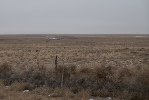
Tumbleweeds, Albuquerque's west side, December 2013, John Fleck

Tumbleweeds, Albuquerque’s west side, December 2013, John Fleck

This open land on Albuquerque’s west side, a 20 mile drive from downtown but probably half of that as the crow flies, is getting a newly improved four-lane road and drainage. It’s currently home to a cluster of shooting ranges, the place where we turn our post-sewage plant poop into compost, and a small airport. And beef on the hoof. If you look on the Albuquerque metro area’s long term planning maps, this chunk of land is colored a bright orange for “Developed Land, 2035”.

I’m reading Justin Hollander’s Sunburnt Cities, which argues that we in the sunbelt cities need to prepare for a rustbelt-like population decline. I’m not yet prepared to buy Hollander’s argument in total. After post-Economic Shitstorm declines in the years after 2008, places like Phoenix (one of Hollander’s case studies – he doesn’t deal with Albuquerque directly) are seeing their population curves turn back up.

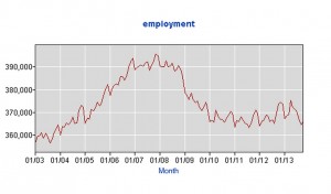
But when you look at graphs like this, showing Albuquerque’s post-ES employment, it’s pretty clear that Hollander’s nevertheless onto something significant in terms of the planning assumptions that lead people to color land like this a bright orange for “developed land” on their planning maps:

Albuquerque employment, Bureau of Labor Statistics

Albuquerque employment, Bureau of Labor Statistics

Dad always had a camera

I got a new camera.

Lissa and I have always had a family camera, but it’s been mostly her thing. She’s the artist, I’m the word guy. She lets me use it whenever I want, so I’ve always taken a lot of pictures, but I never took it terribly seriously. At the newspaper, I work with some really talented shooters, and between Lissa’s artistic vision and the skills of my coworkers, I’m acutely aware of the modesty of my ability to use a camera to identify and then convey a thought.

But taking pictures is fun, and I’m always interested in learning different ways to tell stories, so I got a new camera. I’d been using Lissa’s big DSLR camera  lately. It’s a great camera, but it’s a lot of camera, so I settled on a little one that would be easier to just slip in a bag and have with me all the time.

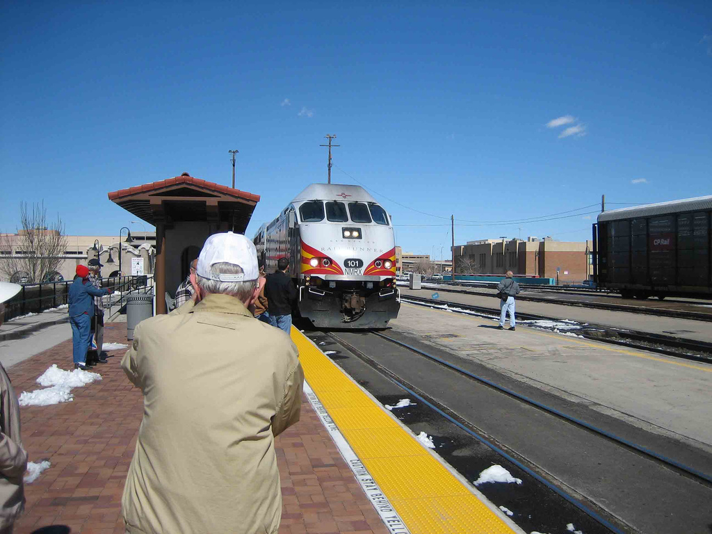
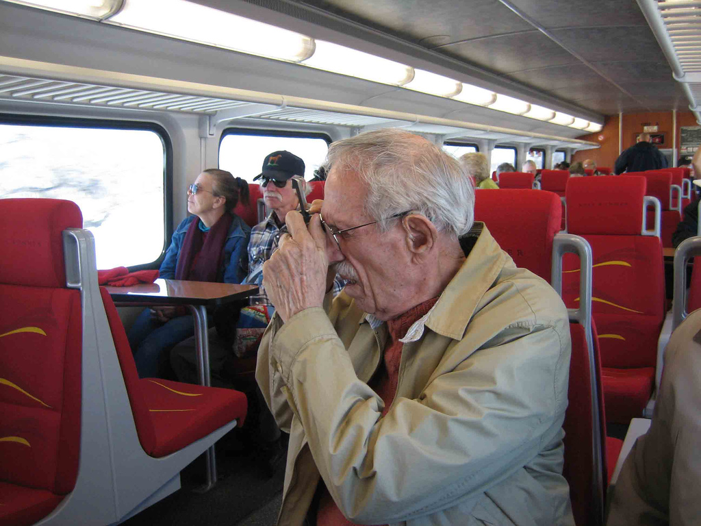
Going through a bunch of my old pictures last night, I came across a set I’d taken back in 2007 when we took Mom and Dad on a joyride on the Railrunner, central New Mexico’s commuter train. What had never really occurred to me until I looked at those pictures was the way Dad always had a camera. I’ve written before about my father’s life in art:

Art was intrinsic to our lives, not a thing separate.

I’ve not particularly thought about my dad as a photographer (he was a painter!), but there he was – me taking pictures of him taking pictures:

Dad taking pictures I, John Fleck, 2007

Dad taking pictures I, John Fleck, 2007

and this

Dad taking pictures II, John Fleck, 2007

Dad taking pictures II, John Fleck, 2007

These pictures are all kinds of complicated for me. This trip was taken shortly after a doctor told us Dad had Alzheimer’s disease, that the forgetfulness we’d been learning to route around was only the beginning. I remember the trip for that reason, for a ghostly picture I also took that day of Dad’s dim reflection in the train window, a blunt metaphor that’s still painful to look at.

But for reasons I don’t remember, I also took pictures of Dad taking pictures. Dad shot slides most of his life, and had a series of serious cameras (I remember light meters), but he was never a gearhead, and in his later years he mostly just used little instamatic-type cameras that he could slip in a bag and have with him all the time. Sound familiar? So obvious in retrospect.

Record Upper Colorado River Basin water use in 2011

According to the U.S. Bureau of Reclamation’s new Consumptive Uses and Losses Report (pdf), consumptive use of Colorado River water in the states of the upper basin (Colorado, New Mexico, Utah, Wyoming and a sliver of Arizona) reached 4.281 million acre feet in 2011, the highest on record.

The previous high was 4.245 million acre feet in 1994. (Source: The Colorado River Documents 2008, page 2-15 up through 2008, consumptive use reports for the rest).

The state of Colorado also had its biggest Colorado River water use year ever at 2.495 million acre feet in 2011.

fifty years of drought

From Jonathan Overpeck last month in Nature (gated):

The complexity of these megadroughts still defies complete explanation and yet it implies that unusually persistent anomalies of sea surface temperature can combine with amplifying changes in vegetation and soil to drive droughts that — if they happened today — would outstrip many of our institutional capacities to deal with such aridity. For example, another tree-ring study highlighted a 50-year drought, with only one normal year of precipitation, in the headwaters of both the Colorado River and the Rio Grande during Roman times. It is hard to imagine how such a drought would play out today, but it would surely prove a much greater challenge to regional water resources and forests than any drought of the past 120 years.

Fifty years of drought, with only one year of normal precipitation. Holy moly. I’d like more discussion of what our “institutional capacities to deal with such aridity” might look like, rather than just a sweeping assertion. We’ve seen our “institutional capacities” able to deal with drought outside of historical experience. But holy moly. Fifty years?


Declining westerlies and Pacific Northwest hydrology: a hypothesis

Charlie Luce from the U.S. Forest Service’s Boise Aquatic Sciences Laboratory and colleagues have a paper in the most recent Science examining the question of whether declining westerlies are behind the changing snowpack in the mountains of the Pacific Northwest:

Decreases in lower-tropospheric winter westerlies across the region from 1950-2012 are hypothesized to have reduced orographic precipitation enhancement, yielding differential trends in precipitation across elevations and contributing to the decline in annual streamflow. Climate projections show weakened lower troposphere zonal flow across the region under enhanced greenhouse forcing, highlighting an additional stressor relevant for climate change impacts on hydrology.

Previous work has found no significant decline in precipitation, but a decline in stream flows. Luce argues that’s because most of the rain and snow measurement stations on which that conclusions is based are at lower elevations, rather than the higher elevations that contribute the bulk of the snowpack.

It’s important to recognize that this is a hypothesis, but luckily for science we’re going ahead with the greenhouse emissions experiment, so we’ll know the answer soon enough. Well, not exactly soon enough if you’re a resident of the Pacific Northwest who has built a society based on the current runoff patterns.