Turns out Casablanca isn’t a desert. I was misinformed.

One of my favorite water nerd film moments is the conversation between Humphrey Bogart and Claude Rains in which Rains’ Inspector Renault tries to get Bogart’s Rick to explain why he came to Casablanca:

the fog should have clued me

the fog should have clued me

Captain Renault: What in heaven’s name brought you to Casablanca?
Rick: My health. I came to Casablanca for the waters.
Captain Renault: The waters? What waters? We’re in the desert.
Rick: I was misinformed.

I love it even more now, after blog commenter Paul pointed out that Casablanca’s coastal climate is particularly wet in winter. It’s not a desert after all.

I was misinformed. (And I love my blog’s readers.)

The last time Lake Mead was full, as seen from outer space

My new hobby, hunting for pictures of Lake Mead when it was full, led me this evening to the helpful USGS EarthExplorer archives of old U.S. government satellite images, where I found this little beauty. Apologies if it’s a slow load, they’re relatively large image file so interested water nerds can click on it and zoom and stuff. You can see that Saddle Island, near the center of the picture, is actually an island. The old Las Vegas Bay marina is still there on the branch on the upper left of the image. May 2000 is the last time Mead’s surface elevation was above 1,200 feet above sea level, and as Southern California water manager Bill Hasencamp told the L.A. Times last week, we’ll probably not see it full again in our lifetimes.

Landsat image of Lake Mead, May 3, 2000

Landsat image of Lake Mead, May 3, 2000

For comparison, here’s Lake Mead taken Oct. 12 of this year. I tried to crop ’em sorta the same:

Landsat image of Lake Mead, May 3, 2000

Landsat image of Lake Mead, Oct. 12, 2015

A farmer’s defense of the Klamath Basin Restoration Agreement

The Klamath Basin Restoration Agreement embodies one of the great experiments in collaborative watershed management under contested conditions, with a complex web of sometimes conflicting interests among agriculture, indigenous communities, fisheries, environmental flows, and power production. It also demonstrates one of the great risks in collaborative water management in the arid West: everyone has to give up something, and there is always a risk that politicians pandering to any one faction can gain traction and sabotage the deal. The incentives of local politics pose huge risks.

Ben Duval, a farmer who clearly has some heartburn about the compromises required but supports the KBRA, makes that case eloquently in op ed this weekend:

The KBRA and the related Klamath Settlement Agreements are a product of simple reality — we don’t live in a bubble. Other viewpoints are part of the local, regional and national debate about water. We have to acknowledge the reality that the public sentiment places a high value on the environment, healthy fisheries and other ideals. There is no doubt they also appreciate the safe, stable, and affordable food supply that irrigated agriculture is so effective at providing. However, we cannot simply dismiss the other values that are important and also depend on our Klamath River.

Thanks to Michael Campana for the pointer.

Albuquerque’s water use down another 3.4 percent in 2015

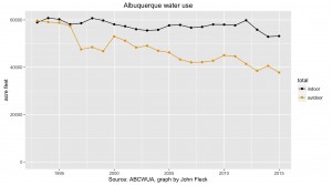
I keep asking my friends who manage municipal water systems in the West how low their communities’ water use can go. None of them really know, which is fascinating. Their customers’ water use just keep dropping.

I’ve been following a couple of communities particularly closely – Albuquerque (because it’s my home town) and Las Vegas (the focus of a lot of my research attention for my book). The two communities also are a useful comparison because both do accounting in a sufficiently similar way that I’m able to do reasonable apples-to-apples comparisons. (Municipal comparisons are a notoriously difficult problem because of different accounting approaches, especially with respect to effluent return flows.)

In 2014, water use in Las Vegas dropped dropped another 3 percent, to 205 gallons per capita per day, part of a long, steady slide. It’s dropped 38 percent in the last decade. I don’t have good 2015 Las Vegas data yet, but based on the preliminary Bureau of Reclamation reports, it looks like consumption of Lake Mead water in Southern Nevada in the first nine months of this year is down another 1.5 percent from the same period last year.

Welcome to Albuquerque, Desert Sands, swimming pool for registered guests only, by John Fleck

Empty Albuquerque swimming pool, using less water. by John Fleck

I just got Albuquerque’s numbers for the first nine months of the year, which are down 3.4 percent from the same period last year. That should put us at somewhere between 130 and 131 gallons per capita per day this year, a 48 percent reduction in water use per person since 1995.

This kind of reduction in per person use of a critical resource is astounding, and says two important things, I think. The first is that we were pretty profligate with our water use until quite recently. The second is that it’s still not clear where the water conservation floor lies.

Note on data for the water nerds: These numbers are based on total withdrawals. My calculations for consumptive fraction: Albuquerque 55 gpcd, Las Vegas 120. See here for background on the difference.


Roadrunner accessorizes garden art

Roadrunner in L. Heineman's garden, 10/17/2015

Roadrunner in L. Heineman’s garden, 10/17/2015

I was trying to get a shot of our neighborhood roadrunner this morning as it hopped down into Lissa’s garden, a sort of “living Garden Gnome” shot. But I realized as I looked through the results that the garden itself, Lissa’s great work of living art, overwhelms the bird, however cool the roadrunner might be.

Here is a picture of that time Lake Mead was full

Lake Mead, behind Hoover Dam. Undated photo for Historical American Engineering Record survey, courtesy Library of Congress

Lake Mead, behind Hoover Dam. Undated photo for Historical American Engineering Record survey, courtesy Library of Congress

“When will Lake Mead fill up again? Probably not in our lifetimes,” said Bill Hasencamp, the MWD’s point person for the Colorado River. “If you saw it full, save those pictures.”

LA Times

My best guess is that the picture above was taken in 1987.


Albuquerque recovering stored groundwater, historic first for New Mexico

Albuquerque yesterday (Oct. 15) began pumping groundwater from an aquifer in the city’s northeast heights, the first time aquifer storage and recovery in New Mexico has reached the “recovery” phase.

New Mexico is late to this party – states around us have been doing this for years. But it’s a huge milestone in water management here.

Bear Canyon recharge, courtesy ABCWUA

Bear Canyon recharge, courtesy ABCWUA

This started, I think, back in 2008 with water recharged into Bear Canyon Arroyo, a sand-and-gravel-bottomed natural arroyo that flows down alongside the Arroyo del Oso Golf Course in the midst of suburban Albuquerque. The water comes from the Albuquerque Bernalillo County Water Utility Authority’s allocation of San Juan-Chama Project water, imported from the Colorado River Basin. In a pilot phase over a number of years, the Water Authority stored 1,073 acre feet of water, which is what is now being pumped out over the next month, according to Katherine Yuhas, who’s overseeing the project for the agency.

The pumping will be done over the next month from six wells in the area around Bear Canyon, drawing on the same area of the aquifer that has been recharged.

The experiment here is as much institutional as it is hydrologic – how do you handle the accounting, making sure the water really got to the aquifer and doing the accounting as the Albuquerque Bernalillo County Water Utility Authority recovers it? I can’t emphasize the importance of this piece enough – it’s something we talk about a lot in the intro to contemporary issues class I’m helping teach for University of New Mexico water resources grad students. Water management is half hydrology, half law, and half institutions. (I’m primarily on the law and policy side, not super good at math, but I think I’ve got the ratios roughly right.) So you not only need to figure out the physical part of getting the water into the ground and measuring that it got where you sent it. You also have to deal with the legal and institutional part – getting the Office of State Engineer to accept your measurements, agree with how the accounting is done when you pull the water out, etc.

Aquifer storage and recovery allows managers to smooth out variability, putting water in the ground on the wet side of the variability curve and pulling it out on the dry side. In Albuquerque, this would provide flexibility to manage San Juan-Chama water, which is imported across the continental divide from the upper headwaters of the San Juan River, in the Colorado River Basin.

This is an area in which New Mexico water management is staggeringly far behind other states. William Blomquist, in his classic collection of Southern California groundwater management case studies Dividing the Waters, describes simple recharge operations in Pasadena’s Arroyo Seco carried out during the drought of 1895-1904. Recharge of various sorts – storm water, imported Colorado River water, treated sewage effluent – has been done in Southern California ever since. One of the critical insights in Blomquist’s book is the importance of getting the institutional pieces right.

In Arizona, groundwater banking of surplus Colorado River water has been standard operating procedure for decades, with 3.965 million acre feet banked as of the end of 2014 (pdf). So Albuquerque’s 1,073 acre feet is small stuff. But it’s an important start.

The wickedness of the Salton Sea

I’ve been joking to my Colorado River management friends about how I keep trying to leave the Salton Sea out of my book. This effort has been such a failure that the Salton Sea now makes multiple appearances in the current draft. All paths to the end of my book’s argument seem to pass through the stinky, super-saline body of agricultural drainage water in southeastern California.

The Salton Sea, left, discusses plans for its future with a visiting journalist

The Salton Sea, left, discusses plans for its future with a visiting journalist

My latest effort to not write about the sea sent me back to reread a classic of planning literature, Horst Rittel and Melvin Webber’s 1973 “Dilemmas in a General Theory of Planning“. Rittel and Webber outline a general class of societal problems that are inherently difficult because they are, to use the authors’ lovely coinage, “wicked”. They don’t mean these problems are witch-like, but rather that they share these characteristics:

  • there is no definitive formulation of a wicked problem – the possible solutions depend (strongly) on the problem definition, and the act of defining is a socially contested process
  • wicked problems are never “solved” – in R and W’s language “they have no stopping rule”

Contrast this with what they call “tame” problems – ones for which we can clearly articulate the problem to be solved, and for which the definitions of success and failure are crisp.

My favorite example of a tame problem is the 1960s Apollo program to send astronauts to the moon. The problem to be solved was easy to describe: sending astronauts to the moon and safely returning them. Spaceship blows up on the way home? No question that’s failure.

Tame problems are not necessarily easy to carry out, they’re just easy to define.

Rittel and Webber were writing at a time when people were trying to apply the successes of science and engineering to social problems. We know how to build bridges that don’t fall down. Next up, poverty! But poverty turns out to be harder to define, and the solutions you pursue depend entirely on the definition you choose:

By now we are all beginning to realize that one of the most intractable problems is that of defining problems (of knowing what distinguishes an observed condition from a desired condition) and of locating problems (finding where in the complex causal networks the trouble really lies).

Which brings us to the Salton Sea, a problem located at the end of a really confusing causal network.

First formed in 1905 when the Colorado River breached Imperial Valley’s early irrigation works in a big way, the sea would have soon evaporated were it not for continued inflows of the valley’s irrigation drainage water. In fact, contrary to those who argue that “it was an accident, let it die”, it seems hydrologically likely that even without the accident of its original sin, the sea would exist today in sort sort of equilibrium after more than a century of ag runoff in the valley.

Its rise and fall has always posed problems – flooding of the farms around its shores drove major litigation in the 1980s over allegations that Imperial Irrigation District’s practices were causing the lake to rise because they were “wasteful”. The problem today is the opposite. Efforts to conserve water in Imperial today to permit ag-to-urban transfers in Southern California will slowly deprive the sea of inflows, causing it to shrink.

Greetings from the Salton Sea

Greetings from the Salton Sea

So what?

The “what” here is the wicked problem. Is it the loss of habitat for migrating birds? Is it the increasing air quality problems from the exposed shoreline? Is it the fading dream of a recreational paradise in the desert?

The real problem of the Salton Sea seems to have been that the people working on the problems of the Colorado River Basin were solving a different problem entirely – ensuring that water users from Denver and Grand Junction to Los Angeles and San Diego, with a lot of farms in between, had “enough” water.  (How much is “enough”? Another wicked problem.) Down a tortured causal chain of water shortage (perceived or real) and water savings, you end up with less water flowing to a dying Salton Sea. One of Rittel and Webber’s key insights was that “every wicked problem can be considered to be a symptom of another problem.” Check that one off of your “wicked problems” bingo card.

I played at the top of this post with the Wicked Witch of the West as a rhetorical device, but in the end it doesn’t quite work. When the Great and Powerful Oz gave Dorothy and her traveling companions their assignment –  “Bring me the broomstick of the Witch of the West” – it was pretty clear how success was defined. Tin Man: “B-B-B-But if we do that, we’ll have to kill her to get it!” Whatever. Just bring me the broom.

I’m still not sure I know how to define the problem of the Salton Sea quite so crisply.