“Water is for Fighting Over” – on the shelves in September

Water is For Fighting Over: and other Myths about Water In the West, by John Fleck, Island Press, September 2016

Water is for Fighting Over: and other Myths about Water In the West, by John Fleck, Island Press, September 2016

My life’s kind of a blur right now, but the official Island Press announcement of my book, along with the unveiling of its cover, is a thing that has just happened, so let me pause and catch my breath.

People familiar with my frequent ranting about how Mark Twain never said the thing about whiskey and water (see here, here, and here) may be puzzled over the title. Here’s the essence of the message, as cribbed from the Island Press book summary:

When we think of water in the West, we think of conflict and crisis. In recent years, newspaper headlines have screamed, “Scarce water and the death of California farms,” “The Dust Bowl returns,” “A ‘megadrought’ will grip U.S. in the coming decades.” Yet similar stories have been appearing for decades and the taps continue to flow. John Fleck argues that the talk of impending doom is not only untrue, but dangerous. When people get scared, they fight for the last drop of water; but when they actually have less, they use less.

Having covered environmental issues in the West for a quarter century, Fleck would be the last writer to discount the serious problems posed by a dwindling Colorado River. But in that time, Fleck has also seen people in the Colorado River Basin come together, conserve, and share the water that is available. Western communities, whether farmers and city-dwellers or US environmentalists and Mexican water managers, have a promising record of cooperation, a record often obscured by the crisis narrative.

In this fresh take on western water, Fleck brings to light the true history of collaboration and examines the bonds currently being forged to solve the Basin’s most dire threats. Rather than perpetuate the myth “Whiskey’s for drinkin’, water’s for fightin’ over,” Fleck urges readers to embrace a new, more optimistic narrative—a future where the Colorado continues to flow.

As I’ve written before, I’m dyin’ to share it with y’all.

Granite Bay and the California water ethic

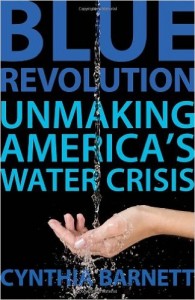
Blue Revolution, by Cynthia Barnett

Blue Revolution, by Cynthia Barnett

When I read this Phillip Reese story Monday evening about a California community willfully defying the state’s water conservation orders, the name of the place rang a bell. I shot off an email to my friend Cynthia Barnett, author of the wonderful Blue Revolution, a call for a new water ethic in the United States. “Wasn’t Granite Bay the place you wrote about in Blue Revolution?” (My copy of the book was on the shelf at my University of New Mexico office – I push it on water resources students every chance I get.)

Turns out my memory was correct. It was the waterfalls I remembered, right there on the first page of the book:

The amenity to envy was no longer the diving board. The must-have, now, was the waterfall.

No community glorified the trend like Granite Bay, California….

In Granite Bay’s best backyards, rocky waterfalls cascade artfully into boulder-lined swimming pools, set off with grottoes, swim-up bars, and built-in hot tubs. Thick bushes and trees bearing flowers and fruit adorn the watery wonders, making a place naturally dominated by needlegrass and sedge look more like Fiji. Precisely groomed lawns, a quarter acre and larger, complete the sublimely unnatural tableau.

As Barnett noted, that comes with a cost – water use more than three times the national average.

As Reese noted, Granite Bay still uses a lot of water:

In July, San Juan Water District customers used more than 400 gallons of water per capita, more than 100 gallons per capita more than any other district in the region, state figures show.

To be fair, Granite Bay residents have cut back just like everyone else, but they’re still among the state’s big residential water users, and the message sent by their unwillingness to keep up the pressure is telling. It made Cynthia sad (email comment shared with permission):

Granite Bay struck me as perhaps the best example in the nation of the illusion of water abundance and our lack of an ethic for water in America. Today, it is perhaps the best example of a lost opportunity to show that even the most water-addicted communities can change, and live ethically with water — while still living really well.

Hanak on federal agriculture policies and water

When we think of federal water policy, we think Bureau of Reclamation or EPA. But just as agriculture is where the water is, federal agriculture agencies are where the money is. Ellen Hanak of the Public Policy Institute of California had a post yesterday with some useful suggestions for spending it well:

Practical reforms in easement programs could yield drought-management results. The wetland recovery program pays farmers to permanently restore fields to wetlands, and the conservation reserve program pays them to convert fields to cover crops for 10–15 years. But such long-term commitments to fallow lands are unappealing to many farmers.

These programs could be more effective by allowing shorter easements and working with groups of farmers rather than individuals. For instance, paying farmers to create temporary wetlands during droughts can stretch scarce water and dollars while supporting waterbirds. Similarly, paying a group of farmers to do rotational fallowing—which means they take turns temporarily fallowing fields—can reduce overall water use while keeping farms in production. Meanwhile, other incentives could focus on farmers who commit to maintaining land in field crops rather than permanent crops—a change that could boost drought resilience in places like California, which has seen a big expansion of tree crops that are harder to fallow.

There is more, and I recommend the work of Hanak and her colleagues for practical, actionable water policy suggestions.

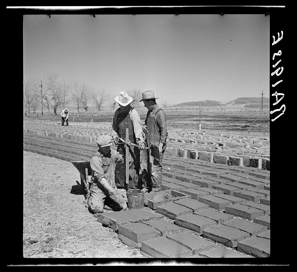
Throwback Thursday: Making adobe brick. Bosque Farms, New Mexico

Making adobe brick. Bosque Farms, New Mexico. Arthur Rothstein, April 1936

Making adobe brick. Bosque Farms, New Mexico. Arthur Rothstein, April 1936

Arthur Rothstein arrived in the Dust Bowl in April of 1936. He was 21 years old, the son of Jewish immigrants, born and raised in New York City. Fresh from Columbia University, Rothstein had been the first photographer hired by Roy Stryker, his former professor, at the Resettlement Administration, a New Deal agency that, from 1935 to 1936, relocated struggling families to communities planned by the federal government. The photography unit, later part of the Farm Security Administration, documented for the public not only the multitude of problems the nation was facing, but what the government was doing about them.

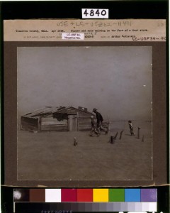
Arthur Rothstein's iconic Dust Bowl picture

Arthur Rothstein’s iconic Dust Bowl picture

That’s from the biography of Rothstein written as part of Ken Burns’ Dust Bowl documentary. Rothstein is justly famous for his photograph of a farmer named Arthur Coble and his sons walking against the dust in Cimarron County, up against the Oklahoma-New Mexico border.

New Mexico was on the far western edge of what we can to call the “Dust Bowl”, and Rothstein’s work here is far less famous. But it’s a wonderful documentary record of a moment in time.

Roy Stryker hired the young photographer as part of a team of documentarians that included Dorothea Lange. Rothstein had to learn to drive in order to do the job.

Historian Michael L. Carlebach (behind paywall) argues that the body of work they produced is as much propaganda as it is documentary journalism or art:

The FSA photography project was the first attempt by the federal government to provide a broad visual record of American society. It was also the first systematic use of photography by the government for partisan purposes. In order to convince the American people and the Congress of the need for reform, especially in the agricultural sector, still photographs that described the deplorable conditions in the countryside were produced and disseminated.

Rothstein’s pictures are interesting in this context. As he travelled the western United States, he seemed to be especially focused on irrigation works, as the Library of Congress’s collection of his work shows. So maybe this is propaganda at a critical moment in American history selling the nation on the benefits of irrigation?

Whatever. They’re wonderful pictures.


In collaborative Colorado River Basin problem solving, who’s at the table, who’s left out?

Tony Davis raises an important issue this morning about Colorado River Basin collaborative problem solving:

But while most of the summit was filled with talk of new technologies and research tools, massive corporate investments in new supplies and hope for ramped-up conservation measures, an Arizonan who spoke at the four-hour summit offered a more discordant note. Gila River Indian Community Chairman Stephen Ray Lewis — whose tribe controls by far the biggest individual share of CAP water — criticized state and federal officials for leaving tribes out of the seven-state talks looking for ways to save water in the Colorado River Basin.

“It is a glaring misstep that needs to be corrected,” Lewis told the summit, held at the Eisenhower Office Building adjacent to the White House. “We want to be at the table. At our hearts, we’re stewards of the land. When we start talking about innovation, we have very innovative solutions to water management.”

I’m a strong advocate for the collaborative process (Buy my book! Available in September!). But this is a huge weakness. The risk to those left out is obvious, but failure to be properly inclusive also jeopardizes the process itself. We’ve seen time and again that collaboration without all the right people in the room yields less robust results. (I devote a whole chapter to this issue.)

On the need for better water data

A student in one of our University of New Mexico Water Resources Program classes asked last week what the magic trick was to finding water data. We’d asked the students to do some really challenging modeling of the flow of water through New Mexico’s Middle Rio Grande watersheds, and one of the biggest difficulties was finding usable data to plug into their models. My faculty colleague who’s helping teach the class (and who is one of the great data wizards of the Middle Rio Grande) didn’t have a good answer. Like all of us, he’s collected spreadsheets and bookmarks over the years that point in the right direction, but each question leads to a new data need. Water data is hard. Often it’s not collected at all, and when it is, it’s not standardized and connected up in ways that might make it accessible.

The result is that important policy questions – how might climate change impact agricultural acreage, or the need for groundwater pumping? what role might direct potable reuse of wastewater play? our students are smart, these are the kind of questions that interest them – are very hard to ask in any sort of a quantitative way.

My experience working with Western water data thus leaves me enormously sympathetic to the argument Charles Fishman made in yesterday’s New York Times about the need for better US water data:

Water may be the most important item in our lives, our economy and our landscape about which we know the least. We not only don’t tabulate our water use every hour or every day, we don’t do it every month, or even every year.
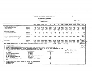
Water Data looks like this - USBR Lower Colorado Accounting, circa 1970

Water Data looks like this – USBR Lower Colorado Accounting, circa 1970

If you’re willing to put in the work, the problem can be tractable. On my hard drive is a precious collection of spreadsheets I collected over the last few years while working on my book – some provided by patient and helpful (and transparent! yay government sunshine!) water agency officials across the West, many built myself from old paper documents accumulated over the years. When a water district manager claims a reduction in summer irrigation, I now know where to go for the monthly totals through time to check it out. (Looking at you, Yuma County Water Users Association. And yes, the claim checked out.) But the current state of the data does not make this easy, and there are many, many geographies and categories of water use for which the data do not exist at all.

And even when the data does exist, it’s been collected in a particular way to meet a particular need, and comparisons across regions and water agencies trying to do the sort of apples-to-apples analysis that good regional<->national water policy requires is nigh impossible.

So yes, I’m in agreement with Charles – those of us trying to improve our nation’s water policies need better data to work with.

But I as I sit here in the midst of putting together a lecture for the students next week on the role of science in politics and policymaking, I am less clear than Charles about the direction the data<->policy arrows run.

Researching my book, I spent a lot of time trying to understand the places and the ways in which water governance has succeeded. My favorite example, which I spend a lot of time on in the book, is the West Basin regional aquifer in Southern California, south and west of downtown Los Angeles. (Here is the 628-page pdf of Elinor Ostrom’s PhD thesis on West Basin. Go ahead and read it, I’ll wait. It’s delightful.) There, the evolution of water governance and the provision of good water data went hand in hand. The evolving governance clarifies the need for data, and then better data feeds back into the evolution of better governance.

Simply collecting and providing good data runs the risk of what David Cash et al. call “the loading dock problem“, where science (in this case data) is collected by the sciencers and then handed to the policyers. This, they argue, is less useful than a two-way process in which those who would use the data help define the data that they need, and take ownership of and confidence in the results. What happened in West Basin very much involved the sort of “coproduction” of science Cash and colleagues describe.

Thus I am of a mixed mind about the usefulness of what Charles asks for:

Congress and President Obama should pass updated legislation creating inside the United States Geological Survey a vigorous water data agency with the explicit charge to gather and quickly release water data of every kind — what utilities provide, what fracking companies and strawberry growers use, what comes from rivers and reservoirs, the state of aquifers.

I fear that such a national effort, much as it might simplify my desire to have a better handle on the water consumed by the Colorado River Basin’s alfalfa farmers, is insufficient to spark the revolution Charles hopes for. So maybe call this “necessary but not sufficient”?