The Loss of El Vado Dam

The Bureau of Reclamation’s announcement at Monday’s meeting of the Middle Rio Grande Conservancy District that it is halting work on El Vado Dam repairs raises hugely consequential questions about water management in New Mexico’s Middle Rio Grande Valley.

The short explanation for the halt is that the current approach to repairing the 1930s-era dam wasn’t working. (The meeting audio is here, though at “press time” for this blog post this week’s is not yet up.) I’ll leave it to others to suss out the technical and bureaucratic details of the repair project, and the endless finger-pointing that’s sure to ensue. My interest here is to begin to sketch out the implications here in the Middle Valley of an indefinite period – a decade or more? – without El Vado.

The Middle Rio Grande Conservancy District built El Vado (with substantial federal subsidy) in the 1930s to provide irrigation supplies by storing high spring runoff for use in summer and fall. But while its purpose was irrigation, it completely changed the Middle Valley hydrograph in ways that all the other water uses have adapted to, both human and ecosystem.

Without El Vado (or some interim replacement – see below), we should expect the Rio Grande to routinely go functionally dry in late summer unless propped up by monsoon rains, which are sporadic and unpredictable.

I see impacts in three areas, only one of which is related to El Vado’s initial purpose.

1: Irrigation

This is the obvious one. Until El Vado is repaired or some sort of replacement schemed out, irrigators should expect a high risk of low or no supply in late summer and fall. Alfalfa will remain a reliable if modest crop (it can hunker down and wait out the dry), but the few commercial operators who need a more reliable supply for their crops – think pecans and chile – will have to depend on groundwater, with all the problems that entails.

2: Municipal Supplies

Albuquerque’s use of its imported San Juan-Chama water in summer indirectly depends on El Vado. Without MRGCD water, released from El Vado, as “carriage water”, the Albuquerque Bernalillo County Water Utility has to leave its imported San Juan-Chama water parked in Abiquiu Reservoir, switching to groundwater. This is what we have done over the last few years, and our much-vaunted aquifer recovery has, as a result, stalled.

This poses a huge challenge for the Albuquerque Bernalillo County Water Utility Authority.

3: Environmental Flows

The idea of an agricultural irrigation dam providing the water for environmental flows seems super weird. But that’s basically the way it’s worked for years here in the Middle Valley. Releases from El Vado, sent downstream to irrigators, provide environmental benefits along the way. For the last couple of years, without El Vado water to supplement flows in late summer, the Rio Grande has operated on a knife’s edge between flowing and dry through Albuquerque.

This poses a huge challenge for efforts to nurse the Rio Grande silvery minnow back from extinction.

Storage alternatives

First and foremost, there is a fast-moving and scrambling discussion about storage alternatives.

Abiquiu Reservoir, a flood control facility on the Rio Chama built, owned, and managed by the U.S. Army Corp of Engineers, is an obvious replacement. The part in italics yields knowing nods, or perhaps grimaces, from folks who work in Middle Valley water management, because the Corps is well known for an exceedingly cautious interpretation of its statutory mandates. “Filling in as a water storage facility to replace El Vado” is only sorta barely at the edge of that mandate. Getting the Corps on board to help with this fix will be key.

Heron Reservoir, on a Rio Chama tributary, stores San Juan-Chama water imported through tunnels beneath the continental divide. It physically can’t replace El Vado because it’s in the wrong place. But discussions have already touched on the idea of doing it on paper via accounting swaps – hold back San Juan-Chama water, let SJC customers use native Rio Grande water via an accounting swap, then deliver Heron water as if it had been El Vado water.

Elephant Butte? Again, it’s in the wrong place, but accounting swaps here are also on the table.

Institutional Framework

The most important subtext is the institutional framework behind all of this. The loss of El Vado is not solely an MRGCD/Bureau of Reclamation problem. It implicates all the Middle Valley’s water stakeholders – especially Albuquerque’s Water Utility Authority, but also the Corps of Engineers, the Fish and Wildlife Service (because of ESA issues), the state water agencies, the communities on the valley floor that have avoided responsibility for any of this by depending on the state’s obscenely permissive domestic well statute.

Five Major Proposals for Post-2026 management of the Colorado River

With the submission of two additional proposals last week, we now have five major proposals for post-2026 Colorado River management.

The folks at the Water and Tribes Intitiative have helpfully organized them in a single place. (Click on the
“Proposed Alternatives for Post-2026 Operating Guidelines” bubble.)

Tribal Principles

A set of guiding principles proposed by 17 of the basin’s sovereign indigenous communities. (click here)

Upper Basin Proposal

What the label says, you already know about this one. (click here)

Lower Basin Proposal

What the label says, you already know about this one. (press release, alternative, presentation)

Environmental NGOs

The “Big Seven” Colorado River Basin environmental groups (click here)

Lake Powell/Grand Canyon/Lake Mead Ecosystem Proposal

A proposal from Jack Schmidt, Eric Kuhn, and John Fleck suggesting ways to manage the storage and distribution of water to provide more flexibility for environmental and other non-water supply benefits. (click here)

Always check the gate. It might be unlocked and lead somewhere interesting!

This gate was unlocked, and led to a marvelous shortcut.

In our years of urban exploring of Albuquerque on our bicycles, my collaborator and I have learned a number of guiding principles that I realized might be worth sharing.

The realization came at this gate, which of course I checked to see if it was locked. It wasn’t, which led to the discovery of a marvelous new shortcut. (Marvelous shortcuts, graded first on safety and second on interestingness, are a precious gift. They need not actually be shorter.)

This is a work in progress, but here are a few:

“Dead End” signs are an invitation

Beach Road, in Albuquerque, does in fact have an outlet.

“Dead End” and “No Outlet” signs should be viewed as an invitation.

Their placement is generally intended to inform the drivers of automobiles. Not pedestrians and bicycles. I would estimate that roughly half the time I ignore them, I find a way through.

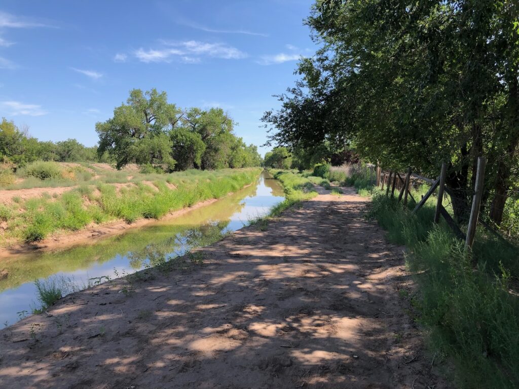
The percentage goes up significantly on Albuquerque’s valley floor, which is spiderwebbed with irrigation and drainage ditches. Consider the delightfully named “Beach Road” in Los Duranes, a neighborhood named after an old village along the Rio Grande. My decision to ignore the “No Outlet” sign was rewarded with a gate designed to allow horses, pedestrians, and cyclists access to the Riverside Drain paralleling the Rio Grande, a delightful dirt path.

Keep an eye out for bollards

A bollard at a gap in a wall with a bicycle in the foreground and a field and houses in the distance, beyond the gap in the wall.

This is a close corollary to the above principle about “No Outlet” signs. Often the cut-throughs at the end of such streets include a space to pass, but with a bollard at the entrance to block motor vehicles. Bollards also guard other gaps in fences and walls.

Consider such bollards an invitation to see what might lie on the other side.

When feasible, take the alley

Irot’s Bird, in the alley behind Central (Route 66) in downtown Albuquerque. November, 2023, photo by John Fleck

Alleys are the most honest part of a city, the back side of things, unadorned. Or, sometimes, spectacularly adorned.

“Graffiti,” Albuquerque city ordinance 11-7-1 explains, “is a form of vandalism which injures and stains Albuquerque.” This is important. In Bogota in 2011, the police killing of a graffiti artist sparked outrage, leading after several years of turmoil to a government decree allowing “responsible and artistic graffiti” in most public spaces. Which triggered deep debates within the community of the artists who made it over the meaning of “true” graffiti.

The deep notion of graffiti as an act of rebellion and place-making is beyond the scope of this blog post, but graffiti has always been at the heart of a “discourse of disorder.” It is place-making, or place-claiming, and it’s delightful, and you’ll find it in alleys. Magnificent work like Irot’s bird, but also ragged tags.

When feasible, take the alley.

Speed Humps

Yellow sign with black lettering reading "speed hump"

Always follow the speed humps

The reason they build speed humps is because cars were driving too fast. Speed humps slow them down.

These signs are thus conveying two important pieces of information.

First, it means the road goes somewhere interesting. That’s why all the cars were going that way and driving too fast, leading to neighborhood meetings and traffic engineering studies and speed hump construction.

Second, it means that what cars still use the street are now likely to be going more slowly.

No Trespassing Signs

Bicycle leaning against a "no trespassing" sign with open desert behind

Thar be dragons.

Criminal trespass consists of unlawfully entering or remaining upon the lands or property of another knowing that any consent to enter or remain has been denied or withdrawn by the person or persons lawfully in possession of the premises or after the request or demand to leave the premises by the authorized representative of the person or persons lawfully in possession of the premises.

– Albuquerque city ordinances, 12-2-3

My first genuine bicycle exploration, at perhaps age ten, involved an old orange grove barn a few blocks from my house. My friends and I packed lunches and began wandering, finding the barn empty and inviting. We climbed the wooden ladder into the loft to dine.

We were wary of being caught, and nervous about the consequences. It was thrilling.

You should of course always be wary of Albuquerque city ordinance 12-2-3 and its kin. I would never encourage urban explorers to ignore signs such as the one above, or to paint over them or shoot them.

However you respond to signs like the one above, the urban explorer must always respect “No Trespassing” signs on lands of indigenous communities. That’s the only really important rule.


Otowi flow, without the log scale: 21st century peaks are ~half what they were in 1980-2000

Graph of flow on the Rio Grande at Otowi, showing significant 21st century decline

Rio Grande Otowi flow using linear rather than log scale

Alert Inkstain reader John correctly questions the impression left by the log scale I used last time ’round in my graph of flow at Otowi:

[W]hile I appreciate the usefulness of logarithmic scales for being able to discern patterns at the low end of the flow range, it does somewhat hide the magnitude of the changes pre/post 2000. The median peak flow since 2000 is barely half of the median peak in the 81-00 period, but you wouldn’t know that without paying close attention to the y-axis scale. And while the 2024 flows are indeed approaching the recent median, they are still roughly 10% below that line (again, something hard to discern from a log plot).

John highlights a fascinating tradeoff that we (the folks who use my graph and I) have been debating since I started doing it. Log scale does a much better job of highlighting the low flow parts of the graph, but John’s right that it hides important intuitions, for example masking the striking difference in peaks between the 1981-2000 period and our climate altered world.

Note that to make this read better, I went back to dropping the max and min lines.

Happy Rio Grande Spring Runoff!

A complex graph showing rising Rio Grande flows at Otowi, approaching the 21st century median

It is telling that I got excited when I noticed inflow into New Mexico’s Middle Rio Grande Valley approaching “normal”, which I now define as the median of 21st century flow.

Our climate-altered world, y’all.

A note on the evolution of the graph: I’ve added the “max” and “min” lines back. I dropped them because I thought it made things too busy, but it was creating confusion because the top and bottom of the purple looked like the most/least.

New Mexico’s Rio Grande reservoirs: Running on Empty

A graph with a red line showing New Mexico's northern Rio Grande reservoirs and a red line showing northern reservoirs. Both are extremely low since the early 2000s.

Reservoir storage on New Mexico’s Rio Grande and Rio Chama on April 1, 2024

Inspired by Jack Schmidt’s monthly “how much water is in Colorado River storage” posts (see here for last month’s), I’ve been playing with a similar tool to help me think about the status of our reservoirs on the Rio Grande system here in New Mexico.

The graph above helps me with two important intuitions about how the system is functioning.

At the decadal scale, the water management shift in the early 2000s from a time of plenty to a time of not plenty is dramatic.

At the interannual scale, the decline in water kept in storage upstream of the middle valley (the red line above) goes from bad to worse beginning in the late teens.

Data choices

North and South

Based on a useful conversation with Jack about this, it makes sense here to split things up into two bins – the northern reservoirs (which hold the water available for our use here in New Mexico’s Middle RIo Grande Valley) and the southern reservoirs (which hold storage for the Elephant Butte Irrigation District, El Paso and surrounds, and Mexico).

Time series

Because of a quirk in the data I have access to, and because I am too lazy to do the work to overcome the quirk, it makes sense to start the time series at 1980. But that also makes conceptual sense in terms of how I think about the system – our “modern era” of water management includes these two broad multi-decadal periods – the wet stuff 1980-2000, and the dry stuff ever since.

Time step

I find it most helpful to plot this at an annual time step. How does storage right now compare to last year at this time? So the graph above is the storage as of April 1 (actually March 31). I’ve plotted it both ways (daily as well), but the interannual ups and downs make it harder for me to see what’s going on.

2024 v. 2023

After last year’s unusually wet year:

  • Northern reservoirs are up ~27,000 acre feet on April 1
  • Southern reservoirs are up ~95,000 acre feet.

The Loss of El Vado

Summer maximum versus end of year storage in El Vado Reservoir

The loss of El Vado Reservoir, currently under repair, is striking. But what’s also striking is how significantly we were draining it in recent years, before the current repairs started in 2022.

The Middle Rio Grande Conservancy District built El Vado in the 1930s (with an under-appreciated amount of federal subsidy) to extend the irrigation season, capturing spring runoff for use in the dry months of late summer and fall. (“Canals move water in space, dams move water in time.”)

I’m still playing with how best to illustrate this. The graph above shows how full El Vado gets each year as it swells with spring runoff (blue dot) and how far we’ve drained it by the end of the year (red dot).

Catchy Song Lyric version

Lookin’ back at the years gone by like so many summer fields

Runnin’ on, runnin’ on empty
Runnin’ on, runnin’ blind
Runnin’ on, runnin’ into the sun
But I’m runnin’ behind

– Jackson Brown, “Running on Empty”


Tribal sovereignty and pumped storage hydropower in Nevada

Daniel Rothberg wrote this week about an important case in Nevada that is testing the boundaries of the question of tribal sovereignty:

The Pyramid Lake Paiute Tribe filed a formal motion earlier this month to intervene in a federal regulatory proceeding that could eventually pave the way for a pumped storage hydropower project on the tribe’s land — a project the tribe opposes.

The filing comes only weeks after the Federal Energy Regulatory Commission (FERC) ruled that it would deny permits for hydropower projects on tribal land in cases where projects do not have a tribe’s support.

There’s a lot of enthusiasm right now about pumped storage hydropower – a way to add a sort of battery to the electrical grid to smooth out the fluctuations of solar and wind power. Here’s Daniel:

Pumped storage hydropower projects generate electricity by cycling water between two reservoirs at different elevations. They pump water from a low-elevation reservoir to a higher-elevation reservoir when there is excess energy available. When energy is needed, the water is released back to the lower reservoir and generates electricity as it flows down an elevation gradient and through a turbine — with the help of gravity.

But the sovereignty question here seems straightforward: pumped hydro may be of value broadly, but if the Pyramid Lake Paiute Tribe doesn’t want it on tribal land, isn’t their right to refuse the project inherent in the very concept of sovereignty?

I don’t know FERC legal stuff at all, but I’ve spent a lot of time wrestling with the question of the sovereignty of indigenous communities in the United States. Its evolution in New Mexico is a central question Bob Berrens and I wrestle with in our forthcoming book, Ribbons of Green.

Tribal/Pueblo sovereignty – a nation within a nation, separate but also a part – is inevitably murky. The Pyramid Lake Paiute effort to intervene here is worth following.

New Mexico and the Colorado River

The first day of Rio Grande deliveries of runoff to Elephant Butte in November from Albuquerque’s Central Ave. Bridge, shot on Atlanta Film Co Euphoric 100, Olympus OM10. Photo copyright Rin Tara


A guest post from my Utton Center colleague and Colorado River research collaborator Rin Tara, staff attorney and water policy and governance analyst at the Utton Center, University of New Mexico School of Law.

By Rin Tara

Over the last year, I had the joy of working with John on a law review article addressing potential risks to New Mexico’s San Juan-Chama Project water supply. The paper, titled Last Call: The Limitations of New Mexico’s Existing Water Management Framework in the Face of Reduced Colorado River Water Deliveries, was published earlier this month in the Colorado Environmental Law Journal.

The purpose of the project was to dig into the law surrounding the New Mexico’s San Juan-Chama Project, which imports Colorado River water into the Rio Grande Basin that has become vital to water supplies in Santa Fe, Albuquerque, and New Mexico’s Middle Rio Grande Valley. Our goal was to understand the durability of New Mexico’s annual Colorado River deliveries. The short summary of our learnings is that these deliveries are vulnerable to provisions built into the legislation. The sections below are pulled from the paper, which I (self-servingly) recommend everyone read in full.

In 1962, Congress passed an Act authorizing the construction of the Navajo Indian Irrigation Project and the beginning stages of the SJCP. 76 Stat. at 96. The Act states that:

[T]he Secretary shall operate the project so that there shall be no injury, impairment, or depletion of existing or future beneficial uses of water within the State of Colorado, the use of which is within the apportionment made to the State of Colorado by article III of the Upper Colorado River Basin compact, as provided by article IX of the Upper Colorado River Basin Compact and Article IX of the Rio Grande compact.

This passage references two sections of the UCRBC. Article III of the UCRBC establishes percentages of the annual Colorado River flow allocated to each Upper Basin State.153 New Mexico, as noted earlier, is entitled to 11.25 percent of the Upper Colorado River Basin Colorado River allocation. Colorado, in contrast, receives 51.75 percent. Although the Upper Basin states are subject to significant Colorado River curtailment within the Upper Basin should they exceed their UCRBC percentage allocation, sometimes referred to as the “penalty box,” New Mexico may be forced into curtailments before exceeding their full 11.25 percent allocation. This Act is worded such that New Mexico is not only prohibited from exceeding its 11.25 percent cap on Colorado River water usage, but New Mexico may also be required to curtail its SJCP water usage if the SJCP water diversions interfere with Colorado receiving its full 51.75 percent of the Upper Colorado River allocation. This language is significant because it permits Colorado to require New Mexico to reduce its SJCP water use if Colorado determines that the SJCP diversions are impeding Colorado’s ability to make full use of its Colorado River water.

We note

that there will never be a priority call for SJCP water because the SJCP allocations exist outside of the prior appropriation system. Instead, priority calls are possible for users whose SJCP allocation has been reduced so much that the water users’ other water rights are insufficient to meet their needs. A loss of SJCP water would create a cascade of water shortages, since users would be drawing more completely on other sources, which would create water stress on allocated water that originates in the Rio Grande Basin.

As anyone who follows this blog knows,

the broad challenges of meeting possible Colorado River shortages are mirrored in New Mexico’s water management obstacles. Just as prior appropriation does not serve the Colorado River Basin broadly, it does not serve New Mexico. New Mexico has a cultural history of water shortage sharing, which draws a strong contrast from many other western states like California. As water shortages in the West continue to worsen, shortage sharing will be a critical part of water management. While prior appropriation has been durable up until this point, we have no past data that reflects our current reality. If existing norms are no longer effective for managing water shortages, then existing legal structures will also be ineffective. Fortunately for New Mexico, within the state, there are flexible systems of water management that allow water users to adapt collaboratively to reduced water availability. Acequia water management presents a community-centric model for shortage sharing, repartimiento. Similarly, the MRGCD also exemplifies a collaborative water governance system that does not rely on priority calls. Instead of priority calls, the state can instead look to these water-sharing models that more accurately reflect the cultural values of the state and share the inevitable economic burdens of reduced Colorado River water deliveries.

Although these discussions tend to raise blood pressure, I believe they are worth having now, before water stress makes these conversations feel all but impossible. New Mexico is uniquely situated to handle these challenges with creativity and set a new standard for handling the continued Colorado River shortages, basin-wide.  

New Mexico’s Rio Grande, at the U.S. Supreme Court

The U.S. Supreme Court will hear oral arguments tomorrow (Wed. March 20, 2024) about the fate of ongoing litigation between Texas and New Mexico about how to share the waters of the Rio Grande.

The two states (Colorado is technically a party two, but this is really Texas v. New Mexico) have what they think is a deal, which involves a new measurement point for water deliveries to Texas and likely significant reductions in irrigation on the New Mexico side of the border.

Dani Prokop at Source New Mexico has been covering this like a beat reporter, by which I mean thoroughly and well. I’ll direct you to her setup story published this morning for more on what to expect, and when. But I’d like to call out something my UNM School of Law colleague Reed Benson told her, which has broader implications <cough>Colorado River</cough>:

With the length and complexity of the cases, they often take more than one court opinion, and sometimes more than one special master overseeing the case. But there’s one crucial difference in this case, Benson said: the states are willing to work together.

“If this settlement proves to be able to get it resolved in a decade, it is, I would say, a positive development, as we look at the challenges of interstate water management, as rivers are more and more affected by climate change,” he said. “It’s good to see the states be able to resolve their differences.”

In addition to the daily scene-setter, Prokop also published a terrific deep dive into the background of the case.

Counseling patience on the current Colorado River kerfuffles

Despite the Sturm und Drang of last week’s competing proposals to the federal government for managing drought and climate change on the Colorado River, there’s a lot to be hopeful about.

On their faces, the Upper Basin and Lower Basin proposals have a lot of “Water’s for fighting over after all!” vibe. But if you take them “seriously but not literally”, to borrow a meme from recent political rhetoric, it’s clear there is much to be hopeful about.

Here’s the part I do take both seriously and literally. New Mexico’s representative in all of this, my representative, Estevan Lopez, said this:

We look forward to working with our sister Lower Basin States to resolve differences in approach and create a 7-state consensus alternative.

The key understanding the gap between the “Water is for fighting over!” rhetoric of last week and Estevan’s comment is to remember two interlocking things about the two basin submissions to the U.S. Bureau of Reclamation.

Tell us Your Plan Before You’ve Had a Chance to Develop It

The first piece to understand is that we are in the midst of intense, difficult, and importantly closed door negotiations among the Colorado River Basin states. The negotiations have a long way to go. Asking the states to freeze and make public a position now puts them in a difficult position!

The reason for the need to make preliminary proposals public now, a couple of years before we need to finalize action on this stuff, is legitimate. The whiz kids at Reclamation need time to do the “what if” modeling, a key step in the administrative process of development a National Environmental Policy Act review, the so-called “Environmental Impact Statement”, or EIS. This can’t wait for the states to work out a deal. That’s the reason for the March 2024 it’s-not-a-deadline “please send us your ideas” deadline from Reclamation.

Given the remaining uncertainty, the states faced a dilemma – submit something close to a “best and final offer,” the place you hope to end up? Or submit a “tough initial negotiating position” – essentially your starting point.

The Lower Basin, with a longer history of interstate wrestling with water use reductions going back to the 2001 Interim Surplus Guidelines, submitted something closer to the former, reflecting the Lower Basin’s willingness to support the first tranche of needed cuts, but suggesting the Upper Basin should share in the second tranche if drought and climate change require us to dig deeper.

The Upper Basin, using substantially less water and operating largely independently in terms of their use of Colorado River water, don’t have the same experience in intrabasin negotiation. The Upper Basin submitted something like the latter. Suggesting that the entire burden of cuts fall on the Lower Basin is obviously not where we’re doing to end up, but it preserves a tough negotiating position.

Let’s Model It!

The second important thing to remember, and that should give us pause about getting too worked up about the specifics right now, is that the whole point of this exercise is to sketch out some options that can be modeled to help inform decisions. It’s impossible to look at these proposals right now – even if we wanted to treat them as real and serious plans – and say what effect they would have.

That’s the point, at its best, of the NEPA process. Its purpose is to inform decisions.

For example, I’ve stared hard at one of the key differences between the two proposals – using total storage in Mead and Powell as the benchmark for making decisions about how to make cuts, versus using a larger suite of reservoirs. Without doing the modeling, I’m not sure I understand their practical implications. Perhaps the states, with internal modeling capabilities, have already done this, but it’s not public, so let’s model it and talk about it publicly. That’s what NEPA is for!

My Upper Basin Sympathies

I must declare my allegiances here. As a resident of the Upper Basin, it has been frustrating over the last decade to watch as the Lower Basin sucked the reservoirs down, only tapping the brakes fitfully, and never quite hard enough until the last few years.

But it is from that vantage point that I’ve worked hard with Upper Basin colleagues in recent years to make clear to my fellow residents of Wyoming, Utah, Colorado, and New Mexico the realities underlying some of our shared groupthink, because (to push a poker analogy to the breaking point), some of the things we treat as high cards – “the Lower Basin is overusing its compact allocation,” and “we routinely take shortages in dry years” – may not be.

Because, ultimately, the best way to act on my allegiance to the Upper Basin is to funnel it through the allegiance we all should have to the Colorado River Basin as a whole.