
Shrinking river
My Utton Center colleague Rin Tara and I spent the day out in the field yesterday, a visit to River Mile 60 at the bottom end of New Mexico’s Middle Rio Grande.
(Disclosure: We took bikes, but “out in the field” sounds fancier than “on a bike ride.”)

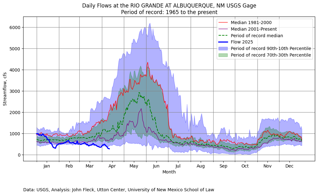
Shrinking when it should be growing.
The trip was fodder for a piece I’m working on looking at the US Bureau of Reclamation’s Middle Rio Grande river maintenance program carried out under the Flood Control Acts of 1948 and ‘50. Or possibly it’s a piece about the flooding in the 1920s that doomed the community of San Marcial. Or maybe its a piece about the remarkable geomorphology of a high sediment load river doing river things.
Or maybe it’s just a piece about a breathtaking expanse of desert with a struggling river valley flowing through its heart. Probably all of those things, which is why, dear readers, that you may not see the piece for a while.
The river, as defined by the presence of water, was barely there. It’s a weird stretch where sediment built up when it was the delta for the high stands of Elephant Butte Reservoir, a quaint reminder of when we had a lot of water. The river is now cutting back down through the debris, and the whole area is a mess from a human water management perspective.
From the river’s perspective? Meh, it’s just a river doing river things.
At a time when flows should be rising as a result of melting snow, they are declining as a result of the absence of melting snow. We cut the bike ride shorter than I had planned, because it was hot and I am old. But I’ll be back. It’s a lovely spot, and I have to figure out what to write.