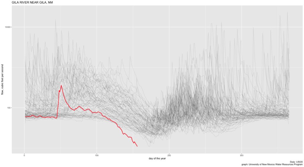
If my math is correct, flow on the Gila River gauge located near Gila, New Mexico, dropped today to the lowest ever measured, in a record that goes back 89 years.
The red line is the daily flow, in cubic feet per second, as measured by the U.S. Geological Survey. The cloud of gray lines is each previous year, in a record that goes back 89 years.

Record low flows on New Mexico’s Gila River
As I write this, the flow is 8.42 cubic feet per second. The previous record low came June 22, 2006, at 9.77 cfs. Look at how far that red line has dropped below the gray cloud. This is not simply a bad year. This is a far drier year than anything that river has seen in a very long time.

Can a graph of the San francisoi river in NM be shown?
Tim – Here you go! https://www.inkstain.net/fleck/2018/06/by-request-a-graph-of-the-san-francisco-river-near-glenwood-new-mexico/