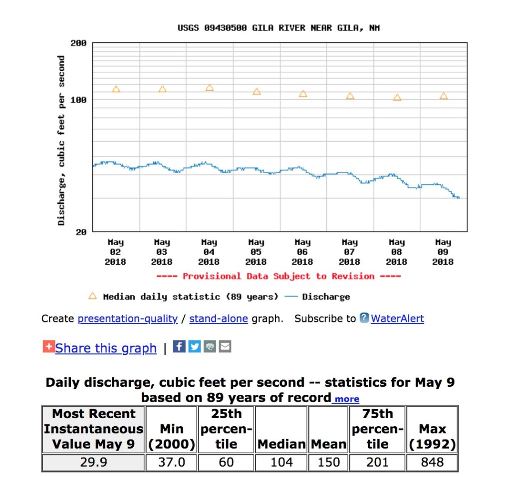
Our UNM Water Resources Program students used the Gila River in New Mexico for their spring case study projects, so I’ve made it a habit to watch the USGS “Gila near Gila” gauge. Class is finished, but the habit is not.
Flow there dropped below 30 cubic feet per second this evening.
Update: I didn’t do the analysis right. It’s the lowest on record for this point in the year, not the lowest in general.
If I’ve done the analysis right, this is the lowest recorded flow on the Gila – not just for May 9, but the lowest period.

Record low on the Gila
Records go back to 1927.

Any idea where I can get monthly rainfall data for Rio Rancho?
When I look online, I can only get monthly data for the Abq airport, which is typically the driest station in the area.
Carl –
The Western Regional Climate Center has a database of all the Coop sites: https://wrcc.dri.edu/coopmap/#
And if you are a Cocorahs volunteer observer, you have access to the PRISM data: https://cocorahs.org/Content.aspx?page=prismportal