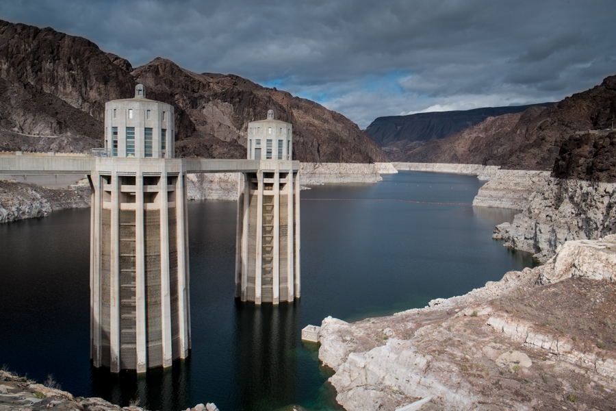
Here’s my obligatory picture of Lake Mead’s bathtub ring, as seen this afternoon from Hoover Dam:
The surface elevation this afternoon was 1,088.97 feet above sea level, the lowest it’s been at this time of year since 1956. It has dropped 20 feet since this time a year ago, which is among the biggest one-year drops in history.
The reason for the big one-year drop has interesting policy implications.
One of the innovations in the 2007 shortage sharing agreement among the federal government and the seven basin states was the creation of “Intentionally Created Surplus” water management widget, a tool to free Lower Colorado River Basin water users from the tyranny of “use it or lose it”. Its purpose, according to the decision document that created it (pdf), was to “minimize the likelihood and severity of potential future shortages” by allowing water users to bank unused water in Lake Mead:
ICS may be created through projects that create water system efficiency or extraordinary conservation or tributary conservation or the importation of nonColorado River System water into the Mainstream. ICS is consistent with the concept that entities may take actions to augment storage of water in the lower Colorado River Basin.
The 2007 agreement anticipated use of things like fallowing, desalination and canal lining to create ICS credits.
One of the big ICS users has been the Metropolitan Water District of Southern California, which by the end of 2012 had banked 489,389 acre feet of ICS credits in Lake Mead. But with drought hitting California and Met in a big way, in 2013 the agency began taking its banked water out, withdrawing 93,858 acre feet in 2013 and another 331,965 of ICS water in 2014.
This is a smart water management tool, allowing MWD to build some resilience by saving water now in order to consume it later. But it offers zero overall net basin water conservation over longer time frames – water conserved in one year is simply used in a later year. ICS simply moves water in time. That 331,965 acre feet Met took out last year above and beyond its normal allocation is five feet of elevation it put in in previous years and withdrew in 2014.
ICS is a cool tool, but the only thing that will keep Lake Mead from dropping is a new class of policy tool that would allow conserved water to stay in the reservoir for good.


How long will the bathtub ring look unnatural, assuming the water never again covers it up completely?
Do you mean “Will it wash off?” or “Will we get used to it?” I don’t know the answer to either, but I realized today I don’t know the details of the chemistry that creates it.
I mean, “will it wash off?” Wikipedia says
“The bathtub ring is white because of the deposition of minerals on previously submerged surfaces.”
http://en.wikipedia.org/wiki/Lake_Mead#History
but doesn’t give a time period. I wonder if the rings might be one of the more permanent signs that humans once here.
Would be a pretty simple equation to figure out how long it will last. Find out the likely mineral content of the ring and it’s thickness. Then find out the typical rate of erosion for the mineral, and cross reference that with the average local precipitation. That should give you a basic range.
Another example of a bathtub ring can be seen on ancient Lake Maynard on the Great Basin Highway. The lake has been gone for many years. Yet the stain remains.
Salinity may be a factor and the nature of the rocks that get stained by the water over time. However, anyone’s guess. There is a report that addresses salinity in the Colorado river http://www.usbr.gov/uc/progact/salinity/pdfs/PR22.pdf which made a reference to bathtub rings.
dg
“a new class of policy tool that would allow conserved water to stay in the reservoir for good” aka higher prices to reduce demand, a statutory reserve of water that cannot be crossed, and tradable property rights that make it easier to allocate remaining water more efficiently among numerous water users…