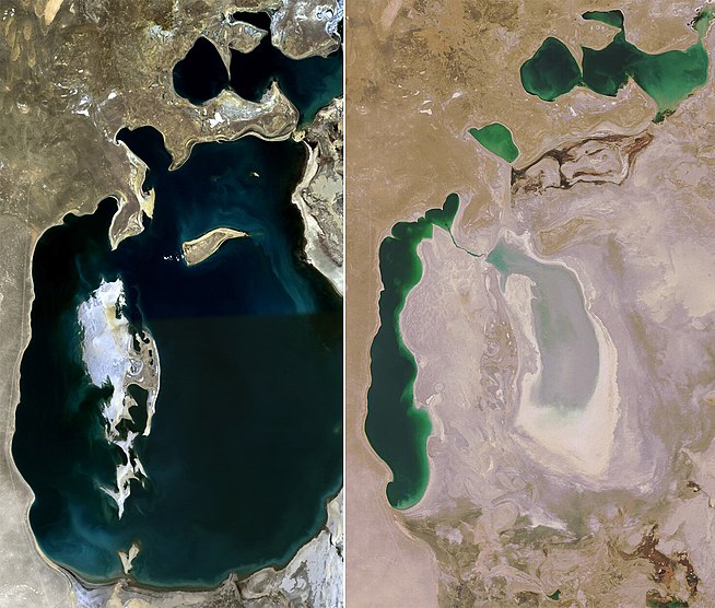
NASA’s great Earth Observatory published satellite images of the Aral Sea showing changes over the last year as the sea (really four distinct bodies of water now) shrinks as water that once flowed in is diverted for human consumptive use.
Which led me, thanks to a helpful twitter tip, to this great pair of satellite images showing 1989 and 2008:

Aral Sea, 1989 and 2008

It’s mind blowing, isn’t it? Not quite 20 years ago, it was the 4th largest lake in the world.
Amazing how quickly something truly unsustainable can take hold, yeah.
Read something a while ago that closing off the upper part has lead to a bit of refilling.