This being “World Rivers Day“, I spent the morning puzzling over the nature of ours.
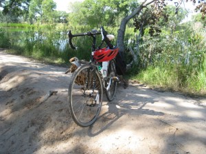
Truth is, I was planning on being aware of our river this morning anyway, via a ride on my new bicycle (seen here propped against a log at one of the constructed wetlands adjacent to the Rio Grande). I don’t really need formal river awareness activities. I’m down by the Rio Grande most weekends, and quite a few weekdays, being aware. Our river is a source of endless fascination.
One of the new bike’s main purposes, in fact, is to get me down to the river. It’s a hybrid road-dirt machine, so I can ride the five miles of street I need to get to the river, then ride the levees and dirt trails. (Bike geek tech here.) I’ve kitted it out with saddle bags to hold binoculars for bird-watching and enough food and water to get lost in my thoughts without incurring significant danger.
This morning I used it to get off the paved bits and onto the levee roads that flank the river through the heart of Albuquerque.
Albuquerque’s relationship with its river is an odd one. When I moved here 20 years ago, I was puzzled by the way the city turned its back on the Rio Grande. Aside from bridges carrying cars across it, there were very few places where you could actually get out to see the river. Few trails or picnic tables or benches. It has changed a bit, but not a lot. The Rio Grande is arguably the proximate cause of my city’s location in this particular spot of all other spots in which it might have been built. But it’s like it’s now been used and discarded.
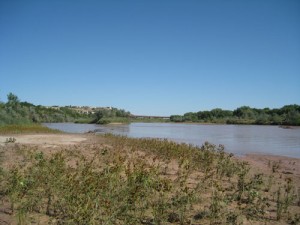
This picture was taken on the west side of the river, looking north toward the big Interstate 40 bridge across the river. In the foreground, you can see a mud flat still wet from the high flows caused by an epic storm last Wednesday. A guy died. They found his body on an island upstream from here. But that’s another story.
For purposes of this narrative, you’d have to follow me up a levee road until it peters out on a stretch of river where the bluffs obviated the need for flood control protection, and there’s nothing but little single track through the willows, one of which dumped out on the mud flat. I guess enough people do care about their river to keep beating out the single track, because this is not a trail system, just people like me trying to figure out how to get out to see the Rio Grande.
The Rio’s flowing at about 600 cubic feet per second through Albuquerque as I write this, which means nothing if you’re not a water numbers nerd. Three points of comparison:
- The flow in the Rio today is about 50 percent above normal for this time of year.
- Wednesday night’s flood was four times higher, which was enough to kill a guy.
- The Mississippi at St. Louis is flowing at 431,000 cubic feet per second right now.
I’m a numbers guy, so thinking about the Rio Grande, for me, involves thinking a lot about numbers like these – cubic feet per second, acre feet per year. But it’s also important for me to get out as often as I can and look at the river, to help make sense of the numbers.
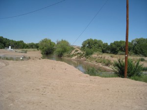
I looped back south and then across the river, where I stopped to look at one of the main irrigation ditches. It serves as a reminder of why Albuquerque is where it is – water diverted from up north, being carried to farms south of here. It’s another way of thinking about the – not flood danger, or recreation, or nature, but food. The river here, in a sense, spreads out across the middle Rio Grande Valley in a vast distributary system of ditches that you could think of as being as much river as the main channel is through this stretch of New Mexico.
A few years back, I interviewed one of the ditch riders, who talked about how spring is his favorite time of year, when they first turn the water out into the ditches and the valley starts greening up. It’s like the valley is taking a great deep breath, he told me.
Lots of different ways to be with, and to think about, our river.


That’s all you are gonna show? No pix of the gruppo or brake setup?! Sheesh.
Best,
D