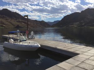
Lake Mead ends 2017 at elevation 1,082.5, almost two feet above last year at this time. Lake Powell ends the year at 3,623, up more than 20 feet from a year ago. Combined storage in the two primary Colorado River reservoirs ends the year up more than 2 million acre feet.
This is in part the result of a good snowpack in the winter of 2016-17, but is more than that. Excess runoff into Powell this year from that snowpack was 1.14 million acre feet. The only way you get from there to an increase in storage of 2 million acre feet is by using less water. And that is perhaps the most remarkable piece of Colorado River news as we end 2017.
In the lower basin states of Arizona, Nevada, and California, this year’s preliminary estimate of total use – 6.77 million acre feet – is the lowest since 1987.
Consider:
- Southern Nevada this year has taken just 81 percent of its full Colorado River allotment.
- Its use of Colorado River water has dropped 25 percent since its peak in 2000, at time during which its population has risen 55 percent. This is not the result of a shift to groundwater, this is straight up conservation success.
- Southern California (bolstered by a wet snowpack in the Sierra Nevada), is taking just 4 million acre feet of water.
- That is its lowest Colorado River water use in the history of modern record-keeping on the river, which dates to the U.S. Supreme Court’s 1963 Arizona v. California decision.
- Southern California’s use of Colorado River water this year is down 25 percent from its 2002 peak.
- Arizona will use 2.5 million acre feet of Colorado River water this year, its lowest since 2005.
Part of this, of course, is the big Sierra Nevada snowpack. But it’s also driven by the remarkable decoupling of water use from population and economic growth in the arid southwestern United States. According to a new dataset of municipal water use published this year by the U.S. Geological Survey, total water use in the municipalities served with Colorado River water declined 7 percent from 2010 to 2015, even as population rose 10 percent.
Population is going up. Water use is going down. When people have less water, as I wrote in my book, they use less water.
If we were ending 2017 with Lake Mead’s elevation below 1,075, we’d be in shortage, there would be mandatory cutbacks, and we’d all be writing hand-wringing pieces about the looming apocalypse. The fact that it’s ending at 1,082.5 has largely gone uncommented upon, but if shortage matters, then the lack of shortage must be equally important.
Notes on sources:
- Elevation numbers from Lake Mead and Lake Powell from USBR daily reports.
- Runoff from NOAA’s Colorado Basin River Forecast Center.
- Last year’s Mead and Powell year-end numbers from the USBR 24-month reports.
- Historic water use numbers from the annual USBR decree accounting reports. (We compiled all the data for a project I did a couple of years ago with UNM Water Resources Program students Chris Babis and Sara Gerlitz. Chris and Sara have graduated and gone on to do neat stuff, I’ve continued to maintain the data. One of my spring projects is to set up a public repository for this and other Colorado River data I’ve been collecting.)
- Current year-end water use numbers from the USBR’s regularly updated lower basin water use forecast.
- USGS municipal water use.


It is good to hear that people in cities are using less water. Good for us. Your excellent analysis did not mention any reductions in agricultural water usage, so I presume there were none, or they were insignificant, or, and I’d guess this is the most likely possibility, agricultural usage increased. Agricultural usage is, as you know better than anyone, the crucial factor because farmers use four times as much water as cities. Also, I wonder if changes in runoff from ancient sources could be estimated from precipitation and runoff measurements. It would be interesting to know what percentage of the change in reservoir levels can be attributed to changes in runoff from sources other than annual precipitation.
Dr. Sunshine –
Agricultural water usage has gone down as well. Imperial Irrigation District, by far the largest water user on the Colorado River, used 2.5 million acre feet this year, down from a peak of 3.1 million in 2002. The Yuma-area districts across the river in Arizona, the other major ag region on the river, used 660,000 acre feet in 2017, well down from their 1980s-era peak of nearly a million acre feet. And we don’t have the full numbers yet, but a big part of the water use reduction in central Arizona seems to be from programs to reduce ag water use to conserve water. That’s a significant part of the reduced use on the Central Arizona Project.